


- Usage in publication:
-
- Blue Hill shales
- Blue Hill horizon
- Modifications:
-
- Original reference
- Dominant lithology:
-
- Shale
- AAPG geologic province:
-
- Salina basin
- Central Kansas uplift
Summary:
Pg. 218, 225, 228, 229. Blue Hill shales; also called Blue Hill horizon. Dark-blue, loosely coherent, nonfossiliferous shales, 100 feet thick, overlying OSTREA shales and forming top division of Victoria clays and of Benton group. Overlain by SEPTARIA layer, included in Niobrara. Age is Late Cretaceous.
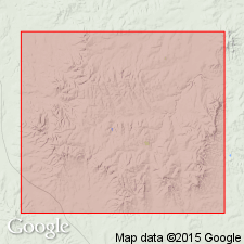
Occurs in banks along river from White Rock to mouth of Hackberry River, north-central KS.
Source: US geologic names lexicon (USGS Bull. 896, p. 220); supplemental information from GNU records (USGS DDS-6; Denver GNULEX).
- Usage in publication:
-
- Blue Hill shale*
- Modifications:
-
- Revised
- Adopted
Summary:
Blue Hill shale. Included the SEPTARIA layer in Blue Hill shale, and subsequent writers, including the USGS, have followed that definition. Age is Late Cretaceous.
Source: US geologic names lexicon (USGS Bull. 896, p. 220).
- Usage in publication:
-
- Blue Hill shale member*
- Modifications:
-
- Revised
- AAPG geologic province:
-
- Central Kansas uplift
Summary:
Blue Hill shale member of Carlile shale. In Ellis County, western Kansas, uppermost 20 to 25 feet called Codell sandstone bed (new). Thickness 175 to 215 feet. Age is Late Cretaceous. Report includes geologic map, stratigraphic chart.
Source: US geologic names lexicon (USGS Bull. 896, Codell entry p. 480); supplemental information from GNU records (USGS DDS-6; Denver GNULEX).
- Usage in publication:
-
- Blue Hill shale member*
- Modifications:
-
- Revised
- Adopted
Dane, C.H., and Pierce, W.G., 1933, [Geology and oil and gas prospects in part of eastern Colorado]: U.S. Geological Survey Press Notice, June 8, 1933
Summary:
Blue Hill shale member of Carlile shale. Restricted Blue Hill shale member to beds beneath Codell sandstone bed of previous reports, and elevated Codell sandstone to rank of a member of Carlile shale. This is definition at present used by the USGS and Kansas Geol. Survey. Age is Late Cretaceous.
Source: US geologic names lexicon (USGS Bull. 896, p. 220).

- Usage in publication:
-
- Blue Hill shale member*
- Modifications:
-
- Overview
- AAPG geologic province:
-
- Salina basin
- Central Kansas uplift
Summary:
Blue Hill shale member of Carlile shale. Apparently named from the Blue Hills, in Mitchell, Russell, and Republic Counties, north-central Kansas, which Logan stated "rest upon the OSTREA beds and are composed of the Blue Hill shale, capped by a layer of Ft. Hayes limestone," and probably also for Blue Hill Township, Mitchell County. OSTREA shales has been replaced with Fairport chalky shale member. Age is Late Cretaceous.
Source: US geologic names lexicon (USGS Bull. 896, p. 220).

- Usage in publication:
-
- Blue Hill(?) shale member*
- Modifications:
-
- Areal extent
- AAPG geologic province:
-
- Denver basin
Summary:
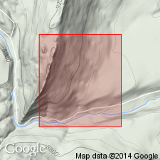
Carlile shale mapped as a narrow band on southwest part of map in Jefferson Co, CO in the Denver basin where it is in contact with the older Greenhorn limestone and with the younger Niobrara formation. Divisible into (ascending): Fairport chalky shale member about 25 ft thick, Blue Hill? shale member about 15 ft thick, and Codell sandstone member 2 ft thick. Ammonites identified in the Fairport and Codell. Of Late Cretaceous age. Geologic map.
Source: GNU records (USGS DDS-6; Denver GNULEX).
- Usage in publication:
-
- Blue Hill Shale Member*
- Modifications:
-
- Areal extent
- AAPG geologic province:
-
- Las Vegas-Raton basin
Summary:
Is one of four members of Carlile Formation. Areally extended to Gold Creek exposure in sec 4, T31N, R17E, Colfax Co, NM in the Las Vegas-Raton basin. Is 137 ft thick in measured section where it overlies Fairport Member and underlies Juana Lopez Member, both of Carlile. Divided into: 1) lower unit of black to medium-gray shale separated by dark, reddish-brown siltstone with cone-in-cone structures near top, and irregular to lenticular limestone concretions; 2) middle unit with an upper and lower concretion zone of brown-weathering limestone separated by silty shale with burrow markings; and 3) upper unit of noncalcareous, soft, silty, medium-dark-gray shale. Cone-in-cone structures occur in upper concretionary zone of middle unit. Is of Cretaceous age.
Source: GNU records (USGS DDS-6; Denver GNULEX).
- Usage in publication:
-
- Blue Hill Member*
- Modifications:
-
- Areal extent
- AAPG geologic province:
-
- Sioux uplift
Summary:
Recognized as one of four members of the Upper Cretaceous Carlile Shale at Lake Traverse, Traverse Co, MN on the Sioux uplift. Overlies Fairport Member of Carlile. Underlies Codell Sandstone Member of Carlile. Is approximately 21.3 m thick. Contains COLLIGNONICERAS WOOLLGARI (Mantel) about 1.5 m below the top. Of shallow water marine origin.
Source: GNU records (USGS DDS-6; Denver GNULEX).
For more information, please contact Nancy Stamm, Geologic Names Committee Secretary.
Asterisk (*) indicates published by U.S. Geological Survey authors.
"No current usage" (†) implies that a name has been abandoned or has fallen into disuse. Former usage and, if known, replacement name given in parentheses ( ).
Slash (/) indicates name conflicts with nomenclatural guidelines (CSN, 1933; ACSN, 1961, 1970; NACSN, 1983, 2005, 2021). May be explained within brackets ([ ]).