The National Geologic Map Database is migrating to a new infrastructure. We apologize for any service disruptions during this process.
|
|---|


- Usage in publication:
-
- Blossom sands
- Modifications:
-
- Original reference
- Dominant lithology:
-
- Sand
- AAPG geologic province:
-
- Ouachita folded belt
Summary:
Pg. 371, 373. Blossom sands. Glauconitic sands, brown and red at surface from oxidation of iron, interlaminated with and grading into clay. Thickness 80 to 100 feet. Top member of Eagle Ford formation in northeastern Texas. Underlies Brownstown marl. Same as Sub-Clarksville sands of Veatch [USGS Prof. Paper 46]. [Age is Late Cretaceous (Gulf).]
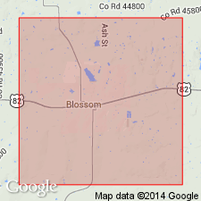
[Named from Blossom, Lamar Co., northeastern TX, which is located on an outcrop of the sand.]
Source: US geologic names lexicon (USGS Bull. 896, p. 215).

- Usage in publication:
-
- Blossom sand
- Modifications:
-
- Overview
- AAPG geologic province:
-
- Ouachita folded belt
Summary:
Blossom sand. Later work by L.W. Stephenson showed that Blossom sand is younger than Eagle Ford clay, and in 1917 it was treated by the USGS as a distinct formation overlying the Eagle Ford [see Stephenson's USGS Prof. Paper 120-H, Pg. 152-154, pl. 30, geol. map, 1918]. The 1925 and 1929 (AAPG Bull., v. 11, p. 8) work of L.W. Stephenson established fact that the clay underlying Blossom sand and formerly called Eagle Ford in northeast Texas is younger than true Eagle Ford clay and = lower part of Austin chalk, and he named it Bonham clay [later changed to Bonham marl].
Source: US geologic names lexicon (USGS Bull. 896, p. 215).
- Usage in publication:
-
- Blossom sand*
- Modifications:
-
- Overview
- AAPG geologic province:
-
- Ouachita folded belt
Summary:
Chart 9. Blossom sand. Shown on correlation chart above Bonham equivalents and below Brownstown marl. [Age is Late Cretaceous (Gulf).]
Source: US geologic names lexicon (USGS Bull. 1200, p. 389).
- Usage in publication:
-
- Blossom sand*
- Modifications:
-
- Biostratigraphic dating
- AAPG geologic province:
-
- East Texas basin
- Ouachita folded belt
Summary:
Pg. 36, fig. 1. Blossom sand of Austin group. Only two species of foraminifera have been recorded, AMMOBACULITES COPROLITHIFORMIS (Schwager) and GAUDRYINA BENTONENSIS (Carman). Both are arenaceous, suggesting the presence of a sparse, facies-controlled fauna comparable to that of the basal Gulf Woodbine group. Age is Late Cretaceous (Gulf).
Recognized in northeastern TX (Longitudes of Commerce, Paris, and Clarksville).
Source: Publication; US geologic names lexicon (USGS Bull. 1200, p. 389).
- Usage in publication:
-
- Blossom Sand*
- Modifications:
-
- Areal extent
- AAPG geologic province:
-
- Arkla basin
Summary:
Because the term Blossom has reportedly come to be applied in the subsurface to any or all of the sands in the Austin equivalent, it is proposed that Blossom Sand be areally restricted, and not be used in the report area of northern Caddo and northwestern Bossier Parishes, LA. The informal unit Trees City sand is proposed to refer to the lower of two sands in the upper Tokio Formation as developed in the subsurface of the report area. No attempt is made to demonstrate continuity between Trees City sand in northern Caddo Parish, LA and type Blossom Sand in Lamar Co, TX. See Tokio Formation (Ogier, 1963).
Source: GNU records (USGS DDS-6; Denver GNULEX).

- Usage in publication:
-
- Blossom Sand
- Modifications:
-
- Mapped 1:250k
- Dominant lithology:
-
- Sand
- Clay
- AAPG geologic province:
-
- Ouachita folded belt
Summary:
Blossom Sand. Quartz sand, calcareous, glauconitic, ferruginous, thin clay interbeds, brown; weathers brown and red; in upper part abundant marine megafossils in sandstone concretions. Thickness 20 to 250 feet, thins westward. [Correlative with upper part of Tokio Formation of Oklahoma and Arkansas.] Lies above Bonham Formation and below Brownstown Marl. Age is Late Cretaceous.
[Mapped in mostly continuous belt south of Red River, in Fannin, Lamar, and Red River Cos., northeastern TX.]
Source: Publication.

- Usage in publication:
-
- Blossom Sand
- Modifications:
-
- Mapped 1:250k
- Dominant lithology:
-
- Sand
- Clay
- AAPG geologic province:
-
- Ouachita folded belt
Summary:
Pamphlet [p. 3]. Blossom Sand of Austin Group. Quartz sand grading westward into clay. Sand, brown, weathers to reddish-brown and red, very fine-grained to fine-grained, calcareous, glauconitic, ferruginous, calcareous concretions and septaria common, some thin clay interbeds. Clay, medium-yellowish-gray, weathers to light-yellowish-gray, silty, calcareous, poorly bedded to massive, some interbeds of silt, marine megafossils scarce. Thickness approximately 20 feet, feathers out westward in Fannin County, northeastern Texas. Age is Late Cretaceous.
[Mapped in Bonham area, central eastern edge of map sheet, Fannin Co., northeastern TX.]
Source: Publication.
For more information, please contact Nancy Stamm, Geologic Names Committee Secretary.
Asterisk (*) indicates published by U.S. Geological Survey authors.
"No current usage" (†) implies that a name has been abandoned or has fallen into disuse. Former usage and, if known, replacement name given in parentheses ( ).
Slash (/) indicates name conflicts with nomenclatural guidelines (CSN, 1933; ACSN, 1961, 1970; NACSN, 1983, 2005, 2021). May be explained within brackets ([ ]).