

- Usage in publication:
-
- Blacksmith formation*
- Modifications:
-
- Original reference
- Dominant lithology:
-
- Limestone
- AAPG geologic province:
-
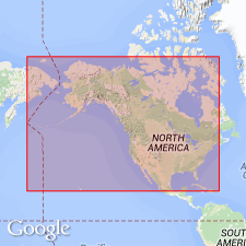
- Wasatch uplift
Summary:
Pg. 6, 7. Blacksmith formation. Gray arenaceous limestone in massive layers. Thickness 570 feet in Blacksmith Fork, Cache County, northeastern Utah, and 23 feet west of Liberty, Bear Lake County, southeastern Idaho. Underlies Bloomington formation and overlies Ute formation. [Age is Middle Cambrian, based on fossils.]
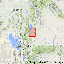
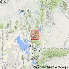
Type locality: Blacksmith Fork Canyon, 8+/- mi above its mouth and 15 mi east of Hyrum, Cache Co., northeastern UT.
Source: US geologic names lexicon (USGS Bull. 896, p. 207).

- Usage in publication:
-
- Blacksmith limestone*
- Modifications:
-
- Revised
- Dominant lithology:
-
- Dolomite
- AAPG geologic province:
-
- Wasatch uplift
Summary:
Pg. 1112-1113, 1117 (fig. 4), 1121. Blacksmith limestone. As amended, 450 feet thick at type section. Consists of white-gray, dull-steel-gray, and in upper 60 feet dark-lead-gray fine- to medium-grained usually thick-bedded dolomite and interbedded magnesian limestone. Overlies Ute limestone (emended); underlies Bloomington limestone. [Age is Middle Cambrian (Albertan).]
Source: US geologic names lexicon (USGS Bull. 1200, p. 375).
- Usage in publication:
-
- Blacksmith limestone*
- Modifications:
-
- Areal extent
- Dominant lithology:
-
- Limestone
- AAPG geologic province:
-
- Wasatch uplift
Summary:
Blacksmith limestone. Cliff-forming, massive, gray to blue, fine-grained limestone. Thickness 670 feet in Rock Creek and 725 feet west of Garden City. Overlies Ute limestone; underlies Bloomington formation. Fossils scarce; one trilobite found in basal bed in Randolph quadrangle. Age is Middle Cambrian.
Source: Modified from GNU records (USGS DDS-6; Denver GNULEX).
- Usage in publication:
-
- Blacksmith limestone
- Modifications:
-
- Areal extent
- Dominant lithology:
-
- Limestone
- AAPG geologic province:
-
- Wasatch uplift
Summary:
Pg. 1130, 1133. Blacksmith limestone. Described in Logan quadrangle, Utah, where it forms prominent cliffs. Thickness near Call's Fort 800 feet; on High Creek 710 feet.
Source: US geologic names lexicon (USGS Bull. 1200, p. 375).
- Usage in publication:
-
- Blacksmith Limestone*
- Blacksmith Dolomite*
- Modifications:
-
- Redescribed
- AAPG geologic province:
-
- Snake River basin
- Wasatch uplift
- Great Basin province
Summary:
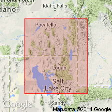
Pg. 36 (fig. 5), 45-48, pls.1, 4-7. Disscussion of nomenclature history and stratigraphic problems. In easternmost sections (Wasatch Range, Utah; see pl. 6) which consist dominantly of dolomite, Blacksmith Dolomite is used; in sections to the west (Malad, Portneuf, and Bear River Ranges, Idaho; see pls. 4 and 5) which consist of limestone, Blacksmith Limestone is used. Rocks assigned to the Blacksmith Limestone in the Bancroft quadrangle consist dominantly of cliff-forming medium- to thick-bedded and massive limestone. The limestone is mainly mottled or laminated, dark- to medium-gray, and subaphanitic with some beds ranging to medium grain size. Mottles and laminae of silty limestone, weather to yellow, pink, and tan. Beds of oolitic and GIRVANELLA-bearing limestone are scattered throughout the formation. Is about 700 to 900 feet thick. Underlies Bloomington Formation; in most places, upper contact placed at base of lowest shale assigned to the Bloomington. Overlies Bancroft Limestone (new) in western sections and Ute Limestone in eastern sections. Age is Middle Cambrian. Report includes columnar sections, map showing locations of sections, geologic map, faunal lists.
Source: Publication.
- Usage in publication:
-
- Blacksmith Dolostone*
- Modifications:
-
- Redescribed
- Dominant lithology:
-
- Dolostone
- AAPG geologic province:
-
- Great Basin province
Summary:
Blacksmith Dolostone. In fig. 2 and throughout chapter, "dolostone" is used for rocks composed predominantly of the mineral "dolomite." [Although "dolostone" is the proper term, it has not often been applied to dolomitic formations and members in the literature.] Blacksmith Dolostone shown in stratigraphic column of north-central Utah (Great Basin province). Overlies Ute Limestone (Middle Cambrian); underlies Bloomington Formation (Middle Cambrian). Age is Middle Cambrian.
Source: Modified from GNU records (USGS DDS-6; Denver GNULEX).
For more information, please contact Nancy Stamm, Geologic Names Committee Secretary.
Asterisk (*) indicates published by U.S. Geological Survey authors.
"No current usage" (†) implies that a name has been abandoned or has fallen into disuse. Former usage and, if known, replacement name given in parentheses ( ).
Slash (/) indicates name conflicts with nomenclatural guidelines (CSN, 1933; ACSN, 1961, 1970; NACSN, 1983, 2005, 2021). May be explained within brackets ([ ]).