The National Geologic Map Database is migrating to a new infrastructure. We apologize for any service disruptions during this process.
|
|---|


- Usage in publication:
-
- Black Peaks Formation
- Modifications:
-
- First used
- AAPG geologic province:
-
- Permian basin
Summary:
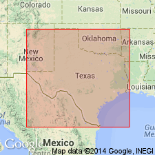
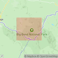
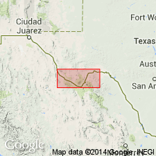
Pg. 12-33, tables, plates, road logs. Black Peaks Formation. Described from Big Bend area, southwest Texas. Varicolored clay interbedded with ledge-forming cross-bedded yellow, buff, and gray sandstone and lenses of conglomerate. Thickness more than 850 feet. Overlies Javelina Formation (new); underlies Hannold Hill Formation (new). Where Hannold Hill is absent, the Black Peaks underlies Canoe Formation (new). Age is Paleocene.
Source: US geologic names lexicon (USGS Bull. 1350, p. 76).
- Usage in publication:
-
- Black Peaks Formation
- Modifications:
-
- Principal reference
- Dominant lithology:
-
- Sandstone
- Clay
- AAPG geologic province:
-
- Permian basin
Summary:
Pg. 98-102, pls. Black Peaks Formation of Tornillo Group. Formal proposal of name. Formation is approximately middle part of Udden's (1907) Tornillo Clay herein redefined and rank raised to group. Consists of alternating sandstone and clay. Most of the sandstones are gray or gray-white; some sandstone beds are massive, cross-bedded, contain red-brown cannonball concretions; two of the sandstone beds contain fossils (crocodiles, fish, turtles, mammals, silicified wood). Clay is mottled gray and maroon. Thickness 284 to 866 feet. Thickest part is in north-central part of Tornillo Flat [type]. Unconformably overlies Javelina Formation and underlies lower Eocene Hannold Hill Formation (both new; of Tornillo Group). Age is Paleocene, based on fossils (Torrejonian mammals). Oldest Tertiary rocks in west Texas.
Named for three small black peaks on east side of Tornillo Flat, northwest of McKinney Hills, Big Bend National Park, Brewster Co., southwestern TX. [According to GNU records (USGS DDS-6; Denver GNULEX, December 15, 1988), type section measured in north-central part of Tornillo Flat.]
Source: US geologic names lexicon (USGS Bull. 1350, p. 94); supplemental information from GNU records (USGS DDS-6; Denver GNULEX).
- Usage in publication:
-
- Black Peaks Formation
- Modifications:
-
- Mapped 1:250k
- Dominant lithology:
-
- Sandstone
- Clay
- AAPG geologic province:
-
- Permian basin
Summary:
Black Peaks Formation. Mapped in Brewster County, Texas. Consists of sandstone and clay; sandstone at base, conglomeratic, cross-bedded, gray to grayish-white, some cannonball concretions split into platy layers; clay, mottled gray and deep dark-red; vertebrate fossils common. Thicknesses measured range from 284 to 866 feet, crops out in northern part of Big Bend National Park. Overlies Javelina Formation (Upper Cretaceous). Underlies Hannold Hill Formation. Age is Paleocene.
Source: Publication.
For more information, please contact Nancy Stamm, Geologic Names Committee Secretary.
Asterisk (*) indicates published by U.S. Geological Survey authors.
"No current usage" (†) implies that a name has been abandoned or has fallen into disuse. Former usage and, if known, replacement name given in parentheses ( ).
Slash (/) indicates name conflicts with nomenclatural guidelines (CSN, 1933; ACSN, 1961, 1970; NACSN, 1983, 2005, 2021). May be explained within brackets ([ ]).