


- Usage in publication:
-
- Black Creek shale
- Modifications:
-
- Original reference
- Dominant lithology:
-
- Shale
- AAPG geologic province:
-
- Atlantic Coast basin
Summary:
zzzzzEarle Sloan, 1905 (South Carolina Geol. Survey geognostic map of South Carolina, advance copies; published in 1908, in South Carolina Survey, 4th ser., Bull., no. 2) and 1907 (Summary of mineral resources of South Carolina, p. 12, 13, 14).
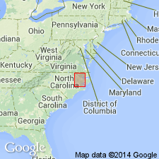
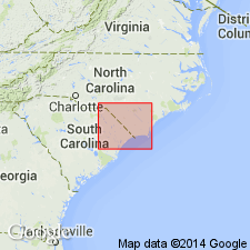
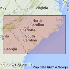
Black Creek shale. Soft shales and black clay, exposed along Black Creek in Darlington and Florence Counties, South Carolina, and along Pee Dee Valley interruptedly from near Society Hill to Jeffries Creek, where it passes under Burches Ferry marl. Its probable equivalent extends easterly through Marion County, South Carolina, where it is exposed in bed of Little Pee Dee tributaries. Overlies Middendorf clays (Lower Cretaceous). Age is Late Cretaceous.
Named from exposures along Black Creek in Darlington and Florence Cos., SC. C.W. Cooke states (USGS Bull. 867, 1936): Although no locality was specified by Sloan as the type, the outcrops of the formation on Black Creek near the crossing of Cashua Ferry road east of Darlington may be regarded as typical.
[According to GNU records (USGS DDS-6; Reston GNULEX, August 11, 1988), "These beds were also named the Bladen formation by Stephenson (1907), for their development in Bladen Co., NC. The name Black Creek antedates Bladen, having been used on a special map of SC, issued in 1906, although Sloan's definition did not appear until 1907, when it was published in "Handbook of North Carolina" and on another map dated 1905. It was the opinion of the GNC (Meeting minutes, 1909, p. 802) that the name Black Creek had priority; it was adopted and the name Bladen was abandoned for USGS usage."]
Source: US geologic names lexicon (USGS Bull. 896, p. 199-200); supplemental information from GNU records (USGS DDS-6; Reston GNULEX).

- Usage in publication:
-
- Black Creek formation*
- Modifications:
-
- Overview
- AAPG geologic province:
-
- Atlantic Coast basin
Summary:
As defined above [Sloan, 1905-1908] the Black Creek excluded the †Middendorf deposits (present in Georgia and South Carolina), which were then supposed to be of [Early] Cretaceous age. Further studies of †Middendorf deposits, however, resulted in proving the [Late] Cretaceous age of their flora, and led to belief that they were = beds composing lower part of Black Creek formation in some localities. In 1912 (USGS Prof. Paper 71, p. 659) L.W. Stephenson redefined Black Creek formation so as to include, at base, the †Middendorf arkose member. Still later work, however, led to exclusion (C.W. Cooke, USGS Prof. Paper 140, p. 137-139, 1926) of †Middendorf deposits from overlying Black Creek deposits (from which they are now [ca. 1938] known to be separated by a distinct unconformity and with which they are in sharp lithologic contrast) and to their being treated as a distinct formation (unconformably overlain by Black Creek formation and unconformably underlain by crystalline rocks), the Black Creek formation being restored to its original definition. The Black Creek is overlain (unconformably in South Carolina but conformably in North Carolina, according to L.W. Stephenson) by Peedee formation, and is of Ripley and Eutaw age. Thickness 0 to 400 feet. The name "Middendorf" has been abandoned, the beds having proved to be same as Tuscaloosa formation, the older name. (See C.W. Cooke, USGS Bull. 867, 1936.)
Source: US geologic names lexicon (USGS Bull. 896, p. 199-200).
- Usage in publication:
-
- Black Creek formation
- Modifications:
-
- Areal extent
- AAPG geologic province:
-
- Atlantic Coast basin
Summary:
Pg. 25-39. Black Creek formation. Consists principally of very dark gray laminated clay and micaceous sand. Clay predominates at typical exposures, which represent lower part of formation, but sand is more abundant in Snow Hill member at top. No reliable estimates of thickness in South Carolina [this report]. Unconformably overlies Tuscaloosa formation; unconformably underlies Peedee formation or younger deposits. [Age is Late Cretaceous.]
Source: US geologic names lexicon (USGS Bull. 1200, p. 360-361).
- Usage in publication:
-
- Black Creek formation
- Modifications:
-
- Not used
- AAPG geologic province:
-
- Atlantic Coast basin
Summary:
Pg. 21. Black Creek formation. Beds mapped as Black Creek by Cooke (1936) in western Sumter County, South Carolina, are now regarded as Black Mingo as herein restricted.
Source: US geologic names lexicon (USGS Bull. 1200, p. 360-361).
- Usage in publication:
-
- Black Creek formation
- Modifications:
-
- Revised
- AAPG geologic province:
-
- Atlantic Coast basin
Summary:
Pg. 2178-2184. In South Carolina, Middendorf Member of Black Creek formation (herein revived as equivalent of upper part of Cooke's (1936) Tuscaloosa formation) is shown to contain plant remains essentially equivalent to those of lower Black Creek formation of North Carolina; lower part of Cooke's Tuscaloosa is herein referred to as Lower Cretaceous(?) (undifferentiated). Includes Snow Hill member at top. Underlies Peedee formation.
Source: US geologic names lexicon (USGS Bull. 1200, p. 360-361).

- Usage in publication:
-
- Black Creek formation
- Modifications:
-
- Revised
- AAPG geologic province:
-
- Atlantic Coast basin
Summary:
Stephenson's (1907) term Bladen is here reinstated as the Bladen member in the lower part of the Black Creek formation. [Justification for reinstatement is in Heron's unpublished Ph.D dissertation "The stratigraphy of the outcropping basal Cretaceous formations between the Neuse River, North Carolina, and the Lynches River, South Carolina", University of North Carolina, Chapel Hill, NC.]
Source: GNU records (USGS DDS-6; Reston GNULEX).
- Usage in publication:
-
- Black Creek shale
- Black Creek formation
- Modifications:
-
- Revised
- AAPG geologic province:
-
- Atlantic Coast basin
Summary:
Black Creek shale; Black Creek formation. Upper Cretaceous formations of North Carolina Coastal Plain are (ascending) Middendorf, Black Creek shale, and Peedee. On basis of present study, it is believed that term Snow Hill calcareous member of Black Creek formation should be dropped from literature and that sediments at Snow Hill be included in Peedee formation. Division of either Black Creek or Peedee formations into members is not warranted. Term Black Creek formation should connote dark-gray to black laminated shales with intercalations of clean sand lying conformably beneath Peedee formation.
Source: US geologic names lexicon (USGS Bull. 1200, p. 360-361).
- Usage in publication:
-
- Black Creek formation*
- Modifications:
-
- Areal extent
- AAPG geologic province:
-
- Atlantic Coast basin
Summary:
Pg. 9 (table), 10-11. Black Creek formation. Described in Greenville area where it is exposed along streams in northern part of Greene and Pitt Counties, [North Carolina]. North and east of Pitt County, formation has been recognized only in subsurface. Thickness 75 to 150 feet. Comprises an unnamed lower member and Snow Hill marl member at top. Unconformably overlies Tuscaloosa formation, exhibiting transgressive offlap relationship; underlies Peedee formation.
Source: US geologic names lexicon (USGS Bull. 1200, p. 360-361).
- Usage in publication:
-
- Black Creek Group*
- Modifications:
-
- Revised
- AAPG geologic province:
-
- Atlantic Coast basin
Summary:
Black Creek used here as Group, and is divided into the lower Tar Heel, middle Bladen, and upper Donoho Creek Formation. Formal revision will be in Sohl and Owens (1991).
Source: GNU records (USGS DDS-6; Reston GNULEX).
- Usage in publication:
-
- Black Creek Group*
- Modifications:
-
- Revised
- AAPG geologic province:
-
- Atlantic Coast basin
Summary:
Black Creek Formation is here revised as Black Creek Group. Lithofacies patterns can be traced from one river valley to the next and downdip into the subsurface, so that the Black Creek can be subdivided into three units, the lower Tar Heel (new name), middle Bladen (revised), and upper Donoho Creek (new name) Formations. The Tar Heel represents the lower nonmarine part and the Bladen represents the upper marine part of the Bladen Member of Heron (1958) in the lower part of the Black Creek. The upper Snow Hill Marl Member is abandoned because its age range encompasses both the Tar Heel and the Bladen, and beds of the Snow Hill are assigned to both units. Unconformably overlies the Middendorf Formation; unconformably underlies Paleogene sediments. Age is Campanian and early Maastrichtian.
Source: GNU records (USGS DDS-6; Reston GNULEX).
- Usage in publication:
-
- Black Creek Formation
- Modifications:
-
- Overview
- AAPG geologic province:
-
- Atlantic Coast basin
Summary:
Cretaceous section in the subsurface at the Savannah River site is divided into (ascending) Cape Fear, Middendorf, Black Creek, and Steel Creek (new) Formations. [Lumbee Group not used.] The Black Creek Formation consists of quartz sands, silts, and clays and is generally darker, more micaceous, and more lignitic that the other Cretaceous units. Lower part consists of tan and light gray fine to coarse sands with moderate to poor sorting. Layers of pebbles and clay clasts are common. A thick, oxidized, kaolinitc clay lens occurs within the lower Black Creek in the western part of the site, suggesting an unconformity within the formation. Upper part of the formation consists mostly of tan and light gray sands. Unit is about 200 ft thick at the northwestern boundary of the study area and thickens to about 300 ft at the southeastern boundary. Depositional environments interpreted as prodelta, delta front, and delta plain. Correlated with type area Black Creek on basis of lithology and numerous palynological assemblages. Appears to correlate with Blufftown and Cusseta Formation and lower part of the Ripley Formation of GA and AL. Campanian and Maastrichtian age based on fossils.
Source: GNU records (USGS DDS-6; Reston GNULEX).
- Usage in publication:
-
- Black Creek Group*
- Modifications:
-
- Revised
- AAPG geologic province:
-
- Atlantic Coast basin
Summary:
Pg. 4+, 11 (fig. 8), 31 (fig. 22). Black Creek Group. In subsurface subdivided into (descending) Donoho Creek, Bladen, Coachman (new), and Cane Acre (new) Formations; depth-interval 873 to 1,544 feet, Clubhouse Crossroads No. 1 drill core, near Clubhouse Crossroads, Dorchester County, southeastern South Carolina. Sediments previously included in Peedee and Black Creek Formations by Hazel and others (1977) and Gohn and others (1977). (The sediments assigned to Black Creek Formation by Hazel and others, 1977, and Gohn and others, 1977, are reallocated to, descending, Cane Acre Formation of Black Creek Group, Caddin Formation, Shepherd Grove Formation, and Middendorf Formation.) Overlies Caddin Formation (new); underlies Peedee Formation. Fossils. Age is Late Cretaceous (middle Campanian to early Maastrichtian; Tayloran to Navarroan Provincial Age; GLOBOTRUNCANITA ELEVATA to GLOBOTRUNCANA FALSOSTUARTI planktic foram zone, CALCULITES OVALIS to QUADRUM TRIFIDUM (NC18 to NC20) calcareous nannofossil zone, ASCETOLEBERIS PLUMMERI to ESCHARACYTHERIDEA PINOCHII ostracode zone).
Black Creek Group in outcrop includes (descending) Donoho Creek, Bladen, and Tar Heel Formations, following Owens (1989) and Sohl and Owens (1991). Correlation of subsurface and outcropping Black Creek Group hampered by recognition of 4 formations in subsurface and only 3 in outcrop.
Source: Publication.
- Usage in publication:
-
- Black Creek Group
- Modifications:
-
- Mapped 1:100k
- Dominant lithology:
-
- Kaolin
- AAPG geologic province:
-
- Atlantic Coast basin
Summary:
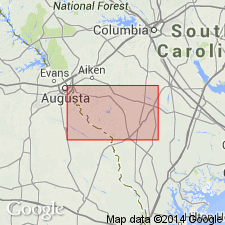
Pg. 5, 7, 14, 21, geol. map. Black Creek Group, undivided. Exposed along upper reaches of Savannah River and its tributaries. Maximum thickness about 91 m (300 feet) in downdip areas. In subsurface, consists of soft, coarsely crystalline white kaolin at top; kaolin beds are of commercial purity and are strip mined in updip areas, and generally form top of exposed Black Creek. Fossiliferous (pollen, dinoflagellates, acritarchs). In part, correlates with upper Campanian Bladen Formation and lower Maastrichtian Donoho Creek Formation of eastern South Carolina. Overlies Middendorf Formation; underlies unnamed unit. Age is Late Cretaceous (late Campanian and early Maastrichtian). Samples from carbonaceous clay yielded pollen zone CA-4 and CA-5 assemblages (of Wolfe, 1976, USGS Prof. Paper 977; Christopher, 1978, Palynology, v. 2; Sohl and Christopher, 1983, USGS Prof. Paper 1285).
Best exposure in quadrangle: large pit on south side of Dixon Airline Road (southwest of Augusta Airport along Butler Creek) about 0.5 mi east of Old Savannah Road.
Source: Publication.
- Usage in publication:
-
- Black Creek Group*
- Modifications:
-
- Areal extent
- Age modified
- AAPG geologic province:
-
- Atlantic Coast basin
Summary:
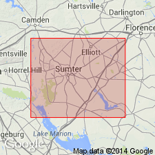
Black Creek Group strata in corehole in Sumter Co., central SC, are similar to subdivisions of Black Creek strata described by Sohl and Owens (1991) for NC and eastern SC. In the study area, the subdivisions of Black Creek Group are queried as Tar Heel(?) Formation, Bladen(?) Formation, and Donoho Creek(?) Formation [until more detailed information is known]. Figure 4 shows the Black Creek Group spanning the Austinian, Tayloran, and Navarroan provincial stages. Correlates with Blufftown and Ripley Formations in AL.
Source: GNU records (USGS DDS-6; Reston GNULEX).
For more information, please contact Nancy Stamm, Geologic Names Committee Secretary.
Asterisk (*) indicates published by U.S. Geological Survey authors.
"No current usage" (†) implies that a name has been abandoned or has fallen into disuse. Former usage and, if known, replacement name given in parentheses ( ).
Slash (/) indicates name conflicts with nomenclatural guidelines (CSN, 1933; ACSN, 1961, 1970; NACSN, 1983, 2005, 2021). May be explained within brackets ([ ]).