- Usage in publication:
-
- Bitter Creek sandstone
- Bitter Creek sands
- Modifications:
-
- Original reference
- Dominant lithology:
-
- Sandstone
- AAPG geologic province:
-
- Coastal basins
- Santa Maria basin
Dibblee, T.W., 1951, Discussion of geology in vicinity [Cuyama district, southern California]; Stop 2: American Association of Petroleum Geologists, Pacific Section, Field Trip Guidebook, Joint annual Spring meeting of American Association of Petroleum Geologists, Pacific Section, Society of Economic Paleontologists and Mineralogists, Pacific Section, May 11-12, 1951, 5 p.
Summary:
[Pg. 4-5.] Bitter Creek sandstone. Light-buff, medium-grained, semi-friable, arkosic sandstone. Thickness about 1,400 feet. Conformably underlies Santa Margarita formation. Overlies Monterey shale in Salisbury Canyon. Is sandy facies of Monterey shale in Cuyama Valley. Fossils, middle Miocene "Cierbo and Briones stages" molluscan fauna. Contains reefs of OSTREA BOURGEOISII, PECTEN (LYROPECTEN) ESTRELLANUS, and ASTRODAPSIS spp. Age is mainly Luisian (middle Miocene). [Road log accompanying report refers to Bitter Creek sands.]
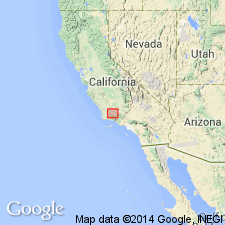
Type locality: at Bitter Creek, Cuyama Valley, [Cuyama Ranch 7.5-min quadrangle, Santa Barbara Co., southern CA]. Crops out prominently on both sides of Salisbury Canyon.
Source: Publication; US geologic names lexicon (USGS Bull. 1200, p. 356).
- Usage in publication:
-
- "Bitter Creek" sand
- Modifications:
-
- Areal extent
- AAPG geologic province:
-
- Coastal basins
- Santa Maria basin
Schwade, I.T., 1954, Geology of Cuyama Valley and adjacent ranges, San Luis Obispo, Santa Barbara, Kern, and Ventura Counties [California]: California Division of Mines Bulletin, no. 170, Map Sheet 1., Prepared 1952
Summary:
Map Sheet 1. "Bitter Creek" sand [map legend]. Middle Miocene sediments in Cuyama Valley exhibit considerable lateral variation both in outcrop and subsurface. Westernmost exposures shown on map are entirely Monterey shale, chiefly siliceous; in subsurface, a short distance to east, the first fingers of sandstone, locally called Bitter Creek, have been noticed. Largely at expense of the shale, but in addition with each unit exhibiting considerable thickening, the sandstones become dominant sedimentary feature of middle Miocene section in central part of Cuyama Valley and hills to south. On north side of Caliente Mountain, the Bitter Creek forms prominent part of section, but less dominantly so than in area to south. This unit, made up chiefly of fine silty locally cross-bedded fossiliferous sandstone, is considered to represent a large middle Miocene delta. To east, Bitter Creek beds interfinger with, and progressively grade into terrestrial conglomerates and red beds locally called Caliente formation.
Source: US geologic names lexicon (USGS Bull. 1200, p. 356).
- Usage in publication:
-
- [Bitter Creek formation]
- Modifications:
-
- Areal extent
- AAPG geologic province:
-
- Coastal basins
- Santa Maria basin
Savage, D.E., 1957, [Age of the Caliente formation, Caliente Range, California] [abs.]: Geological Society of America Bulletin, v. 68, no. 12, pt. 2, p. 1845.
Summary:
Pg. 1845. [Bitter Creek formation]. Shown on chart as marine formation unconformably underlying Caliente formation. Thickness about 1,000 feet.
Source: US geologic names lexicon (USGS Bull. 1200, p. 356).

- Usage in publication:
-
- Bitter Creek [sandstone]†
- Modifications:
-
- Abandoned
Summary:
Pg. 2991. †Bitter Creek [sandstone]. Abandoned. Preoccupied term Bitter Creek replaced with Branch Canyon formation (new). [See Branch Canyon.]
Source: US geologic names lexicon (USGS Bull. 1200, p. 356).
For more information, please contact Nancy Stamm, Geologic Names Committee Secretary.
Asterisk (*) indicates published by U.S. Geological Survey authors.
"No current usage" (†) implies that a name has been abandoned or has fallen into disuse. Former usage and, if known, replacement name given in parentheses ( ).
Slash (/) indicates name conflicts with nomenclatural guidelines (CSN, 1933; ACSN, 1961, 1970; NACSN, 1983, 2005, 2021). May be explained within brackets ([ ]).

