- Usage in publication:
-
- Bisti Member
- Modifications:
-
- Named
- Dominant lithology:
-
- Sandstone
- Mudstone
- Siltstone
- Coal
- AAPG geologic province:
-
- San Juan basin
Summary:
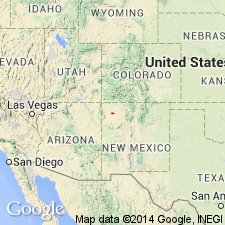
First used informally by Hunt (1986). Here named as basal member of the Late Cretaceous (early and late Maastrichtian), broadly fluvial Kirtland Formation (revised). Members of the Kirtland, ascending, are Bisti (new), Hunter Wash (new), Farmington (redescribed), De-na-zin (new), and Naashoibito (as used by Baltz and others, 1966). Type section is adjacent to site of now defunct Hunter's Store at SW1/4 SW1/4 sec 29, T13W, R24N, San Juan basin, San Juan Co, northwestern NM. [Probably named for Bisti oil field (discovered in 1955) or for Bisti Trading Post at 36 deg, 16'N and 108 deg, 15'W]. Is prominent in all surface exposures of the lower part of the Kirtland from north of San Juan River (San Juan mine lease) to Ah-shi-sle-pah Wash to the south; is also present near Durango, CO. More resistant to weathering than other local sandstones, the Bisti often caps ridges and pinnacles, especially in Hunter Wash and Fossil Forest. Described as a gas reservoir, the Bisti sandstones are thin, but very continuous, tabular, distinctly bicolored with white lower portion and dark brown, ferruginous upper portion. In Fossil Forest, 27 km southeast of Bisti, unit typically comprises two brown-capped sandstones separated by 7.5 m of mudstone, siltstone, and a thin coal. Very conspicuous in geophysical logs as the only sandstone of prominence between Late Cretaceous (Campanian) Pictured Cliffs Sandstone and Late Cretaceous (early Maastrichtian) Farmington Member of the Kirtland. Maximum thickness is 5 m in Hunter Wash area. In erosional contact with underlying Late Cretaceous (late Campanian) Fruitland Formation. Conformably overlain by Late Cretaceous (early Maastrichtian) Hunter Wash Member of the Kirtland. Age is Late Cretaceous (early Maastrichtian) based on vertebrate fossils, as well as on radiometric dates, palynology, and stratigraphic position. Report includes geologic sketch map, fossil lists, and stratigraphic column.
Source: GNU records (USGS DDS-6; Denver GNULEX).
For more information, please contact Nancy Stamm, Geologic Names Committee Secretary.
Asterisk (*) indicates published by U.S. Geological Survey authors.
"No current usage" (†) implies that a name has been abandoned or has fallen into disuse. Former usage and, if known, replacement name given in parentheses ( ).
Slash (/) indicates name conflicts with nomenclatural guidelines (CSN, 1933; ACSN, 1961, 1970; NACSN, 1983, 2005, 2021). May be explained within brackets ([ ]).

