The National Geologic Map Database is migrating to a new infrastructure. We apologize for any service disruptions during this process.
|
|---|


- Usage in publication:
-
- Birdbear formation*
- Modifications:
-
- Original reference
- Dominant lithology:
-
- Anhydrite
- Dolomite
- Limestone
- Shale
- AAPG geologic province:
-
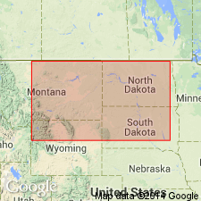
- Central Montana uplift
- Sweetgrass arch
- Williston basin
Summary:
Pg. 2292 (fig. 2), 2302-2303 (fig. 4), 2318-2322. Birdbear formation of Jefferson group. Proposed for widespread beds of light-colored finely crystalline dolomite and limestone that overlie the Duperow and underlie the Three Forks in [subsurface of] Williston basin and central Montana. Thickness ranges from fraction of a foot to 125 feet; in type well 90 feet. Replaces term Nisku formation now restricted to type area in central Alberta. Age is Late Devonian.
Type section (subsurface): depth-interval 10,310 to 10,400 ft, Mobil Producing Company Birdbear No. 1 well, in sec. 22, T. 149 N., R. 91 W., Dunn Co., ND.
[Misprint (US geologic names lexicon, USGS Bull. 1200, p. 346): type well stated to be Birdwell; should be Birdbear.]
Source: US geologic names lexicon (USGS Bull. 1200, p. 346).
- Usage in publication:
-
- Birdbear Member*
- Modifications:
-
- Revised
- AAPG geologic province:
-
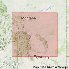
- Bighorn basin
- Central Montana uplift
- Montana folded belt
- Sweetgrass arch
- Williston basin
- Yellowstone province
Summary:
Pg. N6 (fig. 2), N7; 1962, Billings Geol. Soc. Gdbk., 13th Ann. Field Conf., p. 47-50. Birdbear Member of Jefferson Formation. Dolomite, partly pseudobrecciated. Thickness 70 feet at type section of Jefferson; generally ranges 50 to 80 feet. Is the upper member of Jefferson Formation. Overlies lower member of Jefferson; underlies Logan Gulch Member (new) of Three Forks Formation. Recognized in western Montana and northwestern Wyoming. Age is Late Devonian.
Source: Publication.
- Usage in publication:
-
- Birdbear Member*
- Modifications:
-
- Biostratigraphic dating
- AAPG geologic province:
-
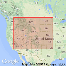
- Snake River basin
- Sweetgrass arch
Summary:
As the upper member of the Jefferson Formation, Birdbear is 10 m thick south and east of town of Monarch, Little Belt Mountains, Cascade Co, MT on Sweetgrass arch where it is of Frasnian?, Late Devonian age, 10 m thick, and in polygnathid biofacies. In Long Canyon, west side of Beaverhead Mountains, Clark Co, ID in Snake River basin, the Birdbear is 12 m thick and of Famennian, Late Devonian age. In Long Canyon, Birdbear is in the PALMATOLEPIS MARGINIFERA conodont zone. The Long Canyon section is the easternmost well-dated section in ID. A Famennian brachiopod SINETECTIROSTRUM also found at Long Canyon.
Source: GNU records (USGS DDS-6; Denver GNULEX).
For more information, please contact Nancy Stamm, Geologic Names Committee Secretary.
Asterisk (*) indicates published by U.S. Geological Survey authors.
"No current usage" (†) implies that a name has been abandoned or has fallen into disuse. Former usage and, if known, replacement name given in parentheses ( ).
Slash (/) indicates name conflicts with nomenclatural guidelines (CSN, 1933; ACSN, 1961, 1970; NACSN, 1983, 2005, 2021). May be explained within brackets ([ ]).