

- Usage in publication:
-
- Bilk Creek sandstone member*
- Modifications:
-
- Original reference
- Dominant lithology:
-
- Sandstone
- AAPG geologic province:
-
- Paradox basin
- San Juan basin
Summary:
Pg. 1748 (fig. 2), 1750, 1752 (fig. 3), 1753 (table 1). Bilk Creek sandstone member of Morrison formation. Proposed as member of Morrison formation. About 20 feet of sandstone or sandy beds capped by carnelian sandstone. Underlies Wanakah marl member; overlies Pony Express limestone member. Age is Late Jurassic. [See La Plata sandstone.]
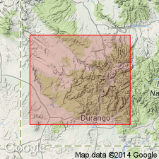
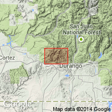
Named from exposures along highway opposite mouth of Bilk Creek, about 6 mi west of Telluride, San Miguel Valley, [approx. Lat. 37 deg. 56 min. 54 sec. N., Long. 107 deg. 55 min. 16 sec. W., in sec. 36 (unsurveyed), T. 43 N., R. 10 W., Gray Head 7.5-min quadrangle, San Miguel Co., Uncompahgre National Forest], southwestern CO. [Additional locality information from USGS GNIS database, USGS historical topographic map collection TopoView; accessed February 11, 2013.]
[Misprint (US geologic names lexicon, USGS Bull. 1200, p. 343): exposures stated to be in Ouray Co.; should be San Miguel Co.]
Source: US geologic names lexicon (USGS Bull. 1200, p. 343).
- Usage in publication:
-
- Bilk Creek sandstone member*
- Modifications:
-
- Revised
- AAPG geologic province:
-
- Paradox basin
- San Juan basin
Summary:
Pg. 27 (table), 28-29, pl. 2. Bilk Creek sandstone member of Wanakah formation. Reallocated to member status in Wanakah formation. Consists of soft, gray-white to red sandstone. Has concretions of red chert near top and a red concretionary layer at base. Thickness about 20 feet. Overlies Pony Express member and underlies unnamed marl member. Age is Late Jurassic.
Source: US geologic names lexicon (USGS Bull. 1200, p. 343); GNU records (USGS DDS-6; Denver GNULEX).
- Usage in publication:
-
- Bilk Creek Sandstone Member*
- Modifications:
-
- Overview
- AAPG geologic province:
-
- San Juan basin
- San Juan Mountains province
Summary:
The thick-bedded to massive sandstone at the base of the Beclabito Member of the Wanakah Formation in northwest NM and northeast AZ occupies the same stratigraphic position as the Bilk Creek Sandstone Member of the Wanakah in southwest CO, San Juan Mountain province and San Juan basin, though exact equivalence not established. Of Middle Jurassic age.
Source: GNU records (USGS DDS-6; Denver GNULEX).
- Usage in publication:
-
- Bilk Creek Sandstone Member*
- Modifications:
-
- Areal extent
- Reference
- AAPG geologic province:
-
- Paradox basin
- Piceance basin
- San Juan Mountains province
Summary:
As the middle member of Wanakah Formation of San Rafael Group, overlies either the Pony Express Limestone Member of Wanakah or the Pony Express equivalent and underlies the beds at Sawpit, the upper beds of the Wanakah. Ranges from 20-33 ft thick. Identified along Gunnison, Uncompahgre, and San Miguel Rivers in Delta, Montrose, Ouray, and San Miguel Cos, CO which lie in the Piceance and Paradox basins, and in the San Juan Mountain province. Newly recognized in the western Black Canyon of the Gunnison. Is capped by a distinctive carnelian sandstone marker bed that ranges from 1 to 14 ft thick. The marker is poorly sorted and fine grained, and contains sparse to abundant coarse quartz grains. The carnelian marker is probably a reworked zone. Of Middle Jurassic, Callovian age. Cross sections. Nomenclature chart. Reference section 33.8 ft thick designated and measured east-facing cliffs bordering the Gunnison River, western Black Canyon, Montrose Co.
Source: GNU records (USGS DDS-6; Denver GNULEX).
For more information, please contact Nancy Stamm, Geologic Names Committee Secretary.
Asterisk (*) indicates published by U.S. Geological Survey authors.
"No current usage" (†) implies that a name has been abandoned or has fallen into disuse. Former usage and, if known, replacement name given in parentheses ( ).
Slash (/) indicates name conflicts with nomenclatural guidelines (CSN, 1933; ACSN, 1961, 1970; NACSN, 1983, 2005, 2021). May be explained within brackets ([ ]).