

- Usage in publication:
-
- Bigford formation*
- Modifications:
-
- Original reference
- Dominant lithology:
-
- Sandstone
- AAPG geologic province:
-
- Gulf Coast basin
Summary:
Pg. 92; GSA Bull., v. 34, p. 75. Bigford formation. Chiefly clay of many colors with subordinate quantities of gray, green, and brown sandstone which at most places is not cross-bedded. Contains many beds of lignite, the heaviest 20 inches thick, and some lens-shaped concretionary masses. Contains no paper shales and sands, such as occur in Indio formation, and no thick, cross-bedded, and commonly quartzitic sands, such as occur in Carrizo sandstone. Thickness 0 to 470+/- feet. Top formation of Wilcox group. In part contemporaneous with Carrizo sandstone and in part younger. Underlies Mount Selman formation. [Age is middle Eocene.]
Named from Bigford Ranch, Webb Co., southern TX.
Source: US geologic names lexicon (USGS Bull. 896, p. 183-184).

- Usage in publication:
-
- Bigford member*
- Modifications:
-
- Overview
- AAPG geologic province:
-
- Gulf Coast basin
Summary:
Bigford member of Mount Selman formation. Was formerly treated as a formation of Wilcox group, based on its fossil plants, but its invertebrate fossils are now generally considered to be of Claiborne age. It is therefore now treated by the USGS as basal member of Mount Selman formation, of Claiborne group, as far north as Atascosa County, southern Texas, and to north of that county the contemporaneous Claiborne deposits which differ lithologically, are called Reklaw member of Mount Selman formation. Age is middle Eocene.
Source: US geologic names lexicon (USGS Bull. 896, p. 183-184).

- Usage in publication:
-
- Bigford formation
- Modifications:
-
- Not used
- AAPG geologic province:
-
- Gulf Coast basin
Summary:
Pg. 619-620. Trowbridge's map and description indicate clearly he intended Bigford to be a facies of Carrizo sand, simply a change from sand to clay along the strike. Miss Gardner (prelim. ed. geol. map of Texas, 1932) has amended and expanded Bigford formation of Trowbridge in order to make it a valid formation and has separated it from Carrizo. Since Reklaw has priority over the amendation of Miss Gardner, and since it is in established usage by geologists of the State, it is preferable to adopt it exclusively, if possible.
Source: US geologic names lexicon (USGS Bull. 896, p. 183-184).
- Usage in publication:
-
- Bigford member*
- Modifications:
-
- Areal extent
- AAPG geologic province:
-
- Gulf Coast basin
Summary:
Pg. 37. Bigford member of Mount Selman formation. Because of similarity of their stratigraphic position above Carrizo sand and similarity of ferruginous beds partly composing them, Reklaw and Bigford members of the Mount Selman have been regarded as contemporaneous. Geographic and stratigraphic positions of the fossiliferous ferruginous sandstones north of Leming, Atascosa County, southern Texas, suggest that they represent eastward extension of Bigford from Frio County. If Leming and Scruggs Creek localities should prove to represent same zone, then on the assumption that the conglomerate is basal part of Reklaw, it would appear that the Bigford is not exact equivalent of the Reklaw, but is older and intervenes between the Carrizo sand and the Reklaw. Age is middle Eocene.
Source: US geologic names lexicon (USGS Bull. 1200, p. 333).
- Usage in publication:
-
- Bigford Formation*
- Modifications:
-
- Revised
- AAPG geologic province:
-
- Gulf Coast basin
Summary:
Pg. D9-D10. Bigford Formation of Claiborne Group. In the Rio Grande embayment south of Frio River, southern Texas, the Bigford Member of Mount Selman Formation is raised to formation rank, and the Mount Selman is abandoned. Consists of sands, some very thin beds of fossiliferous silts and shales, and several coal beds. Thickness 400 to 800 feet. Overlies Carrizo Sand and underlies El Pico Clay. Equivalent to and interfingers with Reklaw Formation north of the Frio. All included in Claiborne Group. Age is middle Eocene.
Source: Publication; Changes in stratigraphic nomenclature, 1968 (USGS Bull. 1294-A, p. A3).

- Usage in publication:
-
- Bigford Formation
- Modifications:
-
- Mapped 1:250k
- Dominant lithology:
-
- Clay
- Sandstone
- Lignite
- AAPG geologic province:
-
- Gulf Coast basin
Summary:
Bigford Formation. Clay, sandstone, and lignite; clay, calcareous, selenitic, varicolored, contains subordinate amount of brown sandy clay and sandstone; sandstone, in part thin-bedded, intercalated with fissile shale, in part thick-bedded, coarse-grained, cross-bedded; some concretions of yellow limestone, a few thin beds of hematite. Thickness 200 to 800 feet. Lies above Carrizo Sand and below El Pico Clay. Age is Eocene.
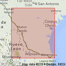
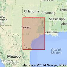
[Mapped in Maverick, Zavala, Dimmit, and Webb Cos., southwestern TX.]
Source: Publication.

- Usage in publication:
-
- Bigford Formation
- Modifications:
-
- Mapped 1:250k
- Dominant lithology:
-
- Siltstone
- Sandstone
- Clay
- AAPG geologic province:
-
- Gulf Coast basin
Summary:
Pamphlet [p. 3]. Bigford Formation. Siltstone, sandstone, and clay; siltstone, in part noncalcareous, medium-gray, indurated, in part argillaceous, sandy, calcareous, light yellowish-gray; sandstone, medium- to coarse-grained, in part calcareous, medium-gray to orange and brown, in part noncalcareous, friable, light yellowish-gray; clay, silty, gypsiferous, light-gray to chocolate-brown, plant fragments common. Thickness 50 to 200+/- feet. Correlative with Reklaw Formation (mapped east of Frio River). Overlies Carrizo Sand; underlies El Pico Clay. Age is Eocene.
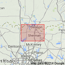
[Mapped west of Frio River along southwestern edge of map sheet, in Frio and Zavala Cos., southern TX.]
Source: Publication.
For more information, please contact Nancy Stamm, Geologic Names Committee Secretary.
Asterisk (*) indicates published by U.S. Geological Survey authors.
"No current usage" (†) implies that a name has been abandoned or has fallen into disuse. Former usage and, if known, replacement name given in parentheses ( ).
Slash (/) indicates name conflicts with nomenclatural guidelines (CSN, 1933; ACSN, 1961, 1970; NACSN, 1983, 2005, 2021). May be explained within brackets ([ ]).