The National Geologic Map Database is migrating to a new infrastructure. We apologize for any service disruptions during this process.
|
|---|


- Usage in publication:
-
- Big Snowy group
- Modifications:
-
- Original reference
- Dominant lithology:
-
- Limestone
- Shale
- Sandstone
- AAPG geologic province:
-
- Central Montana uplift
Summary:
Pg. 1011-1032; 1935, Geol. Soc. Amer. Proc. 1934, p. 367. Big Snowy group. New name for lower part of beds heretofore assigned to Quadrant formation in central Montana. True Quadrant formation is absent in central Montana, where the rocks heretofore assigned to it are all of Mississippian age, are all older than typical Quadrant formation, of Quadrant Mountain, Yellowstone National Park (which is of basal Pennsylvanian age and unquestionably a westward extension of Tensleep sandstone, into which it grades), and are also older than Amsden formation, which is Mississippian and underlies the Quadrant of Quadrant Mountain as well as the Quadrant of southern Montana and overlies Big Snowy group in central Montana. This group has maximum thickness of 1,200 feet and rests on Madison limestone. Is mainly variegated shales with intercalated limestones and sandstones. It is divided into 3 conformable formations, in descending order, Heath formation (new name), Weed's Otter formation, and Weed's Kibbey formation. It is absent in Yellowstone Park, also in north-central Wyoming, and southern Montana. In 1931 (USGS Prof. Paper 165, p. 135-149) F. Reeves, although calling these rocks Quadrant formation, suggested that the upper limestone of the unit is Amsden formation, a suggestion that has been verified by writer's work. In most areas there is unconformity (not angular) between Amsden and Quadrant and between Amsden and Tensleep, but in Three Forks region there is evidence that would support theory of continuous deposition. Age is Mississippian.
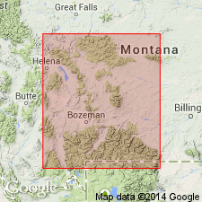
It is named from its extensive distribution and excellent exposures in Big Snowy Mountains, central MT. It is also exposed in Little Belt Mountains, Castle Mountains, and Lombard Hills.
Source: US geologic names lexicon (USGS Bull. 896, p. 186).
- Usage in publication:
-
- Big Snowy group
- Modifications:
-
- Revised
- AAPG geologic province:
-
- Williston basin
Summary:
Pg. 863. Big Snowy group. In subsurface in Cedar Creek anticline, southeastern Montana, Big Snowy group includes (ascending) Charles (new), Kibbey, and Otter formations. Underlies Amsden formation; overlies Madison (Pahasapa of Black Hills).
Source: US geologic names lexicon (USGS Bull. 1200, p. 339-340).
- Usage in publication:
-
- Big Snowy group*
- Modifications:
-
- Revised
- AAPG geologic province:
-
- Williston basin
Summary:
Pg. 65 (chart), 67, 68 (cross section). Big Snowy group. Restricted at base to exclude Charles formation (subsurface and surface?) which is here assigned to Madison group. As restricted, includes (ascending) Kibbey, Otter, and Heath formations. Underlies unit referred to as lower Amsden.
Source: US geologic names lexicon (USGS Bull. 1200, p. 339-340).
- Usage in publication:
-
- Big Snowy group*
- Modifications:
-
- Revised
- AAPG geologic province:
-
- Central Montana uplift
Summary:
Pg. 329-349. Big Snowy group. Revised in Golden Valley County, Montana (Central Montana uplift). Big Snowy group of Scott (1935) is expanded and redefined to include, in ascending order, not only Kibbey sandstone, Otter formation, and Heath formation of his original report, but also three overlying formations --Mississippian or Pennsylvanian Cameron Creek formation (new) and Alaska Bench limestone, and Pennsylvanian Devils Pocket formation. Scott's (1935) Amsden consisted of a lower red shale, siltstone, and sandstone member (Cameron Creek of this report) and an upper gray limestone member (Freeman's Alaska Bench limestone). Thickness 1,509 feet at standard section herein suggested. Underlies Triassic(?) or Permian(?) and Pennsylvanian undifferentiated, or locally Ellis group; overlies units of Madison group. Age is Mississippian and Pennsylvanian. Report includes nomenclature chart, measured sections, cross sections.
Standard section, a composite of Stonehouse Ranch and State Road No. 25 sections: (1) upper part of section measured in secs. 31 and 32, T. 11 N., R. 21 E.; and (2) lower part of section measured in sec. 30, T. 11 N., R. 21 E., and sec. 25, T. 11 N., R. 20 E., Big Snowy Mountains.
Source: US geologic names lexicon (USGS Bull. 1200, p. 339-340); supplemental information from GNU records (USGS DDS-6; Denver GNULEX).
- Usage in publication:
-
- Big Snowy formation*
- Modifications:
-
- Overview
- AAPG geologic province:
-
- Montana folded belt
Summary:
Big Snowy formation. Recognized in Jefferson, Broadwater, and Gallatin Counties, Montana (Montana folded belt province). Forms unresistant grassy topographic sags with a few ledges. Consists of fine-grained clastic and impure thin-bedded carbonate rocks. Overlies Mission Canyon limestone and underlies Amsden formation; cannot always be separated from Amsden formation [compare with Peale, 1893, 1896 and Berry, 1943]. Age is roughly Late Mississippian, but may be as old as late Early Mississippian and as young as Early Pennsylvanian. Report includes fossil lists (corals, brachiopods, etc.), geologic map.
Sections measured and described in (1) northeast corner sec. 25 and southeast corner sec. 24, T. 2 N., R. 1 W.; (2) SE/4 NE/4 sec. 32, T. 3 N., R. 1 E. (100 ft thick); (3) SW/4 SW/4 sec. 29 into NE/4 NW/4 sec. 32, T. 3 N., R. 2 W. (400 ft thick); and (4) NW/4 SE/4 sec. 34, T. 1 N., R. 1 W. (60 ft thick).
Source: Modified from GNU records (USGS DDS-6; Denver GNULEX).
- Usage in publication:
-
- Big Snowy Group*
- Modifications:
-
- Principal reference
- Revised
- Age modified
- AAPG geologic province:
-
- Williston basin
- Powder River basin
- Sweetgrass arch
- Central Montana uplift
Summary:
Big Snowy Group. Restricted to (ascending) the Kibbey, Otter, and Heath Formations. Tyler Formation, Alaska Bench Limestone, and Devil Pocket Formation reallocated to Amsden Group (rank raised). Recognized in Williston basin, Sweetgrass arch, Central Montana uplift, and Powder River basin. Age is Late Mississippian. Kibbey generally considered to be Chesterian, however, in places (see line D-D', plate 2, western Williston basin in eastern Montana) basal part of Kibbey interfingers with uppermost Charles Formation, suggesting late Meramecian age. Otter and Heath are Chesterian; fossil lists given. Heath restricted to rocks below the regional unconformity. The sandstones and black shales above the unconformity are assigned to the Stonehouse Canyon Member (new), basal member of Tyler Formation. Report includes measured sections, cross sections, correlation chart, fossil lists.
Type section (= reference section of Tyler Formation): along prominent cliff forming Alaska Bench (locally called Beacon Hill) extending secs. 25 through 36, T. 13 N., R. 19 E., and sec. 1, T. 12 N., R. 19 E., Fergus Co., central MT (citing Easton, 1962; Maughan, 1967).
Source: Modified from GNU records (USGS DDS-6; Denver GNULEX); GNC index card files (USGS-Menlo).
- Usage in publication:
-
- Big Snowy Formation*
- Modifications:
-
- Overview
- AAPG geologic province:
-
- Idaho Mountains province
- Snake River basin
Summary:
Pg. 5-11, figs. 1, 4. Big Snowy Formation. Partial section (200+ feet; 60+ m thick) measured below type sections of Bloom Member of Snaky Canyon Formation and Bluebird Mountain Formation (all new), between Copper Mountain and Gallagher Peak in southern Beaverhead Mountains, Copper Mountain 7.5-min quadrangle, Clark County, Idaho. Consists of medium-dark-gray, to dark-gray shale which weathers medium-gray and contains interbedded medium-gray, fossiliferous, argillaceous, and sandy limestone and few thin beds of siltstone and very fine-grained sandstone. A few thin zones of grayish-green shale present in uppermost shale zone. Gradationally underlies Bluebird Mountain Formation; contact placed at base of lowest thick, calcareous, very fine-grained, ledge-forming, quartzose sandstone. Intertongues with South Creek, Surrett Canyon, and Arco Hills (new) Formations. To the southeast, in the Snaky Canyon 7.5-min quadrangle, rests directly on Scott Peak Formation. Age is Late Mississippian (Chesterian), based on fossils (brachiopods, bryozoans, mollusks, corals, ostracods, conodonts, algae, and foraminifers); Mamet microfossil zones 16s to 19 (Mamet and Skipp, 1970). Report includes correlation chart, measured sections, fossil list, geologic sketch map.
Source: Publication.
- Usage in publication:
-
- Big Snowy Group*
- Big Snowy Formation*
- Modifications:
-
- Not used
- AAPG geologic province:
-
- Central Montana uplift
Summary:
B1, B2 (fig. 1). Big Snowy Group of Scott (1935) and Maughan and Roberts (1967) restricted to central Montana. In southwest Montana, rocks are assigned to the Snowcrest Range Group (new) and Quadrant Sandstone. In east-central Idaho, rocks previously called Big Snowy Formation by Skipp and others (1979) are assigned to Railroad Canyon Formation (new).
Source: Publication.
For more information, please contact Nancy Stamm, Geologic Names Committee Secretary.
Asterisk (*) indicates published by U.S. Geological Survey authors.
"No current usage" (†) implies that a name has been abandoned or has fallen into disuse. Former usage and, if known, replacement name given in parentheses ( ).
Slash (/) indicates name conflicts with nomenclatural guidelines (CSN, 1933; ACSN, 1961, 1970; NACSN, 1983, 2005, 2021). May be explained within brackets ([ ]).