The National Geologic Map Database is migrating to a new infrastructure. We apologize for any service disruptions during this process.
|
|---|


- Usage in publication:
-
- Big Clifty sandstone
- Modifications:
-
- Original reference
- Dominant lithology:
-
- Sandstone
- AAPG geologic province:
-
- Illinois basin
Summary:
Pg. 10, 13, 15, 16, 51, 73, 369. Big Clifty sandstone in Chester group. Heavy-bedded sandstone. 60 to 130 feet thick, constituting basal formation of Chester group in region adjacent to Louisville, Paducah, and Southwestern RR, Kentucky. Toward south and west borders of coal fields loses it character as a sandstone and passes into shales. Equivalent of "ferruginous" sandstone of Illinois. Underlain by St. Louis group. Age is Late Mississippian.
Named from exposures on Big Clifty Creek, Grayson Co., western KY.
Source: US geologic names lexicon (USGS Bull. 896, p. 182).
- Usage in publication:
-
- Big Clifty sandstone†
- Modifications:
-
- Abandoned
- AAPG geologic province:
-
- Illinois basin
Summary:
Pg. 86-90. †Big Clifty sandstone. "Big Clifty" sandstone of Norwood is same as true Cypress sandstone.
Source: US geologic names lexicon (USGS Bull. 896, p. 182).
- Usage in publication:
-
- Big Clifty sandstone
- Modifications:
-
- Reinstated
- AAPG geologic province:
-
- Illinois basin
Summary:
Pg. 277-278. Big Clifty sandstone. Sandstone lenses occur sporadically in lower part of Golconda (Indian Springs) shale as far west as Marion County, southern Illinois. Eastward these coalesce into a continuous sandstone unit which has its maximum thickness in a belt extending through eastern Gibson County, southwestern Indiana, and Daviess County, western Kentucky. There are places where the sandstone is more than 100 feet thick and lies on an unconformable surface which cuts into and even through Beech Creek limestone. This is most continuous and prominent sandstone in lower and middle Chester of Indiana and Kentucky outcrop belt. Name "Big Clifty" was applied to this sandstone by Norwood (1876). Name has been little used since sandstone has been considered equivalent to Cypress sandstone, previously named in Illinois. Northeast of line extending from Shawneetown, Illinois, through Dixon and Greenville, Kentucky, Big Clifty is separated from true Cypress by sheet of Beech Creek (Barlow) limestone; southwest of this line along outcrop belt through Christian and Caldwell Counties, Kentucky, Big Clifty may lie directly on true Cypress. Age is Late Mississippian (Chesterian).
Source: US geologic names lexicon (USGS Bull. 1200, p. 329-330).

- Usage in publication:
-
- Big Clifty sandstone
- Modifications:
-
- Revised
- Areal extent
- AAPG geologic province:
-
- Illinois basin
Summary:
Pg. 18. Big Clifty sandstone. Name Haney limestone is proposed for the "Golconda" as recognized east of Todd County, western Kentucky, and north into Indiana. Abandoned name Big Clifty returns to use for sandstone that underlies Haney and caps the Dripping Springs escarpment from Todd County eastward and northward to Ohio River. Because Big Clifty is represented by little or no sandstone in westernmost Kentucky outcrop and subsurface, in Illinois outcrop, and most of Illinois subsurface, name is unsuitable to these areas, and name Fraileys shale is proposed for interval between Haney and Beech Creek limestone wherever sandstone is insignificant or lacking. Age is Late Mississippian (Chesterian).
Source: US geologic names lexicon (USGS Bull. 1200, p. 329-330).
- Usage in publication:
-
- Big Clifty formation
- Modifications:
-
- Areal extent
- AAPG geologic province:
-
- Illinois basin
Summary:
Pg. 6, pl. 2. Big Clifty formation. Used here instead of Cypress as it now appears practically certain that name Cypress has been incorrectly used in Indiana. Formation consists of medium-bedded, fine-grained sandstone with gray shale locally at base. Thickness 25 to 40 feet. Underlies Golconda formation; overlies Beech Creek limestone. Age is Late Mississippian (Chesterian).
Source: US geologic names lexicon (USGS Bull. 1200, p. 329-330).
- Usage in publication:
-
- Big Clifty formation
- Modifications:
-
- Revised
- AAPG geologic province:
-
- Illinois basin
Summary:
Pg. 36 (table 5), 40-41, pl. 1. Big Clifty formation of Stephensport group (redefined). Includes shale unit formerly considered to be lower part of Golconda formation [Indian Springs shale member]. Thickness 42 to 50 feet. Underlies Golconda limestone; overlies Beech Creek limestone (both of Stephensport). Age is Late Mississippian (Chester).
Source: US geologic names lexicon (USGS Bull. 1200, p. 329-330); supplemental information from GNU records (USGS DDS-6; Reston GNULEX).
- Usage in publication:
-
- Big Clifty Sandstone Member*
- Modifications:
-
- Adopted
- Dominant lithology:
-
- Shale
- AAPG geologic province:
-
- Illinois basin
Summary:
Big Clifty Sandstone Member of Golconda Formation. Adopted by the USGS for use in Kentucky. Sandstone, light to dark-brown, well-cemented, fine- to medium-grained, massive and strongly cross-bedded; locally includes up to 15 feet of gray or green shale at or near top; in places lower 10 to 15 feet is argillaceous. Sparse brachiopod and pelecypod casts are present in some beds. Thickness about 85 feet; top not exposed. Conformably overlies Girkin Formation. Age is Late Mississippian (Chesterian).
Source: Modified from GNU records (USGS DDS-6; Reston GNULEX).
- Usage in publication:
-
- Big Clifty Sandstone Member*
- Modifications:
-
- Mapped 1:24k
- AAPG geologic province:
-
- Illinois basin
Summary:
Big Clifty Sandstone Member of Golconda Formation. Sandstone and shale. Thickness 60 to 120 feet. Sandstone, yellowish-gray to yellowish-brown, brown-weathering, fine- to medium-grained, quartzose, well-sorted, moderately indurated, locally cemented by iron oxides, cross-bedded, mostly thick-bedded and massive. Forms cliffs as much as 70 feet high except in northwestern part of quadrangle where thin-bedded sandstone is common. Uppermost 10 to 30 feet is fine-grained flaggy sandstone and shale, which grade upward to greenish-gray, gray, and minor grayish-red shale with thin discontinuous coaly streaks. In some places, basal part includes gray clay shale or silty shale, 1 to 10 feet thick in southeastern part and 20 to 30 feet thick in northwestern part of quadrangle; separated from overlying sandstone by disconformity. Where basal shale is absent, sandstone rests disconformably on Beech Creek Limestone Member, and locally on Elwren Sandstone equivalent. Conformably underlies Haney Limestone Member of Golconda Formation. Sparsely fossiliferous (wood fragments coalified or replaced by iron oxides, brachiopods). Age is Late Mississippian (Chesterian).
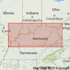
Mapped north of Big Clifty Creek, in Breckinridge and Hardin Counties, western Kentucky.
Source: Publication.

- Usage in publication:
-
- Big Clifty Sandstone Member
- Modifications:
-
- Overview
- AAPG geologic province:
-
- Illinois basin
Summary:
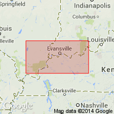
Called Big Clifty Sandstone Member of Fraileys Shale by Illinois Geological Survey. "The Big Clifty enters IL from the east and wedges out within a few tens of miles. Many wells in Lawrence, northern and eastern Jasper, and southern Cumberland Cos. encounter 15-20 ft of Big Clifty. It is near the middle of the Fraileys or, less commonly, near the base. In IN the Big Clifty occupies nearly the whole of the interval represented by the Fraileys Shale in IL."
Source: GNU records (USGS DDS-6; Reston GNULEX).
- Usage in publication:
-
- Big Clifty Formation
- Modifications:
-
- Revised
- Areal extent
- AAPG geologic province:
-
- Cincinnati arch
Summary:
The name Big Clifty Formation is used to replace Hartselle Formation in southeast TN because the unit is lithologically more like the Big Clifty of the Illinois basin and KY than like the type Hartselle in AL. The Big Clifty and Hartselle are equivalent units.
Source: GNU records (USGS DDS-6; Reston GNULEX).

- Usage in publication:
-
- Big Clifty Formation
- Modifications:
-
- Overview
- AAPG geologic province:
-
- Illinois basin
Summary:
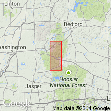
Usage of Indiana Geological Survey is Big Clifty Formation of Stephensport Group. Modified to present form by Gray, Jenkins, and Weidman (1960). "In many places the Big Clifty Formation is composed in descending order of 3 to 14 feet of gray fossiliferous shale and interbedded limestone, 3 to 10 feet of varicolored mudstone and siltstone, 25 to 40 feet of thin-bedded, fine-grained sandstone, and in places as much as 6 feet of black pyritiferous shale at the base. On the outcrop, the sandstone member of this formation is a conspicuous cliff former of great lateral extent, but down-dip in the subsurface of southwestern Indiana, the formation is primarily shale, and sandstone occurs in isolated lenses." Fossiliferous shale and interbedded limestone at top is Indian Springs Shale Member. Recognized on surface in south-central IN from Owen Co. southward to the Ohio River. Conformably overlies Beech Creek Limestone; conformably overlain by Haney Limestone or disconformably by Mansfield Formation (Morrowan).
Source: GNU records (USGS DDS-6; Reston GNULEX).
For more information, please contact Nancy Stamm, Geologic Names Committee Secretary.
Asterisk (*) indicates published by U.S. Geological Survey authors.
"No current usage" (†) implies that a name has been abandoned or has fallen into disuse. Former usage and, if known, replacement name given in parentheses ( ).
Slash (/) indicates name conflicts with nomenclatural guidelines (CSN, 1933; ACSN, 1961, 1970; NACSN, 1983, 2005, 2021). May be explained within brackets ([ ]).