- Usage in publication:
-
- Beulah limestone
- Modifications:
-
- Original reference
- Dominant lithology:
-
- Limestone
- AAPG geologic province:
-
- Denver basin
Summary:
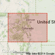
mimeograph, p. 84, 86, 88, 90, 94, and 2 tables. Beulah limestone. Along east side of Front Range, at Beulah, Pueblo County, and in Priest Canyon, [sec. 36, T. 17 S., R. 71 W.], Fremont County, eastern Colorado, consists of 20 feet of shaly, thin-bedded, light-gray to pink, fine-grained, nonfossiliferous limestone, unconformably overlain by Fountain formation and unconformably underlain by Fremont limestone (Upper and Middle Ordovician). On east side of Williams Canyon, [sec. 32, T. 13 S., R. 67 W.], north of Manitou, El Paso County, it is 25 feet thick, contains a few thin beds of sandstone and shale, is unconformably overlain by 100 feet of Madison limestone (Mississippian) and unconformably underlain by Manitou limestone (Lower Ordovician). In Missouri Gulch section, [sec. 35, T. 10 S., R. 69 W.], Manitou Park, Douglas County, it is 65 feet thick, underlies 30 feet of Madison limestone and unconformably overlies Manitou limestone. No fossils found. Assigned to Mississippian or Devonian.
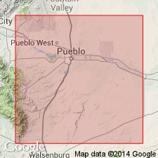
[Named from exposures at Beulah, in sec. 5, T. 23 S., R. 68 W., Pueblo Co., eastern CO, east side of Front Range.]
Source: US geologic names lexicon (USGS Bull. 896, p. 177-178); supplemental information from GNU records (USGS DDS-6; Denver GNULEX).

- Usage in publication:
-
- Beulah limestone†
- Modifications:
-
- Abandoned
- AAPG geologic province:
-
- Denver basin
Summary:
†Beulah limestone abandoned. Replaced with Williams Canyon limestone.
[Misprint (USGS Bull. 896, p. 178): publication date of this manuscript is 1933, not 1932.]
Source: US geologic names lexicon (USGS Bull. 896, p. 177-178).

- Usage in publication:
-
- Beulah limestone*
- Modifications:
-
- Reinstated
- Dominant lithology:
-
- Limestone
- AAPG geologic province:
-
- Denver basin
- Las Vegas-Raton basin
Summary:
Reinstated and named for section measured at Beulah, Pueblo Co, CO, NW1/4 and NE1/4 sec 4, T23S, R68W, its type section in Pueblo Co, CO in the Denver basin. Also occurs in Custer Co, CO in the Las Vegas-Raton basin. Restricted to exposure on South Hardscrabble Creek, Custer Co and ledge north and west of Beulah, Pueblo Co. Is composed of predominantly pink- to red-stained, white to buff, finely sandy and finely oolitic limestone. Concentrations of reddish-yellow dense chert and pyrite found in uppermost layers. Traces of red sandy chert, possibly reworked from underlying Hardscrabble limestone (new) present near base. Is 53 ft thick at type and 40+ ft on South Hardscrabble Creek. Unconformably on Hardscrabble; unconformably underlies Fountain formation. Is correlated with Ste. Genevieve limestone of eastern CO and western KS. Is unfossiliferous; assigned to the Mississippian. Cross sections.
Source: GNU records (USGS DDS-6; Denver GNULEX).

- Usage in publication:
-
- Beulah Limestone*†
- Modifications:
-
- Abandoned
- AAPG geologic province:
-
- Denver basin
Summary:
Applied as a name to outcrops of Mississippian or Devonian age near Beulah, Pueblo Co, CO in Denver basin by Brainerd, Baldwin and Keyte, 1930. Another name Williams Canyon Limestone applied without explanation to the same rock by the same authors in 1933. Neither Beulah nor Hardscrabble have been used beyond an area of 5 mi around the town of Beulah. The two limestones are difficult to distinguish, and impractical to map. Both are abandoned in favor of Leadville Limestone.
Source: GNU records (USGS DDS-6; Denver GNULEX).
For more information, please contact Nancy Stamm, Geologic Names Committee Secretary.
Asterisk (*) indicates published by U.S. Geological Survey authors.
"No current usage" (†) implies that a name has been abandoned or has fallen into disuse. Former usage and, if known, replacement name given in parentheses ( ).
Slash (/) indicates name conflicts with nomenclatural guidelines (CSN, 1933; ACSN, 1961, 1970; NACSN, 1983, 2005, 2021). May be explained within brackets ([ ]).

