

- Usage in publication:
-
- Bertie dolomite
- Modifications:
-
- Named
- Dominant lithology:
-
- Dolomite
- Shale
- AAPG geologic province:
-
- Appalachian basin
Summary:
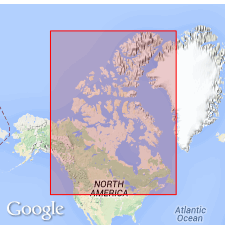
Named Bertie dolomite for Bertie, Ontario, CAN. The lower Helderberg group occupies a comparatively narrow strip of slight thickness in Western CAN, between east end of Lake Erie and township of Cayuga, Ontario. In no place does it exceed 50 feet in thickness and consists of the lowest division of the group as subdivided in NY, or of equivalents of the NY "Waterlime group or Tentaculite limestone." In CAN it is called Bertie or Cayuga dolomite, as its only known exposures are in those townships. A better term may be EURYPTERUS formation, so named for its principal and characteristic fossil, EURYPTERUS REMIPES. In CAN, the Bertie consists of thin-bedded grayish dolomites, interstratified toward base with a few brownish shales and with a brecciated bed composed chiefly of dolomite fragments. The Bertie is of Silurian age.
Source: GNU records (USGS DDS-6; Reston GNULEX).
- Usage in publication:
-
- Bertie formation
- Modifications:
-
- Areal extent
- Revised
- AAPG geologic province:
-
- Appalachian basin
Summary:
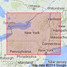
Geographically extended the Bertie formation to NY to include the lower Waterlime EURYPTERUS-bearing magnesian limestones and shales. Unit is 50 feet thick. The Bertie underlies the Cobleskill limestone and overlies the Salina proper or Onondaga salt group. In southern half of Appalachian region the Bertie formation is not lithologically distinguishable from the Salina, and here the term Salina is extended to embrace entire interval between Niagra and Manlius.
Source: GNU records (USGS DDS-6; Reston GNULEX).
- Usage in publication:
-
- Bertie limestone member*
- Modifications:
-
- Revised
- AAPG geologic province:
-
- Appalachian basin
Summary:
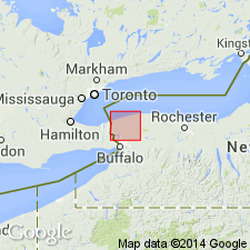
Bertie limestone member of the Salina formation adopted by U.S. Geological Survey. The Bertie is reduced in rank from a formation to a member of the Salina formation. The term Bertie waterlime is dropped because it is a commercial or economic term.
Source: GNU records (USGS DDS-6; Reston GNULEX).
- Usage in publication:
-
- Bertie Group
- Modifications:
-
- Revised
- AAPG geologic province:
-
- Appalachian basin
Summary:
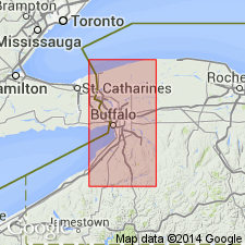
Bertie Group redefined. Author includes the Akron-Cobleskill interval and the newly named Moran Corner Waterlime in his revised Bertie Group. Term Rondout Formation is restricted to its type area in southeastern NY. In this report, Bertie Group in western NY subdivided into (ascending) Fort Hill Waterlime, Oatka Formation, Fiddlers Green Formation, Scajaquada Formation, Williamsville Formation, Cobleskill Formation-Akron Dolostone, and Moran Corner Waterlime. Fort Hill and Moran Corner Waterlimes absent in Ontario, CAN.
Source: GNU records (USGS DDS-6; Reston GNULEX).
For more information, please contact Nancy Stamm, Geologic Names Committee Secretary.
Asterisk (*) indicates published by U.S. Geological Survey authors.
"No current usage" (†) implies that a name has been abandoned or has fallen into disuse. Former usage and, if known, replacement name given in parentheses ( ).
Slash (/) indicates name conflicts with nomenclatural guidelines (CSN, 1933; ACSN, 1961, 1970; NACSN, 1983, 2005, 2021). May be explained within brackets ([ ]).