

- Usage in publication:
-
- Benwood limestone*
- Modifications:
-
- Named
- Dominant lithology:
-
- Limestone
- AAPG geologic province:
-
- Appalachian basin
Summary:
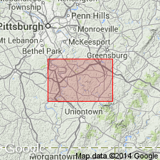
Benwood is geographic name proposed to replace inappropriate name "Great limestone" for the thick limestone that occupies interval between Sewickley coal and Uniontown coal. Unit is generally composed of two members having a total thickness of about 140 ft. Lower member is entirely limestone and 70 or 80 ft thick. Upper member is considerably broken by sandstone and shale beds. Name Benwood was suggested in correspondence by Dr. I.C. White, from town of Benwood, Marshall Co., WV. According to Dr. White, the limestone is well exposed in river bluffs in that vicinity. Age is Pennsylvanian.
Source: GNU records (USGS DDS-6; Reston GNULEX).

- Usage in publication:
-
- Benwood limestone member*
- Modifications:
-
- Revised
- AAPG geologic province:
-
- Appalachian basin
Summary:
In 1907, the West Virginia Geological Survey (Reports on Ohio, Brooke, Hancock, Marshall, Wetzel, and Tyler Counties) restricted the Benwood limestone to lower division of "Great limestone," and applied Fulton green shale to the thin shale (0 to 5 feet) in places separating it from overlying Uniontown limestone, or upper division of "Great limestone." This is present [ca. 1938] established definition of Benwood limestone [Benwood limestone member of Monongahela formation].
[This restricted definition adopted by Shaw (1911) in his Burgettstown-Carnegie folio no. 177.]
Source: US geologic names lexicon (USGS Bull. 896, p. 152).
- Usage in publication:
-
- Benwood limestone
- Modifications:
-
- Revised
- Overview
- AAPG geologic province:
-
- Appalachian basin
Summary:
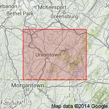
In Fayette Co., PA, Benwood limestone of Monongahela group is divided into several parts by intervening sandstones, shales, and a coal and black shale horizon. Coal is present in only a few sections, but the black shale is persistent and is used to divide Benwood into an upper and lower part. Lower Benwood overlies Upper Sewickley coal and underlies Benwood coal; Upper Benwood underlies Arnoldsburg sandstone.
Source: GNU records (USGS DDS-6; Reston GNULEX).
- Usage in publication:
-
- Benwood member
- Modifications:
-
- Revised
- Overview
- AAPG geologic province:
-
- Appalachian basin
Summary:
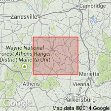
Ohio Geological Survey recognizes the Benwood member of Monongahela series as that section of limestones and shales between Upper Sewickley sandstone and Fulton green shale member. Basal boundary indefinite in many areas as the limestone occurs just above Meigs Creek coal when Upper Sewickley sandstone is absent. Upper boundary uncertain because of inconspicuous development or absence of Fulton green shale. Benwood consists of thick sequences of limestones in many areas and of alternations of limestone and calcareous shales in other localities. Some exposures consist almost entirely of calcareous shales. Thickness in Morgan Co. is 25 to 35 ft.
Source: GNU records (USGS DDS-6; Reston GNULEX).
- Usage in publication:
-
- Benwood limestone member
- Modifications:
-
- Revised
- AAPG geologic province:
-
- Appalachian basin
Summary:
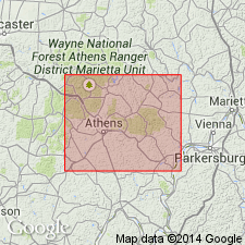
Benwood limestone member assigned to Benwood cyclothem (new) in this report. Name is used for fresh-water limestone above Sewickley sandstone and below Fulton green shale. In Athens Co., OH, unit lacks division of upper and lower units as in PA. A highly variable unit a few in. to 38 ft thick. Occurs as nodules or ledges and is interbedded with calcareous clay shale of redbed type (Tyler redbed member).
Source: GNU records (USGS DDS-6; Reston GNULEX).
- Usage in publication:
-
- Benwood Limestone Bed*
- Modifications:
-
- Revised
- AAPG geologic province:
-
- Appalachian basin
Summary:
Benwood Limestone Member of the Monongahela Formation changed to Benwood Limestone Bed of the Sewickley Member of the Pittsburgh Formation in area of this report. Underlain by the Sewickley coal bed of the Sewickley Member and overlain by limestone A of the upper member of the Pittsburgh Formation. As previously used, Benwood also included limestone A, B, and C of the upper member of the Pittsburgh Formation of this report.
Source: GNU records (USGS DDS-6; Reston GNULEX).

- Usage in publication:
-
- Benwood limestone
- Modifications:
-
- Overview
- AAPG geologic province:
-
- Appalachian basin
Summary:
Unranked nonmarine limestone exposed near town of Benwood, Marshall Co., WV. Overlies Sewickley coal and also locally called Sewickley Member of Pittsburgh Formation of Monongahela Group in PA by Berryhill and others (1971).
Source: GNU records (USGS DDS-6; Reston GNULEX).
For more information, please contact Nancy Stamm, Geologic Names Committee Secretary.
Asterisk (*) indicates published by U.S. Geological Survey authors.
"No current usage" (†) implies that a name has been abandoned or has fallen into disuse. Former usage and, if known, replacement name given in parentheses ( ).
Slash (/) indicates name conflicts with nomenclatural guidelines (CSN, 1933; ACSN, 1961, 1970; NACSN, 1983, 2005, 2021). May be explained within brackets ([ ]).