- Usage in publication:
-
- Benton Spring Group*
- Modifications:
-
- Named
- Reference
- Dominant lithology:
-
- Rhyodacite
- Quartz latite
- Tuff
- AAPG geologic province:
-
- Great Basin province
Summary:
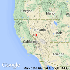
Named for Benton Spring. Type locality: Benton Spring, T9N, R34E, Gabbs Valley Range, Mineral Co, NV. Consists of gray rhyodacite, quartz latite, and rhyolite tuffs multiple-flow cooling units. Ranges from 170 to 900 m thick. Group comprises (ascending): Mickey Pass, Singatse, and Petrified Spring Tuffs. Petrified Spring Tuff not present at Benton Spring, but all three well exposed in fault blocks east of spring and within 2 km northwest of Calavada Summit on hwy 23 in T9N, R35E designated as reference locality. Overlies lavas of Giroux Valley; underlies intermediate lavas or Blue Sphinx Tuff. Is Oligocene age.
Source: GNU records (USGS DDS-6; Menlo GNULEX).
For more information, please contact Nancy Stamm, Geologic Names Committee Secretary.
Asterisk (*) indicates published by U.S. Geological Survey authors.
"No current usage" (†) implies that a name has been abandoned or has fallen into disuse. Former usage and, if known, replacement name given in parentheses ( ).
Slash (/) indicates name conflicts with nomenclatural guidelines (CSN, 1933; ACSN, 1961, 1970; NACSN, 1983, 2005, 2021). May be explained within brackets ([ ]).

