The National Geologic Map Database is migrating to a new infrastructure. We apologize for any service disruptions during this process.
|
|---|


- Usage in publication:
-
- Bennett Creek Breccia
- Modifications:
-
- Original reference
- Dominant lithology:
-
- Breccia
- AAPG geologic province:
-
- Pedregosa basin
Summary:
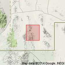
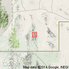
Pg. 21-23, pl. 1. Bennett Creek Breccia. Angular fragments of volcanic and sedimentary rocks embedded in tuff of quartz latite composition. Thickness 0 to 100 feet. Overlies Mojado Fcnmation with angular unconformity in some places and in others rests with erosional unconformity upon Timberlake Fanglomerate (new). Disconformably overlain by Basin Creek Tuff (new). At one locality near head of Bennett Creek formation overlies U-Bar Formation. Age is Tertiary.
Named from exposures south of Bennett Creek, [in N/2 of T. 31 S., R. 18 W.], Walnut Wells quadrangle, Hidalgo Co., southwestern NM.
Source: US geologic names lexicon (USGS Bull. 1350, p. 59).
- Usage in publication:
-
- Bennett Creek Breccia
- Modifications:
-
- Age modified
- AAPG geologic province:
-
- Pedregosa basin
Summary:
Age modified from Tertiary to Oligocene on basis of position within a sequence of volcanic rocks that have been dated as Oligocene. Mapped (geologic map) at northern edge of map area, Pedregosa basin.
Source: GNU records (USGS DDS-6; Denver GNULEX).
For more information, please contact Nancy Stamm, Geologic Names Committee Secretary.
Asterisk (*) indicates published by U.S. Geological Survey authors.
"No current usage" (†) implies that a name has been abandoned or has fallen into disuse. Former usage and, if known, replacement name given in parentheses ( ).
Slash (/) indicates name conflicts with nomenclatural guidelines (CSN, 1933; ACSN, 1961, 1970; NACSN, 1983, 2005, 2021). May be explained within brackets ([ ]).