

- Usage in publication:
-
- Belle City limestone
- Modifications:
-
- Original reference
- Dominant lithology:
-
- Limestone
- Shale
- AAPG geologic province:
-
- Arkoma basin
- Chautauqua platform
Summary:
Pg. 123-125, pls. 3, 27, and map. Belle City limestone. Name used by Boone Jones in unpublished ms. prepared for Oklahoma Geol. Survey in 1922. The name was published, but not defined, by Morgan in Oklahoma Geol. Survey Circ., no. 12, pl. and p. 15, 1923. The formation consists of two limestones and an intervening shale, all fossiliferous. Average thickness 30 feet. The upper limestone is white or light gray, often characterized by well-developed styliolites; is more massive than lower limestone and from 1 foot thick (near Byng) to 15 feet thick (near Canadian River). The lower limestone is of buff color, 1 foot thick (near Byng) to 5 feet thick (near Canadian River), and relatively thin bedded. The intervening shale averages 12 feet in thickness and is of green, blue, and black colors. Underlies Vamoosa formation and overlies Francis formation. Report includes geologic map.
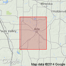
Greatest thickness and probably best exposure on south bluff of Canadian River in sec. 15, T. 5 N., R. 6 E. Named from exposures around Belle City, Seminole Co., central OK.
Source: US geologic names lexicon (USGS Bull. 896, p. 151); GNC OK Corr. Chart, sheet 2, Jan. 1931; supplemental information from GNU records (USGS DDS-6; Denver GNULEX).
- Usage in publication:
-
- Belle City formation
- Modifications:
-
- Overview
- Contact revised
- AAPG geologic province:
-
- Chautauqua platform
Summary:
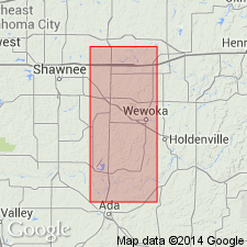
Is one of six formations assigned to the Missouri series in report area. Mapped (geologic map) in north-south belt from central part of Seminole Co. south to the Canadian River, OK on the Chautauqua platform. The northernmost exposures are in SW 1/4 sec. 17, T 10 N, R 8 E. Northern limit due to non-deposition. From this point south, the formation is a few inches to 1 ft thick. Between Wewoka Creek and the Canadian River in T 8 N, R 7E, the outcrop width is approximately 3 miles. Is very resistant to weathering and makes a good horizon for mapping. Consists of two limestones separated by a shale. The lower limestone is buff to yellow and locally fossiliferous. The middle shale is black or dark gray, fossiliferous to green and nonfossiliferous. The upper limestone is gray, chalky-white weathered, dense, fossiliferous with wavy bedding. Lower limestone not present everywhere. Has a maximum thickness [in this county?] of 36 ft. Fossils (brachiopods, gastropods, crinoids, bryozoans) listed. In central part of mapped area, lies between Nellie Bly formation (below) and Hilltop formation (above, new, of Missouri series). Upper contact thus revised. Locally, in central part of mapped area, Vamoosa formation (Virgil series) unconformably overlies Belle City. Cross sections. History of usage described. Stratigraphic columnar diagrams.
Source: GNU records (USGS DDS-6; Denver GNULEX).
For more information, please contact Nancy Stamm, Geologic Names Committee Secretary.
Asterisk (*) indicates published by U.S. Geological Survey authors.
"No current usage" (†) implies that a name has been abandoned or has fallen into disuse. Former usage and, if known, replacement name given in parentheses ( ).
Slash (/) indicates name conflicts with nomenclatural guidelines (CSN, 1933; ACSN, 1961, 1970; NACSN, 1983, 2005, 2021). May be explained within brackets ([ ]).