

- Usage in publication:
-
- Bell Hill dolomite*
- Modifications:
-
- Principal reference
- Dominant lithology:
-
- Dolomite
- AAPG geologic province:
-
- Great Basin province
Summary:
Pg. 19 (fig. 2), 23-25, pl. 1; F.W. Osterwald, 1953, USGS Trace Elements Inv. Rpt. TEI-330, p. 105. Bell Hill dolomite. Made up of two members: lower eight-ninths is dark-gray coarse-grained clastic dolomite; upper one-ninth is light-gray fine-grained dolomite. In northern part of Spor Mountain, a 28-foot-thick dolomite bed with distinctive contorted, convoluted appearance occurs approximately 40 feet from top of unit. Thickness 395 to 430 feet. Overlies Floride dolomite and underlies Harrisite dolomite (both new).
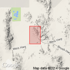
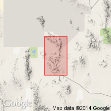
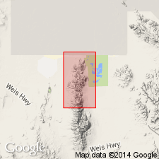
Type section: on steep mountainside 0.5 mi north of Floride Mine, in NE/4 sec. 3, T. 13 S., R. 12 W., Juab Co., northwestern UT [in vicinity of Lat. 39 deg. 43 min. 09 sec. N., Long. 113 deg. 10 min. 59 sec. W., Topaz Mountain West 7.5-min quadrangle]. Named from Bell Hill Mine at southern end of Spors Mountain, [in SE/4 SE/4 sec. 10, T. 13 S., R. 12 W., Lat. 39 deg. 41 min. 57 sec. N., Long. 113 deg. 10 min. 23 sec. W., Topaz Mountain West 7.5-min quadrangle, Juab Co., northwestern UT].
Source: US geologic names lexicon (USGS Bull. 1200, p. 289).
- Usage in publication:
-
- Bell Hill dolomite*
- Modifications:
-
- Overview
- AAPG geologic province:
-
- Great Basin province
Summary:
Section of Bell Hill dolomite 340 ft thick measured about 3,000 ft S 52 deg W of peak 6,830 in the west-central Dugway Range, Tooele Co, UT. Bell Hill overlies Floride dolomite and underlies Harrisite dolomite, and consists of gray to dark-gray, fine- to medium-grained dolomite. The lower contact is with gray, medium-grained dolomite of Floride. Upper contact is with black, medium-grained, massive dolomite of Harrisite. Ranges between 340 and 430 ft thick in report area. Corals (listed) of Middle Silurian age identified from a fossil-bearing bed 4 to 20 ft above formation base. Mapped (geologic map) in southwest and north-central part of area.
Source: GNU records (USGS DDS-6; Denver GNULEX).
- Usage in publication:
-
- Bell Hill Member*
- Modifications:
-
- Revised
- AAPG geologic province:
-
- Great Basin province
Summary:
Reduced in rank and assigned as basal of four members of Laketown Dolomite in Fish Springs Range, Juab Co, UT in Great Basin province. Overlies [unconformably] Floride Member (rank reduced) of Ely Springs Dolomite; underlies Harrisite Member (rank reduced) of Laketown. Middle Silurian age.
Source: GNU records (USGS DDS-6; Denver GNULEX).
For more information, please contact Nancy Stamm, Geologic Names Committee Secretary.
Asterisk (*) indicates published by U.S. Geological Survey authors.
"No current usage" (†) implies that a name has been abandoned or has fallen into disuse. Former usage and, if known, replacement name given in parentheses ( ).
Slash (/) indicates name conflicts with nomenclatural guidelines (CSN, 1933; ACSN, 1961, 1970; NACSN, 1983, 2005, 2021). May be explained within brackets ([ ]).