

- Usage in publication:
-
- Beidell latite-andesite*
- Modifications:
-
- Original reference
- Dominant lithology:
-
- Rhyolite
- Quartz latite
- Andesite
- AAPG geologic province:
-
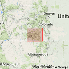
- San Luis basin
Summary:
[Pg. 63-64, pl. 1; credited to Larsen.] Beidell latite-andesite. Flows and tuffs. Lowest beds are rhyolites of no great thickness; they are overlain by several hundred feet of hornblende andesites near quartz latites with some quartz latite and some pyroxene andesite. Over this are several hundred feet of quartz latites near the andesites in composition, which in drainage of San Juan and Red Rock Creeks reach a thickness of nearly 1,000 feet. Probably accumulated about several centers. Largest body (rudely circular in outline and 7+/- miles across) is just west of San Luis Valley, about old mining camp of Beidell, [south of Saguache River], in extreme northern part of Del Norte quadrangle and adjoining part of Saguache quadrangle, [Saguache County], southwestern Colorado. The rock of this body is gray andesite porphyry. Underlies Tracy Creek andesite. Is of pre-Potosi age. Assigned to Miocene(?).
[Receives its name from old mining camp of Beidell, around which it is best developed, Del Norte quadrangle, Saguache Co., southwestern CO.]
Source: US geologic names lexicons (USGS Bull. 896, p. 148; USGS Bull. 1200, p. 279).
- Usage in publication:
-
- Beidell Quartz Latite*
- Modifications:
-
- Age modified
- AAPG geologic province:
-
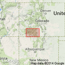
- San Juan Mountains province
Summary:
Age changed from Oligocene --to-- Oligocene and older(?).
Source: Changes in stratigraphic nomenclature, 1974 (USGS Bull. 1405-A, p. A2-A3).
For more information, please contact Nancy Stamm, Geologic Names Committee Secretary.
Asterisk (*) indicates published by U.S. Geological Survey authors.
"No current usage" (†) implies that a name has been abandoned or has fallen into disuse. Former usage and, if known, replacement name given in parentheses ( ).
Slash (/) indicates name conflicts with nomenclatural guidelines (CSN, 1933; ACSN, 1961, 1970; NACSN, 1983, 2005, 2021). May be explained within brackets ([ ]).