The National Geologic Map Database is migrating to a new infrastructure. We apologize for any service disruptions during this process.
|
|---|


- Usage in publication:
-
- Beaver Bend limestone
- Modifications:
-
- Original reference
- Dominant lithology:
-
- Limestone
- Oolite
- AAPG geologic province:
-
- Illinois basin
Summary:
Pg. 7-20. Beaver Bend limestone in Chester group. Bedded limestone, often having massive beds, and highly oolitic; conspicuously jointed. Thickness 0 to 14 feet. Is upper ledge of Mitchell limestone. Underlies Brandy Run sandstone and overlies Sample sandstone. Exposed from Ohio River northward into Putnam County, southwestern Indiana; also recognized in central northern Kentucky. Age is Late Mississippian.
Named from conspicuous bend in Beaver Creek just east of Huron, Lawrence Co., IN.
[GNC remark (ca. 1938, US geologic names lexicon, USGS Bull. 896, p. 138): Later reports give thicknesses up to 118 feet.]
Source: US geologic names lexicon (USGS Bull. 896, p. 138).
- Usage in publication:
-
- Beaver Bend limestone member
- Modifications:
-
- Revised
- Areal extent
- AAPG geologic province:
-
- Illinois basin
Summary:
Pg. 268 (fig. 1), 269, 270 (fig. 3), 271, 273. Beaver Bend limestone member, upper member of Renault formation. Siliceous, ferruginous, coarsely crystalline limestone. In Meade, Hardin, and Breckinridge Counties, central northern Kentucky, Beaver Bend limestone is considered a member of Renault formation. Overlies Mooretown sandstone member; underlies Sample sandstone. Unit has been placed in Gasper oolite and referred to as Renault limestone, but always undifferentiated. Thickness 14.5 feet at Ohio River and as far south as Webster and Lodiburg, both in Breckinridge County; 38 feet in western part of Big Clifty quadrangle. Age is Late Mississippian (Chester).
Source: US geologic names lexicon (USGS Bull. 1200, p. 258); supplemental information from GNU records (USGS DDS-6; Reston GNULEX).
- Usage in publication:
-
- Beaver Bend limestone member
- Modifications:
-
- Revised
- AAPG geologic province:
-
- Illinois basin
Summary:
Pg. 825; J.M Weller and others, 1948, GSA Bull., v. 59, no. 2, chart 4 (column 76). Beaver Bend limestone considered a member of Renault formation in Indiana. Age is Late Mississippian (Chester).
Source: US geologic names lexicon (USGS Bull. 1200, p. 258).

- Usage in publication:
-
- Beaver Bend limestone
- Modifications:
-
- Revised
- AAPG geologic province:
-
- Illinois basin
Summary:
Pg. 7, 13. Beaver Bend limestone. Renault formation of standard Chester column has triple expression in southern Indiana (ascending): Paoli limestone, Mooretown sandstone, and Beaver Bend limestone. Each of these is a distinct stratigraphic unit in parity with other formations of the Chester and deserves a name in its own right. Thicker sections of Beaver Bend are downdip away from eastern outcrop margin; in places along higher margin, unit is quite thin and locally absent. In western Putnam County, southwestern Indiana, cut out and overlapped by Pennsylvanian Mansfield sandstone. Age is Late Mississippian (Chester).
Source: US geologic names lexicon (USGS Bull. 1200, p. 258).
- Usage in publication:
-
- Beaver Bend limestone
- Modifications:
-
- Areal extent
- AAPG geologic province:
-
- Cincinnati arch
Summary:
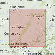
Beaver Bend as upper part of Paoli-Beaver Bend unit extended from western KY into eastern KY. Age is Late Mississippian (Chester).
Source: GNU records (USGS DDS-6; Reston GNULEX).
- Usage in publication:
-
- Beaver Bend limestone
- Modifications:
-
- Overview
- AAPG geologic province:
-
- Illinois basin
Summary:
Pg. 24, pl. 1. Beaver Bend limestone. In Indiana, is light-gray, oolitic, crystalline, and thick-bedded to massive. Thickness 1 to 20 feet. Overlies Mooretown sandstone; underlies Sample sandstone. Age is Late Mississippian (Chester).
Source: US geologic names lexicon (USGS Bull. 1200, p. 258).
- Usage in publication:
-
- Beaver Bend limestone
- Modifications:
-
- Revised
- AAPG geologic province:
-
- Illinois basin
Summary:
Pg. 36 (table 5), 46-47, pl. 1. Beaver Bend limestone of West Baden group (redefined). Brown-gray, thick-bedded, finely crystalline, oolitic limestone 8 to 27 feet thick. Fossiliferous (crinoid columns, brachiopods, blastoids). Upper few feet somewhat shaly in places. Conformably overlies Bethel formation; conformably underlies Sample formation. Age is Late Mississippian (Chester).
Source: US geologic names lexicon (USGS Bull. 1200, p. 258); supplemental information from GNU records (USGS DDS-6; Reston GNULEX).
- Usage in publication:
-
- Beaver Bend Limestone*
- Modifications:
-
- Overview
- AAPG geologic province:
-
- Illinois basin
Summary:
Beaver Bend Limestone adopted for use by the USGS. Age is Late Mississippian (Chester).
Source: GNU records (USGS DDS-6; Reston GNULEX).
- Usage in publication:
-
- Beaver Bend Limestone*
- Modifications:
-
- Overview
- AAPG geologic province:
-
- Illinois basin
Summary:
Beaver Bend Limestone. Light-gray to olive-gray, fine- to medium-grained, bioclastic limestone that has distinctive dusky-yellow weathering color; oolitic in part, especially in upper few feet; locally contains thin discontinuous beds and lenses of clay shale. Fossiliferous (large blastoid PENTREMITES, crinoid columnals locally abundant). Contains aggregations of large clear calcite crystals as much as 3 inches across. Beds commonly 6 inches to 2 feet thick. Overlies Mooretown Formation (Bethel Formation) with gradational contact; underlies Sample Sandstone with sharp contact. Age is Late Mississippian (Chester).
Source: Modified from GNU records (USGS DDS-6; Reston GNULEX).

- Usage in publication:
-
- Beaver Bend Limestone Member
- Modifications:
-
- Overview
- AAPG geologic province:
-
- Illinois basin
Summary:
Pg. 152 (fig. M-32), 154. Beaver Bend Limestone Member, lower member of Ridenhower Formation of West Baden Group. Limestone and shale. Underlies Sample sandstone member (middle member); in southern Illinois where the Sample is absent, it is indistinguishable from Reelsville member (upper member). Age is Late Mississippian (Chester). This is classification of the Illinois Geological Survey.
Source: Publication.
- Usage in publication:
-
- Beaver Bend Limestone*
- Modifications:
-
- Not used
- Areal extent
- AAPG geologic province:
-
- Cincinnati arch
Summary:
Unit called Paoli-Beaver Bend by McFarlan and Walker (1956) in eastern Kentucky here named Miller Knob Member of Slade Formation. Name Beaver Bend rejected for use in eastern Kentucky.
Source: GNU records (USGS DDS-6; Reston GNULEX).

- Usage in publication:
-
- Beaver Bend Limestone
- Modifications:
-
- Overview
- AAPG geologic province:
-
- Illinois basin
Summary:
Pg. 10-11, pls. (article by H.H. Gray and A.S. Horowitz). Beaver Bend Limestone of West Baden Group. Gray skeletal to oolitic to biomicritic limestone. Thickness generally 10 to 14 feet; ranges from 1 to 30 feet. Exposed from central Putnam County southward to Ohio River; recognized in subsurface from Parke County southwestward. In some reports on subsurface of lower Wabash Valley area, Beaver Bend has been erroneously called Lower Paint Creek Limestone. Conformably overlies Bethel Formation; conformably underlies Sample Formation or disconformably underlies Mansfield Formation (Morrowan). Age is Late Mississippian (Chester). Corresponds to lower part of North American Foraminiferal Zone 16s of Mamet and Skipp (1971) and within Zone V3cs of type Visean sequence in Belgium. Yielded conodonts of GNATHODUS BILINEATUS-CAVUSGNATHUS CHARACTUS assemblage zone of North American usage (Collinson and others, 1971, GSA Mem. 127). This is classification of the Indiana Geological Survey.
Source: Publication.
For more information, please contact Nancy Stamm, Geologic Names Committee Secretary.
Asterisk (*) indicates published by U.S. Geological Survey authors.
"No current usage" (†) implies that a name has been abandoned or has fallen into disuse. Former usage and, if known, replacement name given in parentheses ( ).
Slash (/) indicates name conflicts with nomenclatural guidelines (CSN, 1933; ACSN, 1961, 1970; NACSN, 1983, 2005, 2021). May be explained within brackets ([ ]).