The National Geologic Map Database is migrating to a new infrastructure. We apologize for any service disruptions during this process.
|
|---|


- Usage in publication:
-
- Beartooth Butte formation
- Modifications:
-
- Original reference
- Dominant lithology:
-
- Conglomerate
- Limestone
- Shale
- Sandstone
- AAPG geologic province:
-
- Bighorn basin
Summary:
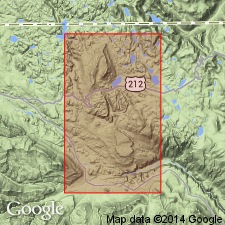
Pg. 723-737. Beartooth Butte formation. Thin-bedded red and buff impure shales, limestone conglomerate, and massive gray limestone; coarse basal conglomerate. Thickness 0 to 150 feet. Underlies Jefferson limestone with slight unconformity and overlies Bighorn dolomite with marked disconformity. Is a channel deposit. Occurs only on Beartooth Butte, in southwestern corner of T. 58 N., R. 105 W., Park County, northwestern Wyoming, 3 miles south of Montana line, just northwest of Beartooth Lake; and in Crandall quadrangle of Absaroka folio. Lower Devonian fauna and flora. [Gave a detailed section of the 4 unnamed members of which it is composed.]
Source: US geologic names lexicon (USGS Bull. 896, p. 135).
- Usage in publication:
-
- Beartooth Butte formation
- Modifications:
-
- Areal extent
- Overview
- AAPG geologic province:
-
- Bighorn basin
Summary:
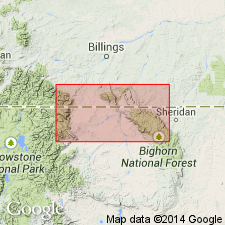
Extended into Bighorn Mountains, Big Horn Co, WY, Bighorn basin. Reported to be a channel deposit 150 ft thick in lower part measured section in Cottonwood Canyon (sec 34, T57N, R93W). Underlies Jefferson? limestone; overlies Leigh? dolomite member of Bighorn dolomite. Fossils include agnathids, arthrodires, and a few plates of cross-opterygians. Correlation with Devonian rocks at nearby localities is shown on plate 1. Stratigraphic chart. Early Devonian age.
Source: GNU records (USGS DDS-6; Denver GNULEX).
- Usage in publication:
-
- Beartooth Butte Formation*
- Modifications:
-
- Areal extent
- AAPG geologic province:
-
- Montana folded belt
- Central Montana uplift
- Powder River basin
- Bighorn basin
- Yellowstone province
- Snake River basin
Summary:
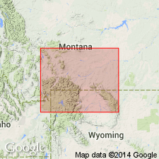
Extends over an area of 30,000 sq mi in southern and central MT, northern WY, and eastern ID within parts of Montana folded belt province, Central Montana uplift, Powder River basin, Bighorn basin, Yellowstone province, and Snake River basin. Figure 1 shows localities of unit. In most places, unconformably overlies Bighorn Dolomite and disconformably underlies Jefferson Formation. Rocks tentatively assigned to Beartooth Butte at Beaver Creek and Logan, MT, are overlain by Maywood Formation; at Half Moon Creek, Beaver Creek, and Logan, MT, tentative Beartooth Butte unconformably overlies shale and limestone-pebble conglomerate of Late Cambrian and Early Ordovician age; in Williston basin, northeast of study area, Beartooth Butte overlies dolomites of Silurian age. At Logan, Little Belt and Big Belt Mountains, Bridger Range and areas farther west, Beartooth Butte replaces lower part of Maywood. Thickness is generally less than 10 ft though occurs in places, including type locality, as thick as 170 ft in channels cut into Bighorn. Correlates with upper part of Water Canyon Formation in northern UT, lower part of Maywood Formation at its type locality, and upper part of Ghost River Formation in west-central Alberta. Unit deposited in a variety of shallow-water marginal marine and continental environments. Early Devonian age.
Source: GNU records (USGS DDS-6; Denver GNULEX).
- Usage in publication:
-
- Beartooth Butte formation
- Modifications:
-
- Areal extent
- AAPG geologic province:
-
- Montana folded belt
Summary:
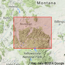
Tentatively extends into southern Montana folded belt province. Basal part of what has been called Maywood formation by other workers at Logan, Half Moon Creek, Beaver Creek and Maywood Ridge (type locality of Maywood) tentatively identified as Beartooth Butte equivalent. Beartooth Butte equivalent beds present in measured sections from Conrow Creek on west to Nixon Gulch on east; absent at Round Mountain, present just to east at Dry Creek and present in sections north of Bridger Peak; absent in southern part of Bridger Range and at most of sections in Gallatin and Madison Ranges. Thin representatives may be present at Arrowhead and Targhee Mountains in Centennial Range. Unconformably overlies Red Lion or Snowy Range formations; underlies Maywood. Correlation chart. Isopach map of combined Maywood and Beartooth Butte over part of area. Early Devonian age.
Source: GNU records (USGS DDS-6; Denver GNULEX).
- Usage in publication:
-
- Beartooth Butte Formation*
- Modifications:
-
- Overview
- AAPG geologic province:
-
- Montana folded belt
- Bighorn basin
- Powder River basin
Summary:
On cross section shown as occurring sporadically at Logan, Gallatin Range, and Beartooth Mountains, MT, Montana folded belt province; Absaroka Range, southern Beartooth Mountains and Bighorn Mountains, WY, Bighorn and Powder River basins; absent east of Bighorn Mountains in WY and SD. Several measured sections. At Clarks Fork Canyon composite section in Beartooth Mountains, Park Co, WY, unit is 11-77 ft thick. Is 140 ft thick at composite section at Cottonwood Canyon; 70 ft thick at composite section at Ed Point area; 8 ft thick at Little Bighorn Canyon section; 22 ft thick at South Fork Rock Creek section; all in Bighorn Mountains, Big Horn, Johnson and Sheridan Cos, WY. Is 6 ft thick at Shoshone Canyon section, near Absaroka Range, Park Co, WY. Unconformably overlies Bighorn Dolomite; unconformably underlies lower member of Jefferson Formation except at Cottonwood Canyon section where unit underlies Souris River Formation. Early Devonian age.
Source: GNU records (USGS DDS-6; Denver GNULEX).
For more information, please contact Nancy Stamm, Geologic Names Committee Secretary.
Asterisk (*) indicates published by U.S. Geological Survey authors.
"No current usage" (†) implies that a name has been abandoned or has fallen into disuse. Former usage and, if known, replacement name given in parentheses ( ).
Slash (/) indicates name conflicts with nomenclatural guidelines (CSN, 1933; ACSN, 1961, 1970; NACSN, 1983, 2005, 2021). May be explained within brackets ([ ]).