- Usage in publication:
-
- Bear Swamp beds
- Modifications:
-
- Named
- Dominant lithology:
-
- Mudstone
- AAPG geologic province:
-
- Appalachian basin
Summary:
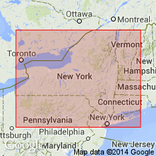
Windom Shale Member of Moscow Formation reaches a maximum thickness of 60 m in the eastern Finger Lakes area of NY. Here it consists of medium to dark gray fossiliferous mudstones and shales with thin concretionary limestone beds and can be divided into approximately 15 informal traceable units and a number of thin, localized shell-rich beds. Units 8-10 are designated the Bear Swamp beds. These mid-Windom Chonetid-rich shales have not been previously recognized as a discrete interval. Package ranges from 0 to 14 m and demonstrates a complex erosion surface at its upper boundary that locally truncates the interval (i.e. western Finger Lakes and Genesee Valley). Unit 8, best developed at the type locality along Bear Swamp Creek at Skaneateles Lake and at Montville Falls at Moravia, consists of medium gray, slightly silty mudstone, dominated by a low diversity fauna especially rich in the chonetid brachiopods. This mudstone grades upward into a silty ZOOPHYCOS-churned mudstone interval about 1 m thick (Unit 9) capped by one or more thin, shell-rich beds contain abundant PSEUDOATRYPA, MEDIOSPIRIFER, and small rugose corals. Coarsening-upward sequence is completed with an upper 1-m-thick shale interval (Unit 10) that locally contains a diminutive brachiopod fauna. In Erie Co., Unit 10 was previously termed the Penn Dixie pyritic beds. In western Erie Co., a thin shell-rich bed within the Bear Swamp was informally named the Big Tree Road bed by Brett and Baird (1982) and a limestone layer previously termed the Amsdell Bed by them caps the upper portion of the middle Windom gray mudstones. The Bear Swamp beds overlie a thin, cryptic conodont bed and a 1- to 2-m-thick shale interval above the Smoke Creek bed. They underlie the Fisher Gully beds. (See Windom entry for complete list of informal units.) Age is Middle Devonian (Givetian).
Source: GNU records (USGS DDS-6; Reston GNULEX).
For more information, please contact Nancy Stamm, Geologic Names Committee Secretary.
Asterisk (*) indicates published by U.S. Geological Survey authors.
"No current usage" (†) implies that a name has been abandoned or has fallen into disuse. Former usage and, if known, replacement name given in parentheses ( ).
Slash (/) indicates name conflicts with nomenclatural guidelines (CSN, 1933; ACSN, 1961, 1970; NACSN, 1983, 2005, 2021). May be explained within brackets ([ ]).

