- Usage in publication:
-
- Beacon Hill sand and gravel
- Modifications:
-
- Original reference
- Dominant lithology:
-
- Gravel
- Sand
- AAPG geologic province:
-
- Atlantic Coast basin
Summary:
Pg. 47-57, 67-72. Beacon Hill sand and gravel (also Beacon Hill formation). Oldest phase of the yellow gravel. Consists of coarse gravel, also fine-grained, and sand. Thickness 0 to 100 feet. Unconformably underlies Pensauken formation and unconformably overlies Cretaceous [sediments]. [Age is late Tertiary (Pliocene?).]
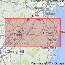
Well developed and exposed on summit of Beacon Hill, 3 mi south of Matawan, [Marlboro 7.5-min quadrangle, Monmouth Co.], NJ.
Source: US geologic names lexicon (USGS Bull. 896, p. 131).

- Usage in publication:
-
- Beacon Hill gravel
- Modifications:
-
- Revised
- AAPG geologic province:
-
- Atlantic Coast basin
Summary:
Beacon Hill gravel restricted to upper or gravel member of Beacon Hill of Salisbury (1894). Consists of coarse gravel, chiefly quartz and chert. Cohansey sand applied to lower member. Underlies Bridgeton formation.
Source: GNU records (USGS DDS-6; Reston GNULEX).

- Usage in publication:
-
- Beacon Hill Gravel*
- Modifications:
-
- Age modified
- AAPG geologic province:
-
- Atlantic Coast basin
Summary:
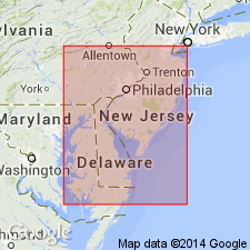
Age of Beacon Hill Gravel, previously mapped as "Upland gravels" by Owens and Minard (1975: USGS Map I-884), here changed from Pliocene(?) to Miocene. Unit crops out at only a few localities in the New Jersey Coastal Plain, especially in a narrow band from Clarksburg on the north to Warren Grove on the south. Northernmost exposures are at Morganville, Monmouth Co., the type locality. These channel-shaped bodies everywhere unconformably overlie Miocene Cohansey Sand. Unit is as much as 12 m throughout this area. Upper beds are irregularly cemented by iron oxide into hard consolidated masses and overlie extensively cross-stratified light-gray to reddish-brown sand or horizontally bedded sandy gravel. Most of the gravel in lower beds is 2.5 cm in average diameter. Quartz, quartzite, and chert are principal constituents of the Beacon Hill Gravel. Interpreted as stream deposit within upper-flow regime with an Appalachian Mountain source and an ancestral Hudson River mode of transport.
Source: GNU records (USGS DDS-6; Reston GNULEX).
For more information, please contact Nancy Stamm, Geologic Names Committee Secretary.
Asterisk (*) indicates published by U.S. Geological Survey authors.
"No current usage" (†) implies that a name has been abandoned or has fallen into disuse. Former usage and, if known, replacement name given in parentheses ( ).
Slash (/) indicates name conflicts with nomenclatural guidelines (CSN, 1933; ACSN, 1961, 1970; NACSN, 1983, 2005, 2021). May be explained within brackets ([ ]).

