- Usage in publication:
-
- Bass River Formation
- Modifications:
-
- Named
- Dominant lithology:
-
- Silt
- Limestone
- AAPG geologic province:
-
- Atlantic Coast basin
Summary:
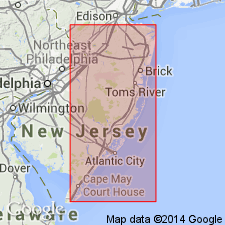
Bass River Formation named in Burlington Co, NJ. Consists of olive-gray to olive black clayey silt with shell fragments, occasionally cemented into massive limestone. 62 m thick at type section; ranges 62 m to 126 m. Occurs in subsurface only. Represents marine transgression. Unconformably overlies Potomac Group; underlies Raritan and Magothy Formations, undivided. Age is Late Cretaceous.
Source: GNU records (USGS DDS-6; Reston GNULEX).

- Usage in publication:
-
- Bass River Formation*
- Modifications:
-
- Age modified
- Biostratigraphic dating
- AAPG geologic province:
-
- Atlantic Coast basin
Summary:
Previously, Cenomanian to early Turonian ages have been assigned to Bass River Formation in several NJ wells on basin of calcareous nannofossils (Valentine, 1984) and planktic foraminifers (Petters, 1976, 1977). However, REHACYTHEREIS EAGLEFORDENSIS occurs near middle of Petters' (176) lower Turonian section in Island Beach hole and near top of Turonian section in Anchor Gas hole, thereby suggesting that at least part of the Turonian section is actually Cenomanian. Similarly, part of correlative Raritan Formation section in Toms River Chemical Company well assigned by Valentine (1984) to lower Turonian contains Cenomanian calcareous nannofossil LITHRAPHIDITES ACUTUS. No Turonian marine sediments in NJ are presently represented by described ostracode assemblages.
Source: GNU records (USGS DDS-6; Reston GNULEX).

- Usage in publication:
-
- Bass River Formation*
- Modifications:
-
- Age modified
- Biostratigraphic dating
- AAPG geologic province:
-
- Atlantic Coast basin
Summary:
Bass River Formation is late Cenomanian based on calcareous nannofossils (Subzone CC 10b of Perch-Nielsen, 1985). Samples from Brick Township core in central eastern NJ contain MICRORHABDULUS DECORATUS, EIFFELLITHUS TURRISEIFFELII, and AXOPODORHABDUS ALBIANUS. First appearance datum (FAD) of E. TURRISEIFFELII marks base of Zone CC 9 and FAD of M. DECORATUS indicates samples can be no older than Zone CC 10, or latest Cenomanian. Presence of A. ALBIANUS, which has last appearance datum (LAD) at top of Cenomanian, also places samples in Zone CC 10. Absence of MICROSTAURUS CHIASTIUS, whose LAD marks top of Subzone CC 10a and base of Subzone CC 10b, further corroborates Subzone CC 10b age. FAD of QUADRUM GARTNERI, which defines base of Zone CC 11 and base of Turonian is not present in samples. Samples from Buena core in southern NJ also contain late Cenomanian calcareous nannofossils dated at no older than Subzone CC 10b, based on presence of MICRORHABDULUS BELGICUS and COROLLITHION EXIGUUM, both of which have FADs at base of Zone CC 10b, and absence of MICROSTAURUS CHIASTIUS and QUADRUM GARTNERI.
Source: GNU records (USGS DDS-6; Reston GNULEX).

- Usage in publication:
-
- Bass River Formation*
- Modifications:
-
- Revised
- AAPG geologic province:
-
- Atlantic Coast basin
Summary:
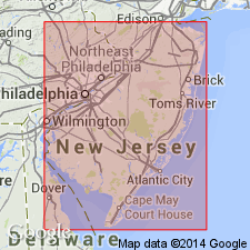
The Bass River Formation, a subsurface unit occurring throughout much of the NJ Coastal Plain, is redefined and stratigraphically restricted to include only the upper beds of the Raritan Formation. Consists of massive, dark gray clay to clayey silt, typically micaceous. Thickness reaches 61 meters. Overlies Raritan Formation and underlies Magothy Formation. Pollen biostratigraphy indicates that the Bass River is of Late Cretaceous (late Cenomanian? to middle Turonian) age.
Source: GNU records (USGS DDS-6; Reston GNULEX).
For more information, please contact Nancy Stamm, Geologic Names Committee Secretary.
Asterisk (*) indicates published by U.S. Geological Survey authors.
"No current usage" (†) implies that a name has been abandoned or has fallen into disuse. Former usage and, if known, replacement name given in parentheses ( ).
Slash (/) indicates name conflicts with nomenclatural guidelines (CSN, 1933; ACSN, 1961, 1970; NACSN, 1983, 2005, 2021). May be explained within brackets ([ ]).

