The National Geologic Map Database is migrating to a new infrastructure. We apologize for any service disruptions during this process.
|
|---|


- Usage in publication:
-
- Basin Creek Tuff
- Modifications:
-
- Original reference
- Dominant lithology:
-
- Tuff
- Quartz latite
- AAPG geologic province:
-
- Pedregosa basin
Summary:
Pg. 36-38, pl. 1. Basin Creek Tuff. Consists of tuff, tuff breccia, and tuff agglomerate of quartz latite composition. Ranges in thickness from 700 feet, north of Gillespie Mountain, to 150 feet, south of Bennett Creek, and pinches out south of Cedar Hill. Rests with apparent conformity upon Oak Creek Tuff north of Gillespie Mountain, unconformably upon Cretaceous rocks on northwestern flank of Winkler anticline, disconformably upon Bennett Creek Breccia (new) south of Bennett Creek, and conformably upon Timberlake Fanglomerate (new) on south side of Cedar Hill. Underlies Cedar Hill Andesite (new). Age is Tertiary.
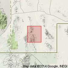
Named from exposures at headwaters of Basin Creek, mostly in S/2 sec. 9 and N/2 sec. 16, T. 30 S., R. 18 W., Walnut Wells quadrangle, Hidalgo Co., southwestern NM.
Source: US geologic names lexicon (USGS Bull. 1350, p. 47-48).
For more information, please contact Nancy Stamm, Geologic Names Committee Secretary.
Asterisk (*) indicates published by U.S. Geological Survey authors.
"No current usage" (†) implies that a name has been abandoned or has fallen into disuse. Former usage and, if known, replacement name given in parentheses ( ).
Slash (/) indicates name conflicts with nomenclatural guidelines (CSN, 1933; ACSN, 1961, 1970; NACSN, 1983, 2005, 2021). May be explained within brackets ([ ]).