The National Geologic Map Database is migrating to a new infrastructure. We apologize for any service disruptions during this process.
|
|---|


- Usage in publication:
-
- Barrel Spring formation
- Modifications:
-
- Named
- Dominant lithology:
-
- Shale
- Limestone
- Quartzite
- AAPG geologic province:
-
- Great Basin province
Summary:
Type section measured in south fork of Mexican canyon which is 2nd canyon north of Barrel Spring canyon [Independence quad, Inyo, CA]. Well exposed in Barrel Spring canyon and in each of 4 canyons to north. Consists of (descending): 1) argillaceous shale, dark gray to black, highly fossiliferous in certain localities, 64 feet; 2) nonfossiliferous dark-gray impure limestone, 25 feet; 3) basal quartzite, white nonfossiliferous, 41 feet. Is 130 feet thick. Conformably overlies Mazourka formation; conformably underlies Devonian quartzite. Five of seven forms present in fauna are either identical with or are closely related to species of Trenton age. Age is Middle Ordovician.
Source: GNU records (USGS DDS-6; Menlo GNULEX).
- Usage in publication:
-
- Barrel Spring formation
- Modifications:
-
- Revised
- AAPG geologic province:
-
- Great Basin province
Summary:
Barrel Spring formation is included in Eureka Group (here raised to group rank) in Mazourka Canyon. Consists of sandstone, shale, and limestone. Divided into 4 unnamed members. Thickness about 100 feet at Mexican Gulch to 150 feet at Lead Canyon Trail. Barrel Spring formation underlies undifferentiated upper part of Eureka group. Overlies Mazourka formation. Fossils collected from lower part of shale member of Barrel Spring formation in Lead Canyon Trail section include conularids, brachiopods, trilobites, and echinoderms. Age is considered to be Mohawkian.
Source: GNU records (USGS DDS-6; Menlo GNULEX).
- Usage in publication:
-
- Barrel Spring formation
- Modifications:
-
- Contact revised
- AAPG geologic province:
-
- Great Basin province
Summary:
Underlies Johnson Spring formation (new) which is name proposed for undifferentiated upper part of Eureka group of Langenheim and others (1956).
Source: GNU records (USGS DDS-6; Menlo GNULEX).
- Usage in publication:
-
- Barrel Spring Formation*
- Modifications:
-
- Adopted
- Mapped 1:62.5k
- AAPG geologic province:
-
- Great Basin province
Summary:
Pg. O25-O26, pl. 1 (geol. map). Barrel Spring Formation. Divisible into 3 units at type section (in ascending order): (1) impure sandstone and limestone, about 50 feet thick; (2) medium-gray nodular bedded limestone containing abundant light-brown weathering silty lenses, about 30 feet thick; (3) dark-gray shale and mudstone forming a most distinctive reddish-brown weathering unit, about 80 feet thick. Brachiopods, trilobites, and graptolites found near base of upper unit. This threefold division can be traced north from type section for about a mile, but elsewhere formation is most easily divisible into only 2 units. The lower 2 units combine to form a light-colored sandy and calcareous mixture, which is commonly hornsfeled. The light-colored lower unit appears to lens out both to the north and south, but the upper red-brown weathering unit is persistent; these 2 units shown separately on accompanying map (pl. 1). Maximum thickness of formation is about 200 feet south of Barrel Springs [!], thins southward to about 70 feet at Willow Springs Canyon and thins northwest to less than 100 feet in vicinity of Badger Flat. Thinning to the north may be in part to faulting. On Badger Flat and to the north, is too thin to show separately on accompanying map (pl. 1), so is mapped with the Johnson Spring Formation. Underlies Johnson Spring Formation; overlies Badger Flat Limestone of Mazourka Group. Previous workers have considered unit to be Trenton(?), Richmond, Richmond and Black River, and Mohawkian. Here, age is tentatively assigned Middle Ordovician.
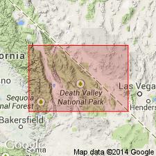
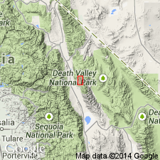
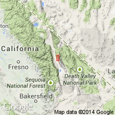
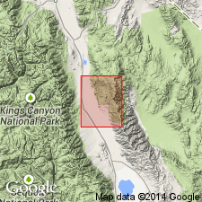
Type section: Mexican Gulch [which is unnamed on present topographic map] but is first canyon north of Bonanza Gulch, in Inyo National Forest, Independence 15-min quadrangle, Inyo Co., CA [approx. Lat. 36 deg. 55 min. 54 sec. N., Long. 118 deg. 03 min. 48 sec. W., Mazourka Peak 7.5-min quadrangle].
Source: Publication; GNU records (USGS DDS-6; Menlo GNULEX).
For more information, please contact Nancy Stamm, Geologic Names Committee Secretary.
Asterisk (*) indicates published by U.S. Geological Survey authors.
"No current usage" (†) implies that a name has been abandoned or has fallen into disuse. Former usage and, if known, replacement name given in parentheses ( ).
Slash (/) indicates name conflicts with nomenclatural guidelines (CSN, 1933; ACSN, 1961, 1970; NACSN, 1983, 2005, 2021). May be explained within brackets ([ ]).