

- Usage in publication:
-
- Bannock Peak Limestone*
- Modifications:
-
- Named
- Biostratigraphic dating
- Reference
- Dominant lithology:
-
- Limestone
- Sandstone
- AAPG geologic province:
-
- Great Basin province
- Snake River basin
Summary:
Bannock Peak Limestone, basal formation of Oquirrh Group. Rocks were previously assigned to West Canyon Limestone Member of Oquirrh Formation. Rocks of the Bannock Peak are distinctively different from the West Canyon. Consists of gray limestone, arenaceous limestone, and calcareous sandstone. Calcareous sandstone and sandy limestone occur in the lower part and grade upward into bioclastic limestone. Ranges between 432 and 446 m thick. Lithology at the type and reference sections shown on a plate. Occurs in the Samaria, Deep Creek, and Black Pine Mountains, and in the Albion, Bannock, and Sublett Ranges, Idaho. Correlates with West Canyon and Lake Point Limestones of Utah. Overlies Manning Canyon Shale; contact placed at base of first thick limestone and interbedded sandstone (Bannock Peak), above a thick black shale (Manning Canyon). Underlies Oquirrh Group undivided; contact placed at base of 10 feet-thick sandy limestone and sandstone (Oquirrh undivided), above ledge-forming limestone (Bannock Peak). In the Samaria Mountains, age is late Chesterian, Morrowan, and Atokan (Chesterian RHACHISTOGNATHUS MURICATUS to Atokan DIPLOGNATHODUS COLORADOENSIS conodont biozones). In the Deep Creek Mountains, age is Morrowan and Atokan (Morrowan Rh. PRIMUS to Atokan D. COLORADOENSIS conodont biozones).
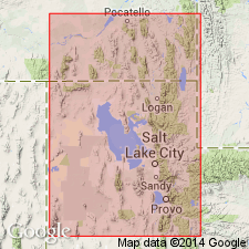
Named from Bannock Peak, northern Deep Creek Mountains, Power Co., ID. Type section: in NW/4 SW/4 sec. 14, T. 16 S., R. 34 W., along ridge to SE/4 SW/4 sec. 10, T. 16 S., R. 34 W., Samaria quadrangle, Oneida Co., ID, in the Great Basin province. Reference section: in SW/4 SE/4 NE/4 sec. 3, T. 9 S., R. 31 E., Power Co., ID, in the Snake River basin.
Source: Modified from GNU records (USGS DDS-6; Denver GNULEX).
For more information, please contact Nancy Stamm, Geologic Names Committee Secretary.
Asterisk (*) indicates published by U.S. Geological Survey authors.
"No current usage" (†) implies that a name has been abandoned or has fallen into disuse. Former usage and, if known, replacement name given in parentheses ( ).
Slash (/) indicates name conflicts with nomenclatural guidelines (CSN, 1933; ACSN, 1961, 1970; NACSN, 1983, 2005, 2021). May be explained within brackets ([ ]).