The National Geologic Map Database is migrating to a new infrastructure. We apologize for any service disruptions during this process.
|
|---|


- Usage in publication:
-
- Bandera Mesa Member
- Modifications:
-
- Original reference
- Dominant lithology:
-
- Tuffaceous sediment
- AAPG geologic province:
-
- Permian basin
Summary:
Bandera Mesa Member of the Devil's Graveyard Formation of the Buck Hill Group. The Bandera Mesa Member, here named, is in the upper part of the Devil's Graveyard Formation (new) of the Buck Hill Group. Consists of pink, red, and brown fluvial and lacustrine tuffaceous mudstone, conglomerate, clay, and limestone, thin basalt flows, and sandstone- and conglomerate-filled channels informally named the Skyline and Cotter channels. Overlies the middle member of the Devil's Graveyard and is separated from it by the Skyline channels. The Cotter channels occur higher in the section. Underlies the Mitchell Mesa Rhyolite or the informal Yellow conglomerate. Thickness is about 1,000 feet. Age is Oligocene based on vertebrate fauna.
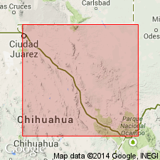
Type area: Area along the front of Bandera Mesa from Puerto Potrillo to Red Hill, and east across Green Valley to McKinney Mountain, Jordan Gap quadrangle, Presidio Co., TX. Boundary stratotypes are designated.
Source: US geologic names lexicon (USGS Bull. 1565, p. 19-20).
- Usage in publication:
-
- Bandera Mesa Member
- Modifications:
-
- Geochronologic dating
- AAPG geologic province:
-
- Permian basin
Summary:
Pg. 23. Bandera Mesa Member (upper member) of Devils Graveyard Formation. Sample from basalt flow overlying sediments containing early Oligocene vertebrates and underlying Mitchell Mesa Rhyolite (about 32 Ma), in Tascota Mesa quadrangle, Presidio County, southwestern Texas, yielded a K-Ar age of 33.2 +/-1.5 Ma (whole-rock). Tuff sample (stratigraphic position uncertain) from McKinney Mountain quadrangle, Presidio County, yielded a K-Ar age of 33.7 +/-1.7 Ma (whole-rock). Data from R.L. Erickson, 1953 (GSA Bull., v. 64, p. 1353-1386), and J.B. Stevens and others, 1984 (Univ. Texas-Austin, Texas Mem. Mus. Bull. 32, 21 p.); ages recalculated using decay constants of Steiger and Jager, 1977 (Earth Planet. Sci. Letters, v. 36, p. 359-362). [Age considered Oligocene. Eocene-Oligocene boundary 36.6 (38-34) Ma (from Geologic Names Committee, USGS, 1983 ed. geol. time scale, with additions from N.J. Snelling, 1985, The Geol. Soc. Mem., no. 10).]
Source: Publication.
For more information, please contact Nancy Stamm, Geologic Names Committee Secretary.
Asterisk (*) indicates published by U.S. Geological Survey authors.
"No current usage" (†) implies that a name has been abandoned or has fallen into disuse. Former usage and, if known, replacement name given in parentheses ( ).
Slash (/) indicates name conflicts with nomenclatural guidelines (CSN, 1933; ACSN, 1961, 1970; NACSN, 1983, 2005, 2021). May be explained within brackets ([ ]).