The National Geologic Map Database is migrating to a new infrastructure. We apologize for any service disruptions during this process.
|
|---|


- Usage in publication:
-
- Bancroft Limestone*
- Modifications:
-
- Original reference
- Biostratigraphic dating
- Dominant lithology:
-
- Limestone
- Claystone
- AAPG geologic province:
-
- Great Basin province
- Snake River basin
- Wasatch uplift
Summary:
Pg. 23, 35 (fig. 4), 36 (fig. 5), 42 (fig. 7), 45, pls. 1, 4-7. Bancroft Limestone. Exposed on east side of Portneuf Range in Bancroft 15-min quadrangle, Idaho; extends southeastward into Wasatch Range, Utah. Is western equivalent of Ute Limestone. Consists of thin- to medium-bedded limestone with a few thin interbedded units of green claystone, especially near base. Mottled and banded, thin-bedded, silty, aphanitic limestone is dominant, especially in upper part; yellow-brown and red to reddish-brown weathering silt mottles and bands give the rock a striking appearance. Lower part is mostly light- to medium-gray subaphanitic limestone with some beds abundantly oolitic and other beds with numerous GIRVANELLA spheroids and ovoids. Is about 520 feet thick at its type; thins southeastward. Thickness is about 300 to 500 feet in Bancroft quadrangle. Overlies Lead Bell Shale (new) or its Cub Tongue (new) to the east. Underlies Blacksmith Limestone; upper contact placed beneath the far more resistant, thick to massive beds of ledge- and cliff-forming limestone assigned to the Blacksmith. In areas of poor exposure, however, upper contact placed at somewhat higher distinct bed of tan- to rusty-reddish-brown weathering dolomitic limestone between beds of medium- to dark-gray limestone. Fossils (trilobites ALOKISTOCARELLA sp. identified by A.R. Palmer, USGS). Age is considered Middle Cambrian (BATHYURISCUS-ELRATHINA trilobite assemblage zone), based on stratigraphic position. Report includes columnar sections, map showing locations of sections, geologic map, faunal lists. Bancroft Limestone adopted by the USGS.
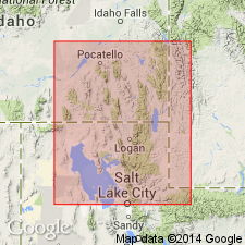
Type section: measured in center of sec. 7, T. 10 S., R. 39 E., Bancroft quadrangle, Bannock Co., ID [Snake River basin]; see p. 8 (fig. 3).
Type area: faulted belt on east side of Portneuf Range, in SW/4 of Bancroft 15-min quadrangle, Bannock and Caribou Cos., ID [Snake River basin, Wasatch uplift] (citing Oriel, 1965, USGS Min. Inv. Field Studies Map, MF-200).
Named from exposures near town of Bancroft, Bancroft 15-min quadrangle, Bannock Co., ID.
[Entry for Bancroft Limestone in US geologic names lexicon (USGS Bull. 1520, p. 16) contains discrepancies in dominant lithology (oolitic limestone); dominant color (green); thicknesses (160 m at type; ranges 90-160 m); type locality (in SW/4 sec. 7).]
Source: Publication; Changes in stratigraphic nomenclature, 1972 (USGS Bull. 1394-A, p. A4-A5); US geologic names lexicon (USGS Bull. 1520, p. 16); GNU records (USGS DDS-6; Denver GNULEX).
For more information, please contact Nancy Stamm, Geologic Names Committee Secretary.
Asterisk (*) indicates published by U.S. Geological Survey authors.
"No current usage" (†) implies that a name has been abandoned or has fallen into disuse. Former usage and, if known, replacement name given in parentheses ( ).
Slash (/) indicates name conflicts with nomenclatural guidelines (CSN, 1933; ACSN, 1961, 1970; NACSN, 1983, 2005, 2021). May be explained within brackets ([ ]).