- Usage in publication:
-
- Banco Bonito flows*
- Modifications:
-
- Original reference
- Dominant lithology:
-
- Rhyolite
- AAPG geologic province:
-
- San Juan basin
Summary:
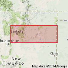
Pg. 53, 54. Banco Bonito flows. A post-Bandelier rhyolite. Black vitrophyre containing dark boulders; outcrops are rhyolite vitrophyre admixed with pumiceous rhyolite. In places the black glass displays a bluish iridescence. Occurs in vicinity of Battleship Rock, in T. 18 N., R. 3 E., Jemez Mountains, Sandoval County, New Mexico. Fills canyons that were cut in Battleship Rock welded tuff (new). Diagram shows Banco Bonito overlying El Cajete flow (new) and underlying late pumice eruptions. Age is [Pleistocene].
Flows appear to have come from low crater called EI Cajete at southern base of Redondo Mountain, Jemez Mountains, Sandoval Co., northwestern New Mexico. Flows are near Banco Bonito picnic ground.
Source: US geologic names lexicon (USGS Bull. 1350, p. 44); supplemental information from GNU records (USGS DDS-6; Denver GNULEX).

- Usage in publication:
-
- Banco Bonito Member*
- Modifications:
-
- Adopted
- Revised
- Dominant lithology:
-
- Obsidian
- AAPG geologic province:
-
- San Juan basin
Summary:
Pg. P18. Banco Bonito Member adopted as upper member of Valles Rhyolite of Tewa Group. Is a porphyritic obsidian flow that fills the southwestern moat of the Valles caldera, north-central New Mexico. Overlies Battleship Rock Member, Valle Grande Member, or El Cajete Member (all of Valles Rhyolite), or Abo Formation. Is youngest eruptive unit in Jemez Mountains; issued from a vent immediately west of El Cajete crater. Age is Pleistocene, based on stratigraphic relations.
Named from Banco Bonito, the steep slope forming the south margin of the flow in central part of Jemez Spring quadrangle, [Sandoval Co.], north-central NM. (Pronounced bahn'-ko bon-ee'-toe.)
Source: Publication; Changes in stratigraphic nomenclature, 1969 (USGS Bull. 1324-A, p. A2).

- Usage in publication:
-
- Banco Bonito Member*
- Modifications:
-
- Geochronologic dating
- AAPG geologic province:
-
- San Juan basin
Summary:
Pg. 25, geologic time scale (inside front cover). Banco Bonito Member of Valles Rhyolite. Sample from a glassy flow in the Jemez Mountains, Lat. 35 deg. 49 min. N., Long. 106 deg. 38 min. W., Jemez Spring quadrangle, Sandoval County, New Mexico, yielded a fission-track age of 0.13 +/-0.10 Ma (zircon). Age calculated using decay constants of Steiger and Jager, 1977 (Earth Planet. Sci. Letters, v. 36, p. 359-362). [Quaternary, based on time scale of Berggren, 1972, Lethaia, v. 5, no. 2, p. 195-215.]
Source: Publication.
For more information, please contact Nancy Stamm, Geologic Names Committee Secretary.
Asterisk (*) indicates published by U.S. Geological Survey authors.
"No current usage" (†) implies that a name has been abandoned or has fallen into disuse. Former usage and, if known, replacement name given in parentheses ( ).
Slash (/) indicates name conflicts with nomenclatural guidelines (CSN, 1933; ACSN, 1961, 1970; NACSN, 1983, 2005, 2021). May be explained within brackets ([ ]).

