- Usage in publication:
-
- Baltimore gneiss*
- Modifications:
-
- Original reference
- Dominant lithology:
-
- Gneiss
- AAPG geologic province:
-
- Piedmont-Blue Ridge province
Summary:
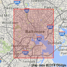
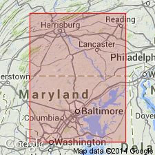
(USGS map of Baltimore and vicinity, to accompany "Guide to Baltimore," prepared for Baltimore meeting Amer. Inst. Mining Engineers Feb. 1892, p. 88-139). [Baltimore gneisses, also Baltimore gneiss, here used to include gneiss overlying Cockeysville marble and the hornblende gneiss underlying Setters quartz schist, and text says Baltimore gneisses embrace a great variety of types. The gneiss that overlies Cockeysville marble is in Wissahickon formation.] Age is pre-Cambrian.
Source: US geologic names lexicon (USGS Bull. 896, p. 107-108).
- Usage in publication:
-
- Baltimore gneisses
- Modifications:
-
- Areal extent
- AAPG geologic province:
-
- Piedmont-Blue Ridge province
Summary:
(Maryland, its resources and institutions, chap. III, p. 55-88). Baltimore gneisses. No certain traces of clastic origin have ever been detected in Baltimore gneisses, although their sedimentary character may be inferred from their rapid alternations of beds of different composition, and from the nature of other rocks intercalated in them, like the marbles and quartz schists.
Source: US geologic names lexicon (USGS Bull. 896, p. 107-108).
- Usage in publication:
-
- Baltimore gneiss
- Modifications:
-
- Areal extent
- AAPG geologic province:
-
- Piedmont-Blue Ridge province
Clark, W.B., 1904, Harford County atlas [Maryland]: Maryland Geological Survey County Report
Summary:
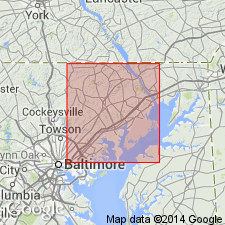
(Maryland Geol. Survey Harford County atlas, geol. map). Pre-Cambrian (Baltimore). Highly crystalline gneisses with bands varying from micaceous quartzite to biotite and hornblende schists. Includes metamorphosed sediments and igneous masses. [Placed beneath Setters quartzite. Columnar section on map reads: "Baltimore gneiss 5,000(?) feet. Banded mica and hornblende gneiss with intruded aplite, pegmatite, and granite."]
Source: US geologic names lexicon (USGS Bull. 896, p. 107-108).
- Usage in publication:
-
- Baltimore gneiss*
- Modifications:
-
- Overview
- AAPG geologic province:
-
- Piedmont-Blue Ridge province
Summary:
Pg. 141-159. Baltimore gneiss. Banded gneiss, highly crystalline. All agree that it is pre-Cambrian. Usually in eastern Maryland it is separated from other metamorphosed sedimentary rocks by igneous masses, but in vicinity of Baltimore and in Philadelphia area, as shown by Dr. Bascom, these banded gneisses immediately underlie the quartzite (Chickies quartzite or Setters quartz schist). Apparently of sedimentary origin.
Source: US geologic names lexicon (USGS Bull. 896, p. 107-108).
- Usage in publication:
-
- Baltimore gneiss*
- Modifications:
-
- Revised
- AAPG geologic province:
-
- Piedmont-Blue Ridge province
Summary:
Pg. 40-62. Baltimore gneiss is restricted to sedimentary gneiss, and the intrusive gneiss is here named Hartley augen gneiss. The Baltimore unconformably underlies Setters formation.
Source: US geologic names lexicon (USGS Bull. 896, p. 107-108).
- Usage in publication:
-
- Baltimore gneiss
- Modifications:
-
- Areal extent
- AAPG geologic province:
-
- Piedmont-Blue Ridge province
Summary:
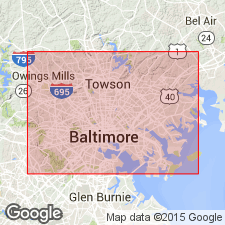
Pg. 105, 140-152. Baltimore gneiss (early pre-Cambrian). Consists of biotite and hornblende gneiss that shows some cataclastic deformation. Varies in appearance from a heavily bedded, granitoid gneiss of white or gray color to a thinly layered ribbon gneiss of alternating light and dark bands.
[Type locality information supplied in this report.] Named from fine outcrops in city of Baltimore, along banks of Jones Falls and Gwynns Falls.
Source: US geologic names lexicon (USGS Bull. 896, p. 107-108); supplemental information from GNU records (USGS DDS-6; Reston GNULEX).
- Usage in publication:
-
- Baltimore gneiss*
- Modifications:
-
- Revised
- AAPG geologic province:
-
- Piedmont-Blue Ridge province
Summary:
(Attributed to Florence Bascom.) Baltimore gneiss includes a nongraphitic facies and a graphitic facies. Latter was formerly treated as a distinct formation and called "Pickering gneiss," but this name is now abandoned, as the rocks are only a graphitic facies of Baltimore gneiss. Assigned to Archean.
[GNC remark (ca. 1938, US geologic names lexicon, USGS Bull. 896, p. 108): In 1934, the USGS decided to adopt Pickering for the pre-Cambrian sedimentary rocks associated with Franklin limestone (a white coarsely crystalline limestone or marble, more or less contemporaneous with Pickering gneiss), with which it is found interbedded as well as apparently overlying. For description of Pickering gneiss see last entry under Pickering gneiss.
The Baltimore gneiss was formerly classified by the USGS as "Archean," but that term having been discarded as a time term the formation is now classified as pre-Cambrian.]
Source: US geologic names lexicon (USGS Bull. 896, p. 107-108).
- Usage in publication:
-
- Baltimore gneiss
- Modifications:
-
- Areal extent
- AAPG geologic province:
-
- Piedmont-Blue Ridge province
Summary:
Baltimore gneiss, on which the rocks of Glenarm series were deposited is now exposed only in southeastern Maryland and Pennsylvania, as far as known.
Source: GNU records (USGS DDS-6; Reston GNULEX).
- Usage in publication:
-
- Baltimore gneiss
- Modifications:
-
- Overview
- AAPG geologic province:
-
- Piedmont-Blue Ridge province
Summary:
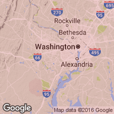
Pg. 33 (table 1), 217, pl. 1. Baltimore gneiss. Baltimore gabbro occurs in peneplained area and occupies a structural basin in the Glenarm series and Baltimore gneiss. Age is Precambrian.
Source: US geologic names lexicon (USGS Bull. 1200, p. 207-208).
- Usage in publication:
-
- Baltimore gneiss
- Modifications:
-
- Areal extent
- AAPG geologic province:
-
- Piedmont-Blue Ridge province
Summary:
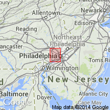
Pg. 924. Baltimore gneiss. Northwest of Philadelphia, the Wissahickon is cut off by Cream Valley fault which brings it into contact with Baltimore gneiss. Age is Precambrian.
Source: US geologic names lexicon (USGS Bull. 1200, p. 207-208).
- Usage in publication:
-
- Baltimore gneiss*
- Modifications:
-
- Revised
- AAPG geologic province:
-
- Piedmont-Blue Ridge province
Summary:
Pg. 980. Baltimore gneiss. Unconformable below Glenarm series, lowest unit of which is Setters quartzite. Age is Precambrian.
Source: US geologic names lexicon (USGS Bull. 1200, p. 207-208).
- Usage in publication:
-
- Baltimore gneiss*
- Modifications:
-
- Areal extent
- AAPG geologic province:
-
- Piedmont-Blue Ridge province
Summary:
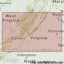
Pg. 172. Baltimore gneiss. Geographically extended into Anna River area of Virginia, where it forms a well-defined belt on east side of area. West of gneiss is Wissahickon schist.
Source: US geologic names lexicon (USGS Bull. 1200, p. 207-208).
- Usage in publication:
-
- Baltimore Gneiss
- Modifications:
-
- Principal reference
- Revised
- AAPG geologic province:
-
- Piedmont-Blue Ridge province
Summary:
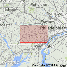
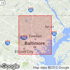
Author proposes to redefine the type locality of the Baltimore Gneiss as the outcrops along Towson Run and Bellona Avenue to Towsontown Blvd in Towson and Cockeysville quadrangles. [According to the Code, type localities may not be redefined. Therefore, this locality is considered to be a principal reference section.] Outcrops along Jones Falls and Gwynns Falls, generally considered to be the type locality of the Baltimore Gneiss, are younger than and texturally different from the rocks known as Baltimore Gneiss in the cores of anticlines lying unconformably beneath the Glenarm. At least 95 percent of the exposed Baltimore Gneiss consists of quartzo-feldspathic gneiss of granodioritic to granitic composition. Remaining five percent consists of amphibolite. The Baltimore is intruded by the Slaughterhouse Gneiss (new) and the Gunpowder Gneiss. Detailed mapping has led to the recognition of four reasonably distinct subdivisions: a layered gneiss member, an augen gneiss member, a streaked-augen gneiss member, and a hornblende gneiss member. All four units probably fall within the time range of 1.1 to 1.0 b.y. (late Precambrian). Type localities of these four unnamed members are given in the Appendix.
Source: GNU records (USGS DDS-6; Reston GNULEX).
- Usage in publication:
-
- Baltimore Gneiss*
- Modifications:
-
- Geochronologic dating
- AAPG geologic province:
-
- Piedmont-Blue Ridge province
Summary:
Pg. 27, geologic time scale (inside front cover). Baltimore Gneiss. Sample from Bryn Mawr, [approx.] Lat. 40 deg. 02 min. N., Long. 75 deg. 19 min. W., Norristown quadrangle, Montgomery or Delaware County, Pennsylvania, yielded a Pb-alpha age of 840 +/-95 Ma (zircon) [Precambrian Y to Z]. Age calculated using decay constants of Steiger and Jager, 1977 (Earth Planet. Sci. Letters, v. 36, p. 359-362).
Source: Publication.
- Usage in publication:
-
- Baltimore Gneiss*
- Modifications:
-
- Geochronologic dating
- Dominant lithology:
-
- Gneiss
- AAPG geologic province:
-
- Piedmont-Blue Ridge province
Summary:
Baltimore Gneiss. Consists of foliated granitic rocks, augen gneiss, layered gneiss, and minor amphibolite. Crops out in cores of a number of foliation folds (mostly domes) in area of Baltimore, Maryland, and West Chester, Pennsylvania. U-Pb ages (zircon discordia curve): Towson dome, 1180 +/-25 Ma; Phoenix dome, 1080 +/-20 Ma. Rb-Sr ages: Phoenix, Towson, and Woodstock domes, 1028 +/-40 Ma; Chester prong and Avondale anticline, 980 Ma and 1060 Ma.
Source: Modified from GNU records (USGS DDS-6; Reston GNULEX).
- Usage in publication:
-
- Baltimore Gneiss
- Modifications:
-
- Reference
- Dominant lithology:
-
- Gneiss
- AAPG geologic province:
-
- Piedmont-Blue Ridge province
Summary:
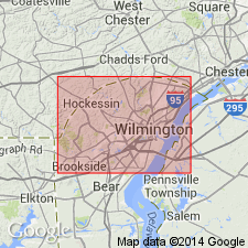
Pg. 2-4, 32. Baltimore Gneiss. Exposed in Mill Creek Nappe and Avondale anticline (West Grove, Kennett Square, and Newark East quadrangles). Consists of granitic gneiss, hornblende-biotite gneiss, and amphibolite with or without pyroxene. Gneisses grade from uniform and weakly layered to strongly layered and migmatitic. Hornblende gneisses and amphibolite layers vary in thickness from less than 0.25 inches to 10's of feet. No ages have been determined for the Baltimore Gneiss in the Mill Creek Nappe in Delaware or Pennsylvania.
Alleinkoff et al (1997) [J.N. Aleinikoff and others, 1997, The Baltimore Gneiss re-revisited: New SHRIMP (zircon) and conventional (titanite) U-Pb ages: GAC/MAC Annual Meeting, Abs. Vol., v. 22, p. A-2] showed that volcanic layers in three of the Baltimore Gneiss domes in or around Baltimore were deposited at 1,245 +/-5 Ma and were affected by subsequent events at 1,210 +/-5 Ma, 1,177 +/-8 Ma, and about 1,030 Ma. U-Pb dating of metamorphic sphene indicates Paleozoic metamorphic events at about 450 Ma, 382 +/-5 Ma, 353 +/-8 Ma, and about 280 Ma, corresponding in general to the Taconic, Acadian, and Alleghenian orogenies, respectively.
Reference section: outcrop at approx. 200 ft elevation, south side of DE Route 82, west of town of Yorklyn, and south of the Red Clay Creek flood plain (locality Bb25-b), Lat. 39 deg. 48 min. 23 sec. N., Long. 75 deg. 40 min. 47 sec. W., Kennett Square 7.5-min quadrangle, New Castle Co., DE.
Source: Publication.
For more information, please contact Nancy Stamm, Geologic Names Committee Secretary.
Asterisk (*) indicates published by U.S. Geological Survey authors.
"No current usage" (†) implies that a name has been abandoned or has fallen into disuse. Former usage and, if known, replacement name given in parentheses ( ).
Slash (/) indicates name conflicts with nomenclatural guidelines (CSN, 1933; ACSN, 1961, 1970; NACSN, 1983, 2005, 2021). May be explained within brackets ([ ]).

