The National Geologic Map Database is migrating to a new infrastructure. We apologize for any service disruptions during this process.
|
|---|


- Usage in publication:
-
- Baldy Hill formation
- Modifications:
-
- Original reference
- Dominant lithology:
-
- Mudstone
- Sandstone
- AAPG geologic province:
-
- Sierra Grande uplift
Summary:
Pg. 31, 35-38, pls. 1a, 1b, 2. Baldy Hill formation of Dockum group. Consists of silty mudstone, with beds of ledge-forming sandy mudstone and very fine-grained sandstone in type section where it is 115 feet thick. A 13-foot interval of claystone present near bottom of section. Formation characterized by purple color, which mottles orange, gray-red, light- to medium-gray, and light olive. Nodules of red and yellow chalcedony and some silicified wood present below top of unit. Several sandstone beds present at base of formation where it underlies Travesser formation (new) 1 or 2 miles east and northeast of type section. Age is Late Triassic.
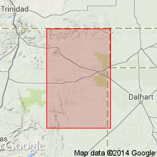
Type section: measured 2,000 ft north of Baldy Hill, in sec. 36, T. 32 N., R. 32 E., Union Co., northeastern NM; measured section shown on pl. 2. Exposed in an area of about 8 sq mi on the former Baker Rank, just north of junction of NM Highways 325 and 370, in eastern T. 32 N., R. 32 E., and western T. 32 N., R. 33 E. Named from Baldy Hill.
Source: US geologic names lexicon (USGS Bull. 1200, p. 204); supplemental information from GNU records (USGS DDS-6; Denver GNULEX).
- Usage in publication:
-
- Baldy Hill Formation
- Modifications:
-
- Revised
- Areal extent
- AAPG geologic province:
-
- Sierra Grande uplift
- Palo Duro basin
Summary:
Lower contact nowhere exposed. Upper contact with Travesser Formation is a disconformity. The Baldy Hill is revised to include a 3 m thick, conglomeratic sandstone bed newly named Cobert Canyon Sandstone Bed. Type section measured. Cobert Canyon Bed was included in the basal Travesser Formation in earlier reports but is reassigned to Baldy Hill in this report because it marks the top of a distinct color change from grayish [brown] (Baldy Hill) to reddish brown (Travesser). Consists of 37 m of yellowish-orange and reddish-brown, bioturbated, quartzose sandstone and siltstone, capped by as much as 3 m of conglomeratic sandstone. Baldy Hill also newly identified in outcrops in sec. 18, T. 5 N., R. 6 E., Cimarron County, Oklahoma, in the Palo Duro basin. Is not assigned to Dockum Group because Dockum is not thought to be "meaningful" (it includes too many different lithologic types), and Triassic of the Dry Cimarron includes strata not found in the Dockum of Texas. Late Triassic (Carnian-Norian) phytosaur and amphibian fossils were found in 1941 from Cobert Canyon Sandstone Bed. Deposited in a clastic-lacustrine environment. Report includes cross sections, correlation chart.
Source: Modified from GNU records (USGS DDS-6; Denver GNULEX).
- Usage in publication:
-
- Baldy Hill Formation
- Modifications:
-
- Areal extent
- AAPG geologic province:
-
- Las Vegas-Raton basin
Summary:
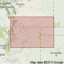
Identified in a measured section at Ricardo Creek, Colfax County, New Mexico, in the Las Vegas-Raton basin. Is in the same stratigraphic position as the upper Carnian Garita Creek Formation, but lithologically is similar to the middle Carnian Los Esteros Member of the Santa Rosa. Overlies Santa Rosa Formation [the part of Santa Rosa stratigraphically equivalent to the Tecolotito Member, lower member of Santa Rosa to south]. Underlies Trujillo Formation. Report includes cross section, correlation chart.
Source: Modified from GNU records (USGS DDS-6; Denver GNULEX).
For more information, please contact Nancy Stamm, Geologic Names Committee Secretary.
Asterisk (*) indicates published by U.S. Geological Survey authors.
"No current usage" (†) implies that a name has been abandoned or has fallen into disuse. Former usage and, if known, replacement name given in parentheses ( ).
Slash (/) indicates name conflicts with nomenclatural guidelines (CSN, 1933; ACSN, 1961, 1970; NACSN, 1983, 2005, 2021). May be explained within brackets ([ ]).