

- Usage in publication:
-
- Bakken formation
- Modifications:
-
- Original reference
- Dominant lithology:
-
- Limestone
- Shale
- Sandstone
- AAPG geologic province:
-
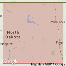
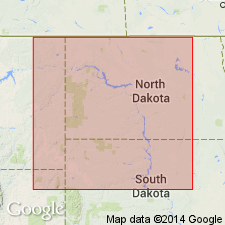
- Williston basin
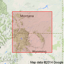
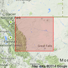
- Sweetgrass arch
Summary:
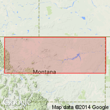
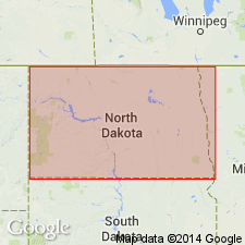
Pg. 72-74, figs. 4, 5. Bakken formation. Name applied to basal Mississippian clastic zone (northern Montana, southern Saskatchewan, Manitoba, and northwestern North Dakota). Previously considered basal clastic unit of Lodgepole limestone. Described in type well as (descending): shale, black, very slightly calcareous, 20 feet; sandstone, light-gray to gray-brown, very fine-grained, calcareous, interbedded with minor amounts of gray-brown, cryptocrystalline limestone, 60 feet; shale, black, fissile, very slightly calcareous, 25 feet. Total thickness 105 feet. Correlated with Sappington sandstone of western Montana, and with Exshaw shale and Banff sandstone in the subsurface of southern Canada. Probably older than Englewood formation of the Black Hills, South Dakota, and Wyoming. Excluded from Madison group. Overlies Three Forks formation; underlies Lodgepole formation. Age is Early Mississippian (Kinderhook).
Type section (subsurface): depth-interval 9,615 to 9,720 ft, Amerada Petroleum Corp. H.O. Bakken No. 1 well, in SW/4 NW/4 sec. 12, T. 157 N., R. 95 W., Willliams Co., ND.
Source: US geologic names lexicon (USGS Bull. 1200, p. 197-198); GNU records (USGS DDS-6; Denver GNULEX).
- Usage in publication:
-
- Bakken formation
- Modifications:
-
- Areal extent
- AAPG geologic province:
-
- Williston basin
Summary:
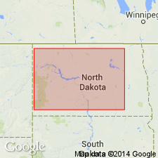
Uses term Englewood formation, instead of Bakken formation, for strata in the Amerada Petroleum Corp., H.O. Bakken No. 1 well, Williams County, North Dakota, in the Williston basin, and elsewhere for the correlative unit in the subsurface of North Dakota.
Source: Modified from GNU records (USGS DDS-6; Denver GNULEX).
- Usage in publication:
-
- Bakken formation
- Modifications:
-
- Revised
- AAPG geologic province:
-
- Williston basin
Summary:
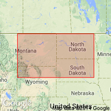
Bakken formation of Madison group. Recognized in northeastern Montana, western North Dakota, and adjacent parts of Saskatchewan and Manitoba, Canada. Overlain by Souris Valley Beds of Madison group and underlain by Devonian Qu'appelle group of Baillie (1953). Age is Mississippian.
Source: Modified from GNU records (USGS DDS-6; Denver GNULEX).
- Usage in publication:
-
- Bakken formation*
- Modifications:
-
- Age modified
- AAPG geologic province:
-
- Williston basin
Summary:
Considered to be Devonian(?) and Early Mississippian age in the subsurface of the central part of the Williston basin and in north-central Montana [on the Central Montana uplift and Sweetgrass arch?]. In earlier reports, assigned to the Devonian(?) and Mississippian. Consists of two radioactive black shales separated by light-gray sandstone, siltstone, or dolomite. Disconformably overlies Three Forks formation. Unconformably underlies Lodgepole limestone. Not deposited on southern and eastern margins of Williston basin.
Source: Modified from GNU records (USGS DDS-6; Denver GNULEX).
- Usage in publication:
-
- Bakken Formation
- Modifications:
-
- Contact revised
- AAPG geologic province:
-
- Williston basin
Summary:
Overlain conformably in eastern North Dakota by the Bottineau interval (new) of Madison Group.
Source: Modified from GNU records (USGS DDS-6; Denver GNULEX).
- Usage in publication:
-
- Bakken Formation
- Modifications:
-
- Reference
- Dominant lithology:
-
- Sandstone
- Shale
- AAPG geologic province:
-
- Williston basin
Summary:
Redescribed well cuttings from type well in Williams County, North Dakota, in Williston basin. Revised the thickness of the middle sandstone unit (to 45 feet) and the lower shale unit (to 40 feet). Isopach maps show thickness and extent of the upper and lower shale units, and the medial sandstone unit in western North Dakota, Williston basin. Lithologic descriptions given for several wells in North Dakota, including the type and reference wells. Lower shale unit considered to be equivalent or nearly equivalent to lower shale unit of Englewood Formation in the Black Hills, South Dakota. Overlain by Lodgepole Formation of Madison Group; underlain by Three Forks Formation. Age is Early Mississippian.
Designated reference section as the cored interval from depths of 10,035 to 10,095 ft in the Socony Vacuum Oil Co., C. Dvorak No. 1 Well, in SE/4 NE/4 sec. 6, T. 141 N., R. 94 W., Dunn Co., [ND], in the Williston basin.
[Misprint (GNU records, USGS DDS-6; Denver GNULEX): Reference section is in North Dakota, not South Dakota.]
Source: Modified from GNU records (USGS DDS-6; Denver GNULEX).
- Usage in publication:
-
- Bakken Formation
- Modifications:
-
- Overview
- Biostratigraphic dating
- AAPG geologic province:
-
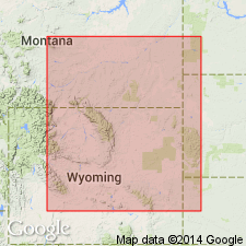
- Sweetgrass arch
- Williston basin
Summary:
Used in northern Montana and northwestern North Dakota, in the Williston basin and on the Sweetgrass arch. Comprises an upper and lower transgressive black shale separated by a medial siltstone. The upper shale is normally more widespread, and its limit coincides with the limit of the formation except in northwestern Montana. There the upper shale was removed by Early Mississippian erosion, and the medial siltstone and lower shale extend farther west. Shows distribution in northern Montana and western North Dakota. The uppermost part coalesced locally with the uppermost part of Englewood Formation of North Dakota, South Dakota, northwestern Nebraska, southeastern Montana, and eastern Wyoming; a vestigial connection is preserved in central North Dakota. Correlation chart shows a hiatus at top of medial siltstone unit at about the Devonian-Mississippian boundary. The medial siltstone and lower black shale units are Late Devonian (Famennian) in age; the upper black shale unit is Early Mississippian (Tournaisian) in age. Overlain conformably by Three Forks Formation.
Source: Modified from GNU records (USGS DDS-6; Denver GNULEX).
- Usage in publication:
-
- Bakken Formation*
- Modifications:
-
- Overview
- Biostratigraphic dating
- AAPG geologic province:
-
- Williston basin
Summary:
Is a Devonian and Mississippian unit recognized in the Williston basin of Montana and North Dakota. Correlates with Sappington Member of Three Forks Formation of the southern Sweetgrass arch (in Teton, Cascade, and Chouteau Counties) and of eastern Montana folded belt province (in Lewis and Clark County). Also correlates with the Exshaw Formation in the subsurface of north-central Montana, northern Sweetgrass arch (in Glacier, Toole, Liberty, Pondera, and northern Teton Counties), and of eastern Montana folded belt province (Flathead County).
Source: Modified from GNU records (USGS DDS-6; Denver GNULEX).
- Usage in publication:
-
- Bakken Formation*
- Modifications:
-
- Areal extent
- AAPG geologic province:
-
- Williston basin
Summary:
The shale at the base of Lodgepole Limestone in the Little Rocky Mountains, Blaine and Phillips Counties, Montana, in Williston basin is assigned to upper black shale unit of Bakken Formation in type section of Lodgepole Limestone, in secs. 19 and 30, T. 26 N., R. 25 E., Blaine County, Montana. Was called Little Chief Canyon Member (abandoned) of Lodgepole Limestone by Knechtel and others (1954). Unconformably overlies Three Forks Formation; conformably underlies Paine Member of Lodgepole Limestone. Age is Early Mississippian (Kinderhookian).
Source: Modified from GNU records (USGS DDS-6; Denver GNULEX).
- Usage in publication:
-
- Bakken Formation
- Modifications:
-
- Biostratigraphic dating
- Overview
- AAPG geologic province:
-
- Williston basin
Summary:
Describes the formation and reports on a diverse conodont collection of more than 650 mostly fragmentary elements from cores from 17 wells in northwestern North Dakota, in Williston basin. Bakken Formation consists of two, mostly noncalcareous, grayish-black to brownish-black shales separated by light- to dark-gray, calcareous and dolomitic siltstone and fine-grained sandstone. Upper shale is Early Mississippian (Kinderhookian) age; the middle member and the lower shale are Late Devonian (Fammenian) age. A hiatus representing the lowermost Kinderhookian separates the upper shale and middle member. The shales were deposited in an anoxic, offshore marine environment. Bedding features and fossils of the middle member indicate a current-influenced, mostly aerobic marine environment. The lower and upper shales were deposited during episodes of widespread marine transgression and the middle member deposition occurred during a time of regional marine regression.
Source: Modified from GNU records (USGS DDS-6; Denver GNULEX).
- Usage in publication:
-
- Bakken Formation*
- Modifications:
-
- Overview
- Age modified
- AAPG geologic province:
-
- Williston basin
Summary:
Assigned to base of author's stratigraphic sequence 4 (Kinderhookian to lower Meramecian) in central Montana and western North Dakota, Williston basin. Is at least partially equivalent to unnamed basal clastic unit which is time transgressive throughout its areal extent in Powder River basin study area and which is also at least partially equivalent to Cottonwood Canyon Member of Madison or Lodgepole Limestones, Englewood Formation, Bakken Formation, Paine Member of Lodgepole Limestone, Leatham Formation, Sappington Member of Three Forks Formation, lower part of Guernsey Formation, and others. Bakken consists of lower and upper dark shale units separated by a medial siltstone. Where upper dark shale unit of Bakken cannot be distinguished, remaining two units are known as Exshaw Formation. In Williston basin, Bakken is disconformable on Upper Devonian Trident Member of Three Forks. Assigned Kinderhookian age as is considered a time-transgressive facies equivalent to Cottonwood Canyon and basal clastic unit. Devonian age assigned to Exshaw (and equivalent part of Bakken) by some other workers was based on equivocal Devonian-age conodonts collected from probable pre-Exshaw basal lag deposits.
Source: Modified from GNU records (USGS DDS-6; Denver GNULEX).
For more information, please contact Nancy Stamm, Geologic Names Committee Secretary.
Asterisk (*) indicates published by U.S. Geological Survey authors.
"No current usage" (†) implies that a name has been abandoned or has fallen into disuse. Former usage and, if known, replacement name given in parentheses ( ).
Slash (/) indicates name conflicts with nomenclatural guidelines (CSN, 1933; ACSN, 1961, 1970; NACSN, 1983, 2005, 2021). May be explained within brackets ([ ]).