The National Geologic Map Database is migrating to a new infrastructure. We apologize for any service disruptions during this process.
|
|---|


- Usage in publication:
-
- Awatubi Member
- Modifications:
-
- First used
- AAPG geologic province:
-
- Plateau sedimentary province
Summary:
First use of the Awatubi Member of the Kwagunt Formation of the Chuar Group. Is dominantly argillaceous, with shales and mudstones of varying color diversified only by thin ferruginous siltstones. At the bottom of the 1128 ft, however, is a massive stromatolite layer, 12 ft thick. This consists of biohermal domes, each 8 to 10 ft in height and width, and made up of a radiate complex of columns 2 to 3 in. in diameter, alternating with confluent domes. The columns show nearly flat laminae, and are generally parallel-sided with few branches Dolomitization has destroyed most of the internal detail, but a clearly defined wall is present, indicative of the form BOXONIA Koroljuk. The matrix between columns is generally crystalline dolomite; that between bioherms is coarsely granular dolomite of a highly porous nature. Flat-pebble conglomerate can be seen at the nucleus of some bioherms. Some 30 ft from the top of the unit, black finely fissile shales yielded abundant CHUARIA CIRCULARIS on both eastern and western slopes of Nankoweap Butte, and the former is thought to be Walcott's type locality. Other beds with CHUARIA were found scattered through the upper part of the member. Age is late Precambrian.
Source: GNU records (USGS DDS-6; Menlo GNULEX).
- Usage in publication:
-
- Awatubi Member
- Modifications:
-
- [Principal reference]
- Dominant lithology:
-
- Shale
- Limestone
- AAPG geologic province:
-
- Plateau sedimentary province
- Southern Rocky Mountain region
Summary:
Pg. 1244 (table 1), 1251-1252, 1257-1258, geol. map (fig. 1), columnar section (fig. 2). Awatubi Member of Kwagunt Formation of Chuar Group. Vari-colored argillaceous shale containing CHUARIA, and a few intervening thin siltstone and sandstone beds. At base of member is a conspicuous 12-foot-thick biohermal stromatolite BOXONIA-bearing bed. Total thickness 1,128 feet (344 m). Is middle member of Kwagunt Formation (new). Underlies basal flaky dolomite beds of Walcott Member (new) and overlies shales of Carbon Butte Member (new); both of Kwagunt Formation. Appears = Walcott's [upper] divisions 10 and 11 of Chuar terrane [USGS Ann. Rpt. 14, p. 508-509, 1894], and part of Hinds' division 7 of Chuar Group [Carnegie Inst. Washington Pub. 463, p. 105-106, 1936]. Fossils. [See also T.D. Ford and W.J. Breed, 1973, The problematical Precambrian fossil CHUARIA: Palaeontology, v. 16, pt. 3, p. 535-550.] Age is late Precambrian (presence of stromatolite BOXONIA suggests late Riphean).
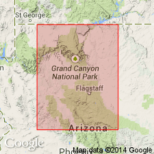
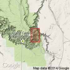
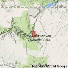
Type section: Awatubi section F, [near peak 4974] in upper reaches of Awatubi Canyon, [approx. Lat. 36 deg. 13 min. 06 sec. N., Long. 111 deg. 51 min. 06 sec. W., Cape Solitude 7.5-min quadrangle], eastern Grand Canyon, Grand Canyon National Park, Coconino Co., northern AZ.
Named from exposures in upper reaches of Awatubi Canyon, [Cape Solitude 7.5-min quadrangle], eastern Grand Canyon, Grand Canyon National Park, Coconino Co., northern AZ.
[Additional locality information from USGS GNIS database and USGS historical topographic map collection TopoView, accessed on September 22, 2024.]
Source: Publication; supplemental information from US geologic names lexicon (USGS Bull. 1520, p. 15).
- Usage in publication:
-
- Awatubi Member*
- Modifications:
-
- Adopted
- AAPG geologic province:
-
- Plateau sedimentary province
Summary:
Awatubi Member of the Kwagunt Formation of the Chuar Group of the Grand Canyon Supergroup is adopted. Age is late Precambrian.
Source: GNU records (USGS DDS-6; Menlo GNULEX).
- Usage in publication:
-
- Awatubi Member*
- Modifications:
-
- Age modified
- AAPG geologic province:
-
- Plateau sedimentary province
Summary:
Age of the Awatubi Member of the Kwagunt Formation is modified from late Precambrian to: Proterozoic Y.
Source: GNU records (USGS DDS-6; Menlo GNULEX).
- Usage in publication:
-
- Awatubi Member*
- Modifications:
-
- Age modified
- AAPG geologic province:
-
- Southern Rocky Mountain region
Summary:
Is the middle member of the Kwagunt Formation of Chuar Group of Grand Canyon Supergroup. Is predominately shale. A ledge-forming biohermal (stromatolite) reef marks the base. Age designation of Proterozoic Y changed to Late Proterozoic, the age term applied to rocks younger than 900 Ma and older than 570 Ma. Change in age designation made to Kwagunt and its Carbon Butte (base), Awatubi, and Walcott (listed in ascending order) Members in northern AZ, Southern Rocky Mountain region. Base of Kwagunt shown at about 850 (estimated) and top of Kwagunt is shown at more than 825 Ma. Columnar section. Is 297 m thick.
Source: GNU records (USGS DDS-6; Denver GNULEX).
For more information, please contact Nancy Stamm, Geologic Names Committee Secretary.
Asterisk (*) indicates published by U.S. Geological Survey authors.
"No current usage" (†) implies that a name has been abandoned or has fallen into disuse. Former usage and, if known, replacement name given in parentheses ( ).
Slash (/) indicates name conflicts with nomenclatural guidelines (CSN, 1933; ACSN, 1961, 1970; NACSN, 1983, 2005, 2021). May be explained within brackets ([ ]).