- Usage in publication:
-
- Auburn Gneiss
- Modifications:
-
- Named
- Dominant lithology:
-
- Gneiss
- Schist
- AAPG geologic province:
-
- Piedmont-Blue Ridge province
Summary:
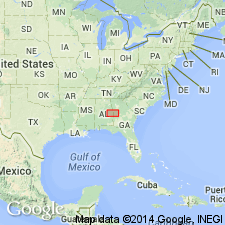
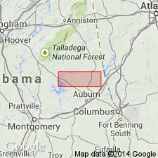
Auburn Gneiss/Gneiss-Schist of Opelika Complex (new name) here named in east-central AL. Described as fine-grained biotite-oligoclase gneiss (quartz-diorite), intermixed with very coarse grained muscovite-biotite schist. Locally contains a few small muscovite-rich pegmatite veins. May represent turbidite sequence. Extends into west-central GA. Age is early Paleozoic. [Actual formal proposal of name has never been published, according to Alabama Geological Survey.]
Source: GNU records (USGS DDS-6; Reston GNULEX).

- Usage in publication:
-
- Auburn Gneiss
- Modifications:
-
- Reference
- Overview
- AAPG geologic province:
-
- Piedmont-Blue Ridge province
Summary:
Auburn Gneiss in the report area is predominantly interlayered, faintly foliated biotite gneiss and migmatitic muscovite-biotite schist. Rare layers of pelitic schist and scattered calc-silicate pods are also present. Schists are characterized locally by a distinct button texture. Unit is approximately 1.5 mi thick in AL, but base is not exposed. Sequence is more diverse than previously thought. Additional reference sections are given here as exposures along the railroad tracks beneath the bridge at Aubrey, 0.75 mi north of North Auburn (NW1/4 sec. 4, T19N, R26E) and along Hodnett Creek, several mi south of Loachapoka (sec. 36, T19N, R24E and sec. 1, T18N, R24E). Author Colberg interprets the migmatitic schists as resulting from potassium metasomatism related to the intrusion of syntectonic granites, namely the Farmville Metagranite (new name) and the Notasulga metagranite (new, informal name).
Source: GNU records (USGS DDS-6; Reston GNULEX).

- Usage in publication:
-
- Auburn Gneiss*
- Modifications:
-
- Overview
- AAPG geologic province:
-
- Piedmont-Blue Ridge province
Summary:
Inner Piedmont is divided into two groups of rocks, Dadeville and Opelika Complexes (Bentley and Neathery, 1970), divided by Stonewall line. Dadeville Complex consists of Agricola Schist, Waresville Schist, Camp Hill Gneiss, Chattasofka Creek Gneiss, Ropes Creek Amphibolite, Waverly Gneiss, Simmons Crossroads metagranite (informal), and various unnamed mafic and ultramafic intrusive rocks. Opelika Complex consists of Loachapoka Schist, Saugahatchee quartzite, and Auburn Gneiss and schist. Farmville Metagranite intrudes these units. Age of all Inner Piedmont rocks is early Paleozoic. Report includes geologic sketch map.
Source: GNU records (USGS DDS-6; Reston GNULEX).
For more information, please contact Nancy Stamm, Geologic Names Committee Secretary.
Asterisk (*) indicates published by U.S. Geological Survey authors.
"No current usage" (†) implies that a name has been abandoned or has fallen into disuse. Former usage and, if known, replacement name given in parentheses ( ).
Slash (/) indicates name conflicts with nomenclatural guidelines (CSN, 1933; ACSN, 1961, 1970; NACSN, 1983, 2005, 2021). May be explained within brackets ([ ]).

