The National Geologic Map Database is migrating to a new infrastructure. We apologize for any service disruptions during this process.
|
|---|


- Usage in publication:
-
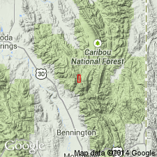
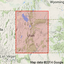
- Aspen Range Formation*
- Modifications:
-
- Named
- Dominant lithology:
-
- Limestone
- Claystone
- Siltstone
- Mudstone
- AAPG geologic province:
-
- Wasatch uplift
Summary:
Named for Aspen Range, Bear Lake Co, ID, Wasatch uplift. Known only in Aspen Range. Type section measured in S1/2 NW1/4 sec 16, T10S, R44E, North Georgetown Canyon, where section 1,743 ft thick divisible into: 1) phosphatic member at base, a dark-gray, fine- to medium-grained limestone, phosphatic brown claystone, and gray siltstone, and mudstone, 20 m thick, a starved basin deposit with brachiopods, forams, conodonts; 2) thin-bedded limestone member, medium-gray, fine-grained limestone, cherty at top, 297 ft thick; 3) sandy crinoidal limestone member, thick-bedded, fine-grained, gray limestone (corals) and gray, calcareous, poorly sorted, some cross-bedding quartz sandstone and siltstone 640 ft thick; 4) birdseye limestone member, gray, fine-grained, thin- to thick-bedded micritic limestone 432 ft thick; 5) chertified siltstone member, gray and green laminated chertified siltstone 93 ft thick, slope former; 6) thick-bedded limestone member, medium-gray, coarse-grained, thick-bedded, cliff-forming limestone 215 ft thick. Overlies Mission Canyon Limestone and unconformably underlies Wells Formation at type. Formerly mapped as Deseret equivalent and as Brazer Limestone. Is a foreland basin deposit that ranges from Osagean to Chesterian age. Correlation chart. Cross section.
Source: GNU records (USGS DDS-6; Denver GNULEX).
- Usage in publication:
-
- Aspen Range Formation*
- Modifications:
-
- Revised
- AAPG geologic province:
-
- Wasatch uplift
Summary:
Divided in North Georgetown Canyon, Aspen Range, Bear Lake Co, ID, Wasatch uplift, into newly named Delle Phosphatic Member, at base, Tetro Limestone Member, sandy crinoidal limestone member, and birdseye limestone member, at top. Delle was called phosphatic member in earlier reports. Correlation chart. Delle is the basal member also of Chainman Shale, Woodman Formation, Deep Creek Formation, Little Flat Formation, Deseret Limestone, and Brazer Dolomite at localities to south and west. Basal contact of Delle is a hard-ground developed on the top of the Mission Canyon. The formation overlies Mission Canyon Limestone in Aspen Range area. Area lies in foreland basin. Isopach and areal extent map of Delle.
Source: GNU records (USGS DDS-6; Denver GNULEX).
For more information, please contact Nancy Stamm, Geologic Names Committee Secretary.
Asterisk (*) indicates published by U.S. Geological Survey authors.
"No current usage" (†) implies that a name has been abandoned or has fallen into disuse. Former usage and, if known, replacement name given in parentheses ( ).
Slash (/) indicates name conflicts with nomenclatural guidelines (CSN, 1933; ACSN, 1961, 1970; NACSN, 1983, 2005, 2021). May be explained within brackets ([ ]).