The National Geologic Map Database is migrating to a new infrastructure. We apologize for any service disruptions during this process.
|
|---|


- Usage in publication:
-
- Ashley marl, bed
- Modifications:
-
- Named
- Dominant lithology:
-
- Marl
- AAPG geologic province:
-
- Atlantic Coast basin
Summary:
The marl of the Ashley and Cooper beds is characterized by its dark gray color and granular texture, while the remains of fishes and Mammalia give its fossil remains a peculiar character and leave no doubt of the position assigned to it, at the top of the Eocene series. These, together with the Santee beds amount to, at least, a thickness of 600 or 700 feet. The beds overlie Eocene Coralline marl and unconformably underlie Pliocene [Miocene] beds. Units are exposed along Ashley and Cooper Rivers, SC. [In text of above report, the beds along Ashley River are called Ashley marl and Ashley beds and the beds along the Cooper River are called Ashley and Cooper beds and Cooper River marls. It is also stated that many of the fossils of the Ashley are found on the Cooper.]
Source: GNU records (USGS DDS-6; Reston GNULEX).

- Usage in publication:
-
- Ashley [marl]†
- Modifications:
-
- Abandoned
- AAPG geologic province:
-
- Atlantic Coast basin
Summary:
†Ashley marl, †Ashley River beds, †Ashley River marl, †Ashley-Cooper beds, †Ashley-Cooper phase, †Ashley-Cooper marl, †Ashley and Cooper beds, and †Ashley phosphate beds. All of [aforementioned] names, used in foregoing and subsequent reports, are replaced by Cooper marl, which is of Jackson age. The Ashley marl of Sloan, 1908 (South Carolina Geol. Survey Bull., 4th ser., no. 2) which he defined as younger than Cooper marl, is interpreted by C.W. Cooke (USGS Bull. 867, 1936) as including in part the Hawthorn formation (lower Miocene) and in part Cooper marl (upper Eocene).
Source: US geologic names lexicon (USGS Bull. 896, p. 81).
- Usage in publication:
-
- Ashley Member*
- Modifications:
-
- Revised
- Dominant lithology:
-
- Marl
- AAPG geologic province:
-
- Atlantic Coast basin
Summary:
In this discussion of the Clubhouse Crossroads Corehole # 1, Cooper Formation and its Harleyville, Parkers Ferry, and Ashley Members are used to conform to previous usage. Age of the Ashley Member is late Oligocene.
Source: GNU records (USGS DDS-6; Reston GNULEX).
- Usage in publication:
-
- Ashley Formation
- Modifications:
-
- Geochronologic dating
- AAPG geologic province:
-
- Atlantic Coast basin
Summary:
Glauconitic micas from the Ashley Formation of the Cooper Group yield Rb-Sr isochron dates of 26.2+/-1.2 Ma. These dates are in agreement with the late Oligocene age assigned by previous authors.
Source: GNU records (USGS DDS-6; Reston GNULEX).
- Usage in publication:
-
- Ashley Formation
- Modifications:
-
- Areal extent
- AAPG geologic province:
-
- Atlantic Coast basin
Summary:
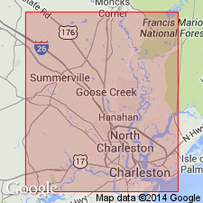
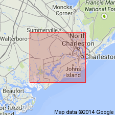
Unit is generally restricted to the Summerville-Charleston area and has not been reported outside of Berkeley, Dorchester, and Charleston Cos., SC. The Ashley thickens toward the southeast and terminates to the northwest near the Dorchester Co. line. The top of the unit generally occurs 5 to 10 ft below the surface; the base extends to depths greater than 50 ft near Charleston Harbor. Throughout the area, the Ashley is unconformably overlain by Pliocene or Pleistocene deposits, or in places by the late Oligocene Chandler Bridge Formation. The barnacles of the Ashley Formation are correlatives of the faunas in the Belgrade and Silverdale Formations of NC and are assigned to the Chattian LOSPHOBALANUS BAUMI Zone. Correlation is supported by calcareous nannofossils found in the Ashley.
Source: GNU records (USGS DDS-6; Reston GNULEX).
- Usage in publication:
-
- Ashley Formation
- Modifications:
-
- Revised locally
- Age modified locally
- Dominant lithology:
-
- Calcarenite
- AAPG geologic province:
-
- Atlantic Coast basin
Weems, R.E., Albright, L.B., III, Bybell, L.M., Cicimurri, D.J., Edwards, L.E., Harris, W.B., Lewis, W.C., Osborne, J.E., Sanders, A.E., and Self-Trail, J.M., 2016, Stratigraphic revision of the Cooper Group and the Chandler Bridge and Edisto Formations in the Coastal Plain of South Carolina: South Carolina Geology, v. 49, p. 1-24.
Summary:
Pg. 3 (fig. 2), 7 (fig. 4), 9-18, 21 (tbl. 6). Ashley Formation of Cooper Group. Thick, typically massive deposits of compact, but unlithified, variably quartzose and phosphatic, muddy foraminiferal sand with a distinctive olive-brown color. Subdivided into newly named members, separated by quartz and phosphate-rich lag beds; in descending order: Givhans Ferry, Runnymede, and Gettysville. Is top formation of Cooper Group. Locally, in area of Clubhouse Crossroads corehole no. 1 site, Dorchester County, southern South Carolina, restricted to beds of early Oligocene (late Rupelian) age. Uppermost 20+ feet (upper Oligocene) reallocated to unconformably overlying Edisto Formation [intervening Chandler Bridge Formation is absent]. In subsurface, contact between Edisto and Ashley placed at strong positive excursion in gamma ray log indicating a phosphatic lag bed. Unconformably overlies Harleyville Formation (upper Priabonian), or where absent, Parkers Ferry Formation (middle Priabonian); both of Cooper Group. Fossils (see Hazel and others, 1977, USGS Prof. Paper 1028). In study area, age is restricted to early Oligocene (late Rupelian; Vandenberghe and others, 2012, Paleogene Period, IN Gradstein and others, The geologic time scale 2012); calcareous nannofossil zone NP 24, planktic foraminifer zones P 20 to 21.
Source: Publication.
For more information, please contact Nancy Stamm, Geologic Names Committee Secretary.
Asterisk (*) indicates published by U.S. Geological Survey authors.
"No current usage" (†) implies that a name has been abandoned or has fallen into disuse. Former usage and, if known, replacement name given in parentheses ( ).
Slash (/) indicates name conflicts with nomenclatural guidelines (CSN, 1933; ACSN, 1961, 1970; NACSN, 1983, 2005, 2021). May be explained within brackets ([ ]).