- Usage in publication:
-
- Ash Canyon member
- Modifications:
-
- First used
- Dominant lithology:
-
- Sandstone
- Conglomerate
- AAPG geologic province:
-
- Orogrande basin
Summary:
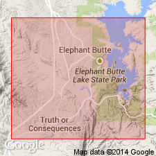
At north end of Caballo Mountains, Sierra Co, NM in Orogrande basin, where a very thick section of Mesaverde formation has been preserved from erosion, the upper 100-200 ft contains a zone of coarse-grained sandstone and quartz pebble conglomerate which has been separated from the main body of the Mesaverde--this is here named Ash Canyon member of Mesaverde [originally used in Thesis by Bushnell, 1953]. No type locality designated. [Probably named for Ash Canyon, Sierra Co.] Is quite distinctive and contains the coarsest material yet seen in the Mesaverde outcrops in south-central NM. Overlies an unnamed part of the Mesaverde. Much silicified wood is found in Mesaverde, and it is especially conspicuous in the upper Ash Canyon beds. One log about 30 ft long and 3 ft wide has been observed in beds east of Elephant Butte Lake. Numerous fossil pelecypod fragments are present in lower beds of Mesaverde formation in the Caballo Mountains. Is of Late Cretaceous age. Columnar sections.
Source: GNU records (USGS DDS-6; Denver GNULEX).

- Usage in publication:
-
- Ash Canyon Member
- Modifications:
-
- Overview
- AAPG geologic province:
-
- Orogrande basin
Summary:
Mapped (geologic map) as the upper member of the Mesaverde Formation in east part of map area, Sierra Co, NM in the Orogrande basin. Intertongues with and overlies main body of Mesaverde. Unconformably underlies Jose Creek Member of McRae Formation. Is 34 m thick at its type locality at Kettle Top; thickness varies about 10 m in area. The geographic locality, Ash Canyon, is located southeast of Elephant Butte Reservoir, about 3 mi east of Truth or Consequences, NM. Composed predominantly of conglomerate beds of subangular to subround pebbles of chert, quartz, and petrified wood. Some medium- to coarse-grained sandstone. Beds are massive and cross-bedded. Is a resistant unit forming hogbacks where dips are steep and mesas where dips are shallow. Cretaceous age.
Source: GNU records (USGS DDS-6; Denver GNULEX).
For more information, please contact Nancy Stamm, Geologic Names Committee Secretary.
Asterisk (*) indicates published by U.S. Geological Survey authors.
"No current usage" (†) implies that a name has been abandoned or has fallen into disuse. Former usage and, if known, replacement name given in parentheses ( ).
Slash (/) indicates name conflicts with nomenclatural guidelines (CSN, 1933; ACSN, 1961, 1970; NACSN, 1983, 2005, 2021). May be explained within brackets ([ ]).

