


- Usage in publication:
-
- Artpark Phosphate Bed
- Modifications:
-
- First used
- Dominant lithology:
-
- Dolostone
- AAPG geologic province:
-
- Appalachian basin
Summary:
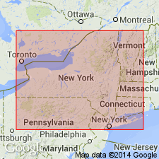
At the north end of Niagara Gorge, CAN, the Artpark Phosphate Bed is described as a distinct, meter-thick phosphatic sandy dolostone lying between the middle and upper Cabot Head Shale. At Niagara Falls, NY, unit occurs at the base of the Grimsby Sandstone and overlies an unnamed sandstone above the Power Glen Shale. Age is Early Silurian.
Source: GNU records (USGS DDS-6; Reston GNULEX).
- Usage in publication:
-
- Artpark Phosphate Bed
- Modifications:
-
- Revised
- AAPG geologic province:
-
- Appalachian basin
Summary:
The green to reddish shales and thin sandstones overlying the Artpark Phosphate Bed are here assigned to the Grimsby Sandstone of the Medina Group. They were previously included in the Power Glen. The Artpark overlies strata here referred to as unnamed sandstone (also assigned to the Grimsby), but called Devils Hole Sandstone by Duke (this report and in press).
Source: GNU records (USGS DDS-6; Reston GNULEX).
- Usage in publication:
-
- Artpark Phosphate Bed*
- Modifications:
-
- Named
- Dominant lithology:
-
- Dolomite
- AAPG geologic province:
-
- Appalachian basin
Summary:
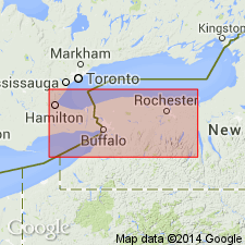
Named the Artpark Phosphate Bed of the Grimsby Formation for Artpark State Park, Lewiston, Niagara Co., western NY. Unit is basal bed of revised Grimsby Formation. Consists of phosphatic sandy dolomite. Thickness is 4.9 ft at type section, but ranges from 0.1 to 6.0 ft. Also well exposed at Somerset railroad viaduct cut at West Jackson Street, Lockport, Niagara Co., NY. Both lower and upper contacts are sharp and well defined. Overlies the Devils Hole Sandstone and underlies the remainder of the Grimsby Formation (both units part of the Medina Group). The Artpark is of Early Silurian (Llandoverian) age based on similar fauna as the Brassfield Limestone in the Midcontinent. [Report employs Early and Late Silurian time scale of Harland and others (1982).]
Source: GNU records (USGS DDS-6; Reston GNULEX).
For more information, please contact Nancy Stamm, Geologic Names Committee Secretary.
Asterisk (*) indicates published by U.S. Geological Survey authors.
"No current usage" (†) implies that a name has been abandoned or has fallen into disuse. Former usage and, if known, replacement name given in parentheses ( ).
Slash (/) indicates name conflicts with nomenclatural guidelines (CSN, 1933; ACSN, 1961, 1970; NACSN, 1983, 2005, 2021). May be explained within brackets ([ ]).