

- Usage in publication:
-
- Argosy Creek Formation*
- Modifications:
-
- Named
- Dominant lithology:
-
- Conglomerate
- Sandstone
- AAPG geologic province:
-
- Idaho Mountains province
- Snake River basin
Summary:
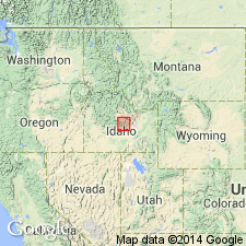
Named uppermost formation of Copper Basin Group (revised). Occurs west of Copper Basin thrust fault, Custer County (Idaho Mountains province), and Blaine County (Snake River basin), south-central Idaho. Argosy Creek includes all units within Copper Basin Group above Drummond Mine Limestone: Scorpion Mountain, Muldoon Canyon, Brockie Lake Conglomerate, and Iron Bog Creek Members, all reduced from formation rank. Argosy Creek defined because upper part of Copper Basin Group is poorly exposed and abrupt facies changes make previous formation-rank units difficult to map. In type area consists of medium-to-thin bedded sandstone which grade upsection into thickly to very thickly bedded sandstones and conglomerate; upper 1000 m, consisting of channelized conglomerate and sandstone with interbedded hummocky sandstone and conglomerate, is well exposed in steep cliffs, but largely inaccessible. Overlies Drummond Mine Limestone of Copper Basin; unconformably underlies Eocene conglomerates or Eocene Challis Volcanic Group. Measured sections and descriptions; page-size geologic maps; correlation charts. Over 1500 m thick in type area. Early and Late Mississippian (Kinderhookian to Chesterian) age based on fossils.
Composite type section: on ridge between north and south forks of Argosy Creek, in SE/4 NW/4 sec. 17, T. 3 N., R. 22 E., and extending into unsurveyed section, within T. 3 N., R. 22 E., Trail Creek quadrangle, Blaine Co., ID. Named from Argosy Creek.
Source: GNU records (USGS DDS-6; Denver GNULEX).
For more information, please contact Nancy Stamm, Geologic Names Committee Secretary.
Asterisk (*) indicates published by U.S. Geological Survey authors.
"No current usage" (†) implies that a name has been abandoned or has fallen into disuse. Former usage and, if known, replacement name given in parentheses ( ).
Slash (/) indicates name conflicts with nomenclatural guidelines (CSN, 1933; ACSN, 1961, 1970; NACSN, 1983, 2005, 2021). May be explained within brackets ([ ]).