

- Usage in publication:
-
- Arcturus limestone
- Modifications:
-
- Original reference
- Dominant lithology:
-
- Limestone
- AAPG geologic province:
-
- Great Basin province
Summary:
Pg. 294. Arcturus limestone. Argillaceous and in part sandy limestone which may be designated Arcturus shaly limestone, although the shaly character is not always apparent. Is easily distinguished by abundance and yellow color of its regolith. Thickness 900 to 1,000 feet. Underlies Ruth limestone and overlies Ely limestone. [Age is Pennsylvanian.]
Source: US geologic names lexicon (USGS Bull. 896, p. 68).
- Usage in publication:
-
- Arcturus limestone*
- Modifications:
-
- Principal reference
- AAPG geologic province:
-
- Great Basin province
Summary:
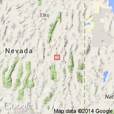
Pg. 26, 28, map. Arcturus limestone was named for Arcturus mining claim, eastern Nevada, on which the formation occurs. It is 400+/- feet thick and lies in the broad central syncline of Ely district and in southwestern corner of Ely quadrangle. In both places it is partly covered by rhyolite flows or by volcanic tuff. Fossils listed. Overlies Ely limestone. The "Ruth" limestone of Lawson is same as Ely limestone. [Age is Pennsylvanian.]
Source: US geologic names lexicon (USGS Bull. 896, p. 68).
- Usage in publication:
-
- Arcturus formation
- Modifications:
-
- Areal extent
- Biostratigraphic dating
- AAPG geologic province:
-
- Great Basin province
Summary:
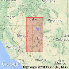
Arcturus formation. Extended into Needle Range, southern Millard County, Utah. Considered to be in part equivalent to the Supai formation of northern Arizona. Age is Early Permian (early Wolfcampian) based on fusulinids.
Measured section in sec. 34, T. 24 S., R. 19 W., 1,078 feet thick.
Source: GNU records (USGS DDS-6; Menlo GNULEX).
- Usage in publication:
-
- Arcturus formation*
- Modifications:
-
- Areal extent
- AAPG geologic province:
-
- Great Basin province
Summary:
Pg. 2174-2178. Name Arcturus geographically extended into Confusion Range, Utah, where it replaces terms "Supai?," "Supai equivalents," and Supai sandstone. Consists of poorly indurated yellowish-gray calcareous sandstone with thin ledge-forming interbeds of dark-gray to tan limestone and dolomite. Total thickness uncertain; minimum thickness 2,700 feet, measured southeast of Indian Pass. Conformably overlies Ely limestone; underlies Kaibab limestone of Park City group. Fossils and stratigraphic position suggest formation is early to middle Permian. Pennebaker (1932), in report on Robinson (Ely) mining district, separated a predominantly sandstone unit of Permian age, which he named Rib Hill formation, from beds previously mapped at Rib Hill as Ely limestone by Spencer (1917). Spencer's description of Ely contains no reference to sandstone, yet Rib Hill area, which is underlain by sandstone, was mapped as Ely limestone. Present writers [Hose and Repenning] believe that in vicinity of Rib Hill, where exposures are poor, inclusion of this predominant sandstone sequence in the Ely by Spencer was inadvertent and that it should have been included in Arcturus formation.
Source: US geologic names lexicon (USGS Bull. 1200, p. 128-129).
- Usage in publication:
-
- Arcturus formation
- Modifications:
-
- Areal extent
- AAPG geologic province:
-
- Great Basin province
Summary:
Pg. 182, 183. Arcturus formation. In southern Butte Mountains, White Pine County, Nevada, Arcturus conformably overlies Carbon Ridge formation. Thickness variable due to angular unconformity at top of unit. Only 264 feet present on west side of range; estimated 2,500 to 3,000 feet present on eastern flank of mountains. Underlies Kaibab(?) formation. [Lithology is predominantly evaporitic. Molluscan fauna correlated to Meade Peak phosphatic shale member of the Phosphoria formation, which is considered to be Early Permian (Wordian) in age.]
Source: US geologic names lexicon (USGS Bull. 1200, p. 128-129); supplemental information from GNU records (USGS DDS-6; Menlo GNULEX).
- Usage in publication:
-
- Arcturus formation
- Modifications:
-
- Revised
- AAPG geologic province:
-
- Great Basin province
Summary:
Pg. 103-106. Arcturus formation. Arcturus limestone was defined by Lawson (1906) as a shaly limestone sequence stratigraphically underlying "Ruth Limestone" and overlying Ely limestone, in Robinson (Ruth) mining district. Lawson's failure to understand structural complexities within general Ruth area resulted in the naming of "Ruth" and "Ely" limestones, which later were proved equivalent by Spencer (1917). Lawson's original description of Arcturus limestone does not make clear to which unit he was referring, but there is little doubt that Lawson's Arcturus limestone did include those beds later referred to as "Rib Hill" by Pennebaker (1932). Additional work is necessary before formation can be further defined and its regional relationship fully understood. At present time, name Arcturus should be applied to those light-colored platy limestones and thin interbedded silts lying stratigraphically above Riepetown sandstone (name proposed to replace Rib Hill) and below Kaibab formation or Loray formation (new). [Fossils (fusulinids and corals). Age is Early Permian (Leonardian).]
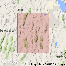
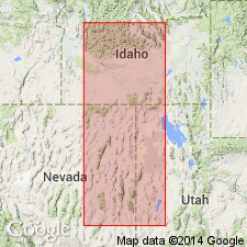
Outcrops of Arcturus distributed over area of about 4,800 sq. mi; [notably in east-central NV (parts of White Pine and Lincoln Cos.) and adjacent west-central UT (parts of Tooele, Juab, and Millard Cos.)].
Source: US geologic names lexicon (USGS Bull. 1200, p. 128-129); supplemental information from GNU records (USGS DDS-6; Denver GNULEX).
- Usage in publication:
-
- Arcturus Formation
- Modifications:
-
- Revised
- Reference
- AAPG geologic province:
-
- Great Basin province
Summary:
Arcturus Formation. Restricted to essentially the rocks Steele (1960) assigned to his Riepetown Sandstone. Proposed reference sections for Arcturus (restricted) at Rib Hill and at Moorman Ranch, both in White Pine County, Nevada. At latter section, Arcturus (restricted) consists of interbedded yellow-brown calcisiltites, noncalcareous siltstones, silty limestones, criquinites, cherty fine-grained siltstones, and sandy limestones, 1,100 to 1,150 feet thick. In its area of outcrop, the Arcturus usually overlies Riepe Spring Limestone and underlies Pequop Formation. Age is Early Permian (late Wolfcampian), based on fusulinids.
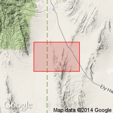
Reference sections for Arcturus (restricted): at Rib Hill (in sec. 21, T. 16 N., R. 62 E., White Pine Co., NV); and at Moorman Ranch (in secs. 7 and 8, T. 17 N., R. 59 E., White Pine Co., NV).
Source: Modified from GNU records (USGS DDS-6; Menlo GNULEX).
- Usage in publication:
-
- Arcturus limestone
- Modifications:
-
- Overview
- AAPG geologic province:
-
- Great Basin province
Summary:
Measured sections at Murray Summit (949.4 ft), Charcoal Ovens (1857.7 ft) and Water Canyon (1815 ft) consist of interbedded limestone and sandstone. Base of Arcturus Formation is located at bottom of prominent thick-bedded limestone succeeding upper part of Riepetown Sandstone. This thick-bedded light-gray limestone is distinguished from Ely Limestone by lack of characteristic corals. Sandstone of lower part of Arcturus Formation is distinguished from Riepetown Sandstone by absence of corals, calcareous character and yellow-buff color. Age is Early Permian. Wolfcampian-Leonardian boundary probably occurs somewhere near the base of the lower part of Arcturus Formation.
Source: GNU records (USGS DDS-6; Menlo GNULEX).
- Usage in publication:
-
- Arcturus Group
- Modifications:
-
- Revised
- AAPG geologic province:
-
- Great Basin province
Summary:
Pg. 585+. Arcturus Group. In eastern Nevada, and southern Confusion Range, Utah, includes (ascending): Riepe Spring Limestone, Riepetown Formation, Pequop Formation, and Loray Formation. In areas of Carlin Canyon and Ferguson Mountain, eastern Nevada, and Gold Hill district and northern Confusion Range, western Utah, where the Riepe Spring and Riepetown are not separable, the term Ferguson Mountain Formation is used instead. Disconformably overlies Hogan Formation of Ely Group except in Carlin Canyon and at Ferguson Mountain, where group overlies Strathearn Formation. Underlies Kaibab Limestone of Park City Group. Age is Permian (Wolfcampian, Leonardian, and Guadalupian). Report includes correlation chart, graphic section, cross sections, and detailed summary of historic use of Permian.
Source: Publication; supplemental information from GNU records (USGS DDS-6; Denver GNULEX).
- Usage in publication:
-
- Arcturus Formation*
- Modifications:
-
- Age modified
- AAPG geologic province:
-
- Great Basin province
Summary:
Table shows age of Arcturus Formation to be Early Permian (Wolfcampian and Leonardian).
Source: GNU records (USGS DDS-6; Menlo GNULEX).
- Usage in publication:
-
- Arcturus Formation*
- Modifications:
-
- Mapped 1:24k
- Dominant lithology:
-
- Dolomite
- Limestone
- Gypsum
- AAPG geologic province:
-
- Great Basin province
Summary:
Arcturus Formation. Light-gray, thin- to medium-bedded, silty to fine-sandy dolomite that weathers orange brown. Includes a few interbeds of gray limestone near base and numerous interbeds of poorly exposed gypsum. Generally forms slopes, low ledges, and small blocky talus. Thickness estimated to be 700+ m; top not exposed. Age is Early Permian (Wolfcampian).
See also Hintze and Best, 1987, Geol. map of Mountain Home Pass and Miller Wash quadrangles, Millard and Beaver Cos., UT, and Lincoln Co., NV, USGS Misc. Field Stud. Map MF-1950, 1 sheet, scale 1:24,000.
Source: Publication.
For more information, please contact Nancy Stamm, Geologic Names Committee Secretary.
Asterisk (*) indicates published by U.S. Geological Survey authors.
"No current usage" (†) implies that a name has been abandoned or has fallen into disuse. Former usage and, if known, replacement name given in parentheses ( ).
Slash (/) indicates name conflicts with nomenclatural guidelines (CSN, 1933; ACSN, 1961, 1970; NACSN, 1983, 2005, 2021). May be explained within brackets ([ ]).