- Usage in publication:
-
- Arcadia marl*
- Modifications:
-
- Original reference
- Dominant lithology:
-
- Marl
- Sand
- AAPG geologic province:
-
- Florida platform
Summary:
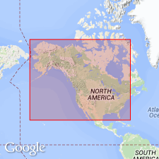
Pg. 131-132, 157, 320. Arcadia marl. Yellowish sandy marl, comprising a putty-like mixture of lime and sand, with minute phosphatic pebbles, a few small shark's teeth, and obscure prints of Ostrea, Spondylus, and other bivalves. When exposed to the air, away from the water, the marl hardens rapidly, sometimes forming a very hard and brittle rock, which splinters and rings almost like chert under the hammer. Thickness on Peace Creek about 9 feet. Overlain by Peace Creek bone bed. [Age is early Pliocene].
[Named from exposures about 6 mi north of Arcadia, along Mare Branch of Peace River, DeSoto Co., southern FL.]
[Arcadia marl abandoned by Matson and Clapp (1909). Considered to be a facies of Caloosahatchee marl.]
Source: US geologic names lexicon (USGS Bull. 896, p. 66).
- Usage in publication:
-
- Arcadia Formation
- Modifications:
-
- Reinstated
- Revised
- AAPG geologic province:
-
- Florida platform
Summary:
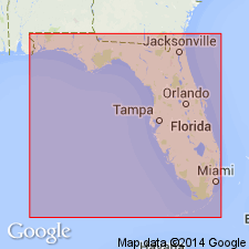
Arcadia Formation described as phosphatic dolomite, very pale orange, poorly sorted, massive, fossiliferous, clayey and sandy. Contains abundant sand-filled burrows and molds of mollusks. Overlies, and in part, interfingers with Tampa Formation. Underlies Bone Valley Formation. Upper contact characterized by series of discontinuous ridges or rolls about 2 to 3 miles long, 1 mile wide, and about 20 to 30 feet high. Smaller mound structures are also present. Both types of structures have their long axis oriented to the north-northwest. Contact with overlying Bone Valley Formation is sharp along the ridges and gradational between ridges.
[GNU remark (May 5, 1994, USGS DDS-6; Reston GNULEX): Authors do not mention Dall and Harris (1892) nor the original use of name as Arcadia marl, nor do they mention its abandonment by Matson and Clapp (1909). Reinstatement and revision in this article are the interpretation of the GNU.]
Source: GNU records (USGS DDS-6; Reston GNULEX).
- Usage in publication:
-
- Arcadia Formation
- Modifications:
-
- Principal reference
- Revised
- Dominant lithology:
-
- Limestone
- Dolostone
- AAPG geologic province:
-
- South Florida province
Summary:
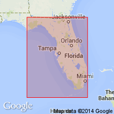
The name Arcadia Formation is reintroduced for the lower Hawthorn carbonate section in south FL. Use is similar to that of Riggs (1967: Univ. of Montana, Ph.D. Dissertation). The original Arcadia Marl, named by Dall and Harris (1892) and abandoned by Matson and Clapp (1909), referred to a carbonate bed exposed along the Peace River and now included within the Peace River Formation (new name). Because the usage introduced by Riggs (1967) was never formalized, this author here formally proposes the name Arcadia Formation and designates a type section in a core in DeSoto Co. where the unit measures 423 ft (129 m). Maximum thickness of 650 ft (198 m) measured in Dade Co. Two members are recognized in portions of south Florida--the Nocatee (new name) and the overlying Tampa (rank reduced). The Arcadia includes sediments formerly assigned to the Tampa Formation or Limestone (King and Wright, 1979) and the Tampa sand and clay unit of Wilson (1977). With the exception of the Nocatee Member, unit consists predominantly of limestone and dolostone with varying amounts of quartz sand, clay, and phosphate grains. The Arcadia Formation unconformably overlies either the Ocala Group or the "Suwannee" Limestone and unconformably underlies the Peace River Formation. Upper part of unit correlates with part of the Marks Head Formation of north FL and GA and the Torreya Formation of the FL panhandle. Suggested age is early early Miocene to late early Miocene.
Source: GNU records (USGS DDS-6; Reston GNULEX).
- Usage in publication:
-
- Arcadia Formation*
- Modifications:
-
- Overview
- AAPG geologic province:
-
- Florida platform
Summary:
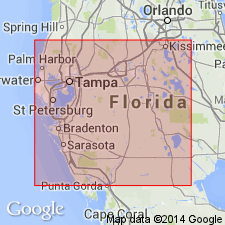
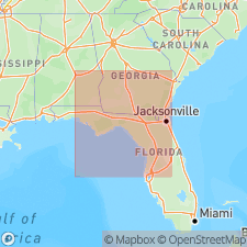
In the Land-pebble district of FL, the Arcadia Formation of the Hawthorn Group (as revised by Scott, 1988) consists of sandy dolomite with abundant phosphate pellets and pebbles. Thickness ranges from 3 to 30 m. In the southern extension, the Arcadia is a sandy, fossiliferous dolomite with phosphate pebbles throughout and is 30 to 45 m thick. Unit is of Miocene age.
Source: GNU records (USGS DDS-6; Reston GNULEX).
- Usage in publication:
-
- Arcadia Formation
- Modifications:
-
- Geochronologic dating
- AAPG geologic province:
-
- Florida platform
Summary:
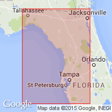
Authors use 87Sr/86Sr isotopic analyses in an attempt to resolve age relations of fossiliferous marine units that contain the remains of terrestrial vertebrates. Tampa Member of the Arcadia Formation yielded a late Oligocene age of 25.4 Ma.
Source: GNU records (USGS DDS-6; Reston GNULEX).
- Usage in publication:
-
- Arcadia Formation
- Modifications:
-
- Biostratigraphic dating
- AAPG geologic province:
-
- Florida platform
Summary:
Tampa Member at the base of the Arcadia Formation contains the Cow House Slough Local Fauna in Hillsborough Co., central FL. The Cow House Slough and the White Springs, found in the Parachucla, are both Arikareean in age. Consequently, the Tampa is at least in part late Oligocene and correlative with the Parachucla as suggested by Scott (1988). Upper part of the Arcadia contains the Sweetwater Branch and Bird Branch Local Faunas, which are early Barstovian (Miocene). The upper Arcadia is correlative with the Dogtown Member of the Torreya Formation in the eastern panhandle of FL.
Source: GNU records (USGS DDS-6; Reston GNULEX).
- Usage in publication:
-
- Arcadia Formation*
- Modifications:
-
- Age modified
- AAPG geologic province:
-
- Florida platform
Summary:
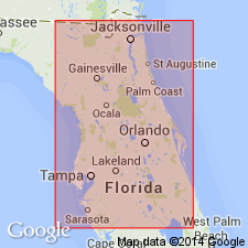
Authors follow usage of Scott (1988). Divided into lower undifferentiated part, Nocatee Member, Tampa Member, and upper undifferentiated part. Age is changed to late (possibly early) Oligocene to middle to earliest late Miocene, based on mollusk and dinocyst data as well as 87Sr/86Sr age estimates. Age indicators in lower part are early to late Oligocene (30.3 to 26.8 Ma); age indicators for Nocatee are late Oligocene (27.1 to 26.3 Ma); age indicators for Tampa range from late Oligocene to middle Miocene (27.9 to 18.9 Ma); and age indicators for upper part range from late Oligocene to middle Miocene (28.6 to 16.7 Ma).
Source: GNU records (USGS DDS-6; Reston GNULEX).
- Usage in publication:
-
- Arcadia Formation
- Modifications:
-
- Age modified
- Biostratigraphic dating
- Geochronologic dating
- AAPG geologic province:
-
- Florida platform
Summary:
Age of Arcadia Formation changed to early Oligocene to early Miocene. Sr isotope analyses (33.1 to 16. 7 Ma) and molluscan assemblages (CHAMELEA MISSISSIPPIENSIS?, CORBULA ENGONATA? Conrad, 1848, DONAX FUNERATA? Dall, 1900, and TURRITELLA CAELATURA) from eleven samples at two localities indicate base of Arcadia is in early Oligocene. These molluscan species have also been reported from lower Oligocene Mint Spring Formation in MS. Nocatee Member of Arcadia is late Oligocene based on Sr isotope analyses and dinocyst assemblages from four cores. A single Sr value from Prairie Creek core gives an early Oligocene age for Nocatee, but dinocysts from same sample yield a late Oligocene age. Tampa Member and part of upper Arcadia are late Oligocene through early Miocene as determined by Sr isotope age estimates and dinocyst and mollusk assemblages. Oligocene-Miocene boundary cannot be identified lithologically where Arcadia Formation spans boundary in western and central parts of peninsula. However, on east coast, boundary represents large unconformity; no upper Oligocene is present.
Source: GNU records (USGS DDS-6; Reston GNULEX).
For more information, please contact Nancy Stamm, Geologic Names Committee Secretary.
Asterisk (*) indicates published by U.S. Geological Survey authors.
"No current usage" (†) implies that a name has been abandoned or has fallen into disuse. Former usage and, if known, replacement name given in parentheses ( ).
Slash (/) indicates name conflicts with nomenclatural guidelines (CSN, 1933; ACSN, 1961, 1970; NACSN, 1983, 2005, 2021). May be explained within brackets ([ ]).

