The National Geologic Map Database is migrating to a new infrastructure. We apologize for any service disruptions during this process.
|
|---|


- Usage in publication:
-
- Arapien shale*
- Modifications:
-
- Principal reference
- Dominant lithology:
-
- Shale
- Sandstone
- Gypsum
- AAPG geologic province:
-
- Wasatch uplift
Summary:
Pg. 122, 123-125. Arapien shale. Subdivided into Twist Gulch member above and Twelvemile Canyon member (both new). Underlies Morrison(?) formation. Age is Late Jurassic. Type area designated.
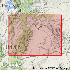
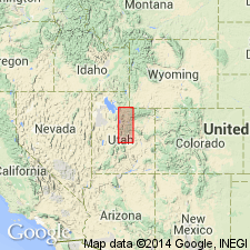
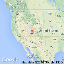
Type area: Arapien Valley, [Sanpete Co., central UT], which lies parallel to base of Wasatch Plateau about 6 mi southeast of Gunnison. Formation is typically, if not completely exposed, on west side of valley.
Source: US geologic names lexicon (USGS Bull. 1200, p. 123-124).
- Usage in publication:
-
- Arapien shale
- Modifications:
-
- Revised
- AAPG geologic province:
-
- Wasatch uplift
- Great Basin province
Summary:
Is the oldest stratigraphic unit exposed in report area. Is stratigraphically restricted to rocks assigned in earlier reports only to the Twelvemile Canyon member of Spieker (1946). Arapien of this report includes "Types" 1 to 4 of Spieker's Twelvemile Canyon member of Arapien. "Type" 5 of Spieker's Twist Gulch member of Arapien is the Twist Gulch formation of this report. Occurs in a narrow outcrop belt that extends along the east margin of the Sevier Valley from east of the town of Gunnison to near Richfield in Sanpete and Sevier Cos, UT on the Wasatch uplift, and on the Gunnison Plateau from north of Salt Creek to south of Levan in Juab Co, UT in the Great Basin province. Areal extent map. Ranges from 2,700 ft thick at Chicken Creek Canyon, to 2,780 ft thick east of Gunnison to an estimated more than 3,000 ft thick. Measured sections. Cross sections. Underlies Twist Gulch formation, a unit formerly classified as the upper member of Arapien shale. Has a fauna typical of the early Carmel. Is equivalent to part of the Twin Creek limestone. Assigned to the Late Jurassic ammonites. May also be Middle Jurassic.
Source: GNU records (USGS DDS-6; Denver GNULEX).
- Usage in publication:
-
- Arapien Formation*
- Modifications:
-
- Redescribed
- Dominant lithology:
-
- Limestone
- Shale
- Sandstone
- Conglomerate
- AAPG geologic province:
-
- Wasatch uplift
Summary:
Name changed [though not stated] from Arapien Shale to Arapien Formation. Composed of light-gray limestone and shale and locally interbedded red to brown sandstone and intraformational limestone conglomerate layers. Occurs as isolated exposures in southern part of quad, Piute Co, UT on the Wasatch uplift. Is younger than the Navajo Sandstone and older than an unnamed Cretaceous to Oligocene conglomerate. Assigned to the Middle Jurassic.
Source: GNU records (USGS DDS-6; Denver GNULEX).

- Usage in publication:
-
- Arapien Shale*
- Modifications:
-
- Areal extent
- AAPG geologic province:
-
- Great Basin province
- Wasatch uplift
Summary:
Arapien Shale of central UT in the Nephi-Levan area, west side of Gunnison Plateau, Juab Co (Great Basin province) is 5,464 ft thick, and is divisible into Twelvemile Canyon Member (3590 ft thick, at base) of Bajocian, Bathonian, and early Callovian age, and Twist Gulch Member (1874 ft thick, at top) of early and middle Callovian age. In the Gunnison-Salina-Richfield area, Sevier and Sanpete Cos (Wasatch uplift), Arapien represents less of Middle Jurassic time; the Twelvemile Canyon is 1800-2700 ft thick and of late Bathonian and early Callovian age; the overlying Twist Gulch is 1730 ft thick and of early and middle Callovian age. Twelvemile Canyon thought to resemble members of Twin Creek Limestone from base of Gypsum Spring to basal Leeds Creek Member; Twist Gulch thought to be lithologically similar to Preuss Sandstone. Stratigraphic chart. Arapien unconformably overlies Navajo Sandstone. Arapien unconformably underlies Curtis Formation in Gunnison area, and younger rocks elsewhere.
Source: GNU records (USGS DDS-6; Denver GNULEX).
- Usage in publication:
-
- Arapien Shale*
- Modifications:
-
- Principal reference
- Revised
- Dominant lithology:
-
- Salt
- Mudstone
- AAPG geologic province:
-
- Wasatch uplift
Summary:
Stratigraphically restricted to rocks of Bathonian or Middle Jurassic age formerly assigned only to Twelvemile Canyon Member, basal member of Spieker's (1946) Arapien. Twelvemile Canyon abandoned; Twist Gulch Member, formerly the upper member of Spieker's (1946) Arapien, removed from Arapien and raised to formation rank. These changes follow use of Hardy proposed in 1952 and that has been followed by most scientists since then. As restricted, Arapien is very deformed, calcareous mudstone with salt, estimated l,220 to 3,960 m thick. Rests on Twin Creek Limestone near Nephi and in subsurface; underlies Twist Gulch Formation and locally Green River Formation. Principal reference locality designated is on Wasatch uplift and extends along east flank of Sevier Valley as a belt 3-5 km wide and about 45 km long from near Sigurd on south in Sevier Co., UT to Sterling on north in Sanpete Co., UT. Reference locality extends along west and north flanks of San Pitch Mountains forming a belt about 3 km wide and 30 km long from near Little Salt Creek on south to Salt Creek on north.
Source: GNU records (USGS DDS-6; Denver GNULEX).
- Usage in publication:
-
- Arapien Shale*
- Modifications:
-
- Areal extent
- AAPG geologic province:
-
- Uinta basin
- Wasatch uplift
- Great Basin province
- Paradox basin
Summary:
Correlates with upper two members of Twin Creek (Leeds Creek and Giraffe Creek Members, in ascending order) between data points 7 (USGS GQ-852, 864) and 8 (NW/4 NW/4 sec. 5, T. 5 S., R. 5 E.), Wasatch Co, UT, Uinta basin. Use of Arapien continues southward from Wasatch Co to about data point 27 (USGS I-1631) over an area that includes Utah and Sanpete Cos (Wasatch uplift), Juab Co (Great Basin province), and Emery Co, (Paradox basin). From data point 27 eastward to end of section in Emery Co, Windsor Member of Carmel Formation is used rather than Arapien. Overlies lower part of Twin Creek; underlies Twist Gulch Formation, unconformably in places. Thickness varies from about 1,000 ft beneath Wasatch Plateau to about 11,000 ft near axis of Sanpete-Sevier Valley anticline; averages 3,500 ft thick along line of section. Maximum depositional thickness thought to be about 2,000-3,000 ft; greater thicknesses due to tectonic thickening by thrusting and folding during Sevier orogeny and post-thrusting mobilization by diapirism. Middle Jurassic age.
Source: GNU records (USGS DDS-6; Denver GNULEX).
- Usage in publication:
-
- Arapien Shale*
- Modifications:
-
- Areal extent
- AAPG geologic province:
-
- Wasatch uplift
- Uinta basin
- Great Basin province
Summary:
Consists of alternating gray to red-mottled, gypsiferous, calcareous mudstone, siltstone, fine-grained sandstone, and sparse limestone. Thin to thick beds of evaporite (chiefly halite, gypsum, anhydrite, calcite), usually crumpled and contorted, also important. Little salt exposed. Original thickness uncertain. Author believes Arapien contains very little limestone; some limestone beds that have been included in Arapien, he considers to belong to upper part of the older Twin Creek Limestone. Those who include these limestones in Arapien show Arapien as resting on Navajo Sandstone. Probably a shallow water and saline deposit laid down in Arapien basin at same time as Leeds Creek Member of Twin Creek. Conformably overlain by Twist Gulch Formation at many localities, but may be overlain by units ranging in age from Jurassic to Holocene. Stratigraphic figures, cross sections, geologic maps. Probably underlies an area of at least 4,500 sq mi; subsurface limit not known; north limit near Thistle, Utah Co (Wasatch uplift); east limit near Scofield Reservoir, Carbon Co (Uinta basin); south limit beneath volcanic flows east of Richfield, Sevier Co (Wasatch uplift); west limit uncertain--lenses out under Pavant Range, Millard Co (Great Basin province). Areal limits map of exposures of Arapien in central UT. Has a Callovian, Middle Jurassic depositional age; salt movement has occurred many times since Callovian.
Source: GNU records (USGS DDS-6; Denver GNULEX).
For more information, please contact Nancy Stamm, Geologic Names Committee Secretary.
Asterisk (*) indicates published by U.S. Geological Survey authors.
"No current usage" (†) implies that a name has been abandoned or has fallen into disuse. Former usage and, if known, replacement name given in parentheses ( ).
Slash (/) indicates name conflicts with nomenclatural guidelines (CSN, 1933; ACSN, 1961, 1970; NACSN, 1983, 2005, 2021). May be explained within brackets ([ ]).