- Usage in publication:
-
- Apex conglomerate*
- Modifications:
-
- Original reference
- Dominant lithology:
-
- Conglomerate
- AAPG geologic province:
-
- Great Basin province
Summary:
Pg. 123, pl. 5. Apex conglomerate. Has considerable range in composition. West-southwest of Packard Peak (in T. 10 S., R. 3 W.) consists of angular to rounded fragments of quartzite with some shale and limestone in well-lithified red sandy calcareous matrix. In Eureka quadrangle, represented by prevolcanic talus deposit of angular to subrounded limestone and quartzite cobbles covered by Packard quartz latite along northern and eastern slopes of Godiva Mountain (in T. 10 S., R. 2 W.), and by conglomerate several tens of feet thick that underlies Packard quartz latite in the type locality in Apex Standard No. 2 shaft. Thickness not stated. Unconformably overlies folded, faulted, and deeply eroded Paleozoic rocks and is overlain by rocks of middle Eocene age. Age is considered Eocene(?). Report includes geologic map.
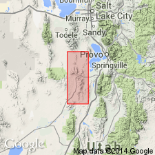
Type section (subsurface): in Apex Standard No. 2 shaft, in NW/4 NE/4 sec. 22, T. 10 S., R. 3 W., East Tintic Mountains, Juab Co., central UT. Named from Apex Standard No. 2.
Reference section (outcrop): south of Apex Standard No. 2 shaft, in center sec. 22, T. 10 S., R. 3 W.
Source: US geologic names lexicon (USGS Bull. 1350, p. 29); supplemental information from GNU records (USGS DDS-6; Denver GNULEX).
For more information, please contact Nancy Stamm, Geologic Names Committee Secretary.
Asterisk (*) indicates published by U.S. Geological Survey authors.
"No current usage" (†) implies that a name has been abandoned or has fallen into disuse. Former usage and, if known, replacement name given in parentheses ( ).
Slash (/) indicates name conflicts with nomenclatural guidelines (CSN, 1933; ACSN, 1961, 1970; NACSN, 1983, 2005, 2021). May be explained within brackets ([ ]).

