- Usage in publication:
-
- Apalachee Formation*
- Modifications:
-
- Named
- Dominant lithology:
-
- Gneiss
- AAPG geologic province:
-
- Piedmont-Blue Ridge province
Summary:
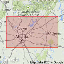
The Apalachee Formation of the Wacoochee Complex is here named for exposures along roads on both sides of the Apalachee River in the northern third of the Apalachee quad., GA. It consists of coarse-grained, granitized, greatly deformed, schistose, generally reddish colored garnet-sillimanite-K-feldspar-plagioclase-biotite, and biotite-plagioclase gneiss that weathers to a chocolate-colored soil. Age is Middle Proterozoic.
Source: GNU records (USGS DDS-6; Reston GNULEX).

- Usage in publication:
-
- Apalachee Formation†
- Modifications:
-
- Abandoned
- AAPG geologic province:
-
- Piedmont-Blue Ridge province
Summary:
Detailed mapping of Apalachee Formation in its type area and other areas in Athens 1:100,000 quads, and study of thin sections, has shown that Apalachee is same as Stonewall Gneiss. Therefore, Apalachee Formation is abandoned and its rocks assigned to Stonewall. Report includes geologic map and correlation chart.
Source: GNU records (USGS DDS-6; Reston GNULEX).
For more information, please contact Nancy Stamm, Geologic Names Committee Secretary.
Asterisk (*) indicates published by U.S. Geological Survey authors.
"No current usage" (†) implies that a name has been abandoned or has fallen into disuse. Former usage and, if known, replacement name given in parentheses ( ).
Slash (/) indicates name conflicts with nomenclatural guidelines (CSN, 1933; ACSN, 1961, 1970; NACSN, 1983, 2005, 2021). May be explained within brackets ([ ]).

