The National Geologic Map Database is migrating to a new infrastructure. We apologize for any service disruptions during this process.
|
|---|


- Usage in publication:
-
- Apache group*
- Modifications:
-
- Original reference
- Dominant lithology:
-
- Quartzite
- Shale
- Conglomerate
- AAPG geologic province:
-
- Southwestern Basin-and-Range region
Summary:
Apache group. Chiefly quartzites, with subordinate shales and conglomerates. Thickness 800 to 1,000 feet. Underlies Globe limestone and unconformably overlies Pinal schist. Divided into (descending): Dripping Spring quartzite, 400 feet; Barnes conglomerate, 10 to 15 feet; Pioneer shale, 200 feet; and Scanlan conglomerate 1 to 6 feet. [Age is pre-Cambrian.]
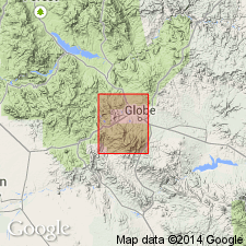
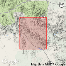
[Named from exposures on western face of Apache Mountains, Globe quadrangle, Gila Co., central AZ.]
[Misprint (US geologic names lexicon, USGS Bull. 896, p. 59): USGS Prof. Paper 13 cited; should be 12.]
Source: US geologic names lexicon (USGS Bull. 896, p. 59-60).
- Usage in publication:
-
- Apache group
- Modifications:
-
- Areal extent
- AAPG geologic province:
-
- Southwestern Basin-and-Range region
Ransome, F.L., 1911, Geology of the Globe district, Arizona: Mining and Scientific Press, v. 102, no. 22, p. 747-748., June 3, 1911
Summary:
Apache group. Recent work in Ray quadrangle, which adjoins Globe quadrangle on south, has revealed that Dripping Spring quartzite as mapped in Globe quadrangle included two quartzites, each 400 feet thick, separated by 250 feet of cherty limestone. The name Dripping Spring is restricted to the lower quartzite. [Age is pre-Cambrian.]
Source: US geologic names lexicon (USGS Bull. 896, p. 59-60).
- Usage in publication:
-
- Apache group*
- Modifications:
-
- Revised
- AAPG geologic province:
-
- Southwestern Basin-and-Range region
Summary:
Pg. 380-385. Apache group. The limestone overlying Dripping Spring quartzite restricted is here named Mescal limestone and the overlying quartzite, which comprises top formation of Apache group, is here named Troy quartzite. [Age is pre-Cambrian.]
Source: US geologic names lexicon (USGS Bull. 896, p. 59-60).
- Usage in publication:
-
- Apache group*
- Modifications:
-
- Revised
- AAPG geologic province:
-
- Southwestern Basin-and-Range region
Summary:
[GNC remark (ca. 1938, USGS geologic names lexicon, USGS Bull. 896, p. 60): N.H. Darton (this publication) removed Troy quartzite (which contains Upper and Middle Cambrian fossils) from the nonfossiliferous underlying formations of Apache group, which he assigned to Algonkian system (now discarded) because of their strong lithologic resemblance to Chuar and Unkar groups of Grand Canyon. The formations now included in Apache group consist of (descending) Mescal limestone, Dripping Spring quartzite, Barnes conglomerate, Pioneer shale, and Scanlan conglomerate. Age is pre-Cambrian. Recognized in central Arizona.]
Source: GNU records (USGS DDS-6; Denver GNULEX).

- Usage in publication:
-
- Apache group
- Modifications:
-
- Revised
- AAPG geologic province:
-
- Southwestern Basin-and-Range region
Summary:
Pg. 29-34. Apache group. At and near [Theodore] Roosevelt Dam, comprises (ascending) Scanlan conglomerate, Pioneer shale, Barnes conglomerate, Dripping Springs quartzite, Mescal limestone, unnamed basalt, and Roosevelt member (new). Underlies Troy quartzite. [Age is Precambrian.]
Source: US geologic names lexicon (USGS Bull. 1200, p. 115).

- Usage in publication:
-
- Apache group
- Modifications:
-
- Areal extent
- AAPG geologic province:
-
- Southwestern Basin-and-Range region
Summary:
Extended to Little Dragoon Mountains, Cochise Co, AZ in the Southwestern Basin-and-Range region.
Source: GNU records (USGS DDS-6; Denver GNULEX).
- Usage in publication:
-
- Apache group*
- Modifications:
-
- Areal extent
- AAPG geologic province:
-
- Southwestern Basin-and-Range region
Summary:
Pg. 31, 32 (fig. 13). Apache group. In Johnson Camp area, Cochise County, central Arizona, comprises (ascending) Scanlan conglomerate, Pioneer shale, Barnes conglomerate, and Dripping Spring quartzite. Overlies Pinal schist, angular unconformity; underlies Bolsa quartzite, angular discordance not apparent in outcrops but regional relations indicate discordance of more than 2 deg. in some parts of mountains. [Age is Precambrian.]
[See also Cooper and Silver, 1964, USGS Prof. Paper 416, Dragoon quadrangle, Cochise Co., AZ.]
Source: US geologic names lexicon (USGS Bull. 1200, p. 115).
- Usage in publication:
-
- Apache Group*
- Modifications:
-
- Revised
- AAPG geologic province:
-
- Southwestern Basin-and-Range region
Summary:
Barnes Conglomerate, formerly a formation of Apache Group, is reduced to member of Dripping Spring Quartzite. Apache Group consists of (in ascending order) Scanlan Conglomerate, Pioneer Formation, Dripping Spring Quartzite [the only unit of the group studied in detail in this report], Mescal Limestone, and an unnamed basalt. Twenty measured sections of Dripping Spring Quartzite described. Twelve measured sections of Barnes described. Age is Late Precambrian.
Source: Modified from GNU records (USGS DDS-6; Denver GNULEX).
- Usage in publication:
-
- Apache Group*
- Modifications:
-
- Revised
- Areal extent
- AAPG geologic province:
-
- Southwestern Basin-and-Range region
Summary:
Recognized in the Slate and Vekol Mountains, AZ in the Southwestern Basin-and-Range region where it consists of (ascending) Pioneer Formation, Dripping Spring Quartzite, and Mescal Limestone. Basalt occurs above Mescal Limestone in the Vekol Mountains, but is not included in Apache Group as it is in other areas. Is of younger Precambrian age.
Source: GNU records (USGS DDS-6; Denver GNULEX).
- Usage in publication:
-
- Apache Group*
- Modifications:
-
- Revised
- AAPG geologic province:
-
- Southwestern Basin-and-Range region
Summary:
In the Christmas quadrangle, Arizona, consists of (ascending) Pioneer Formation, Dripping Spring Quartzite, Mescal Formation, and unnamed basalt. Scanlan Conglomerate [formerly considered a formation] is reduced in rank to a bed, and included at the base of Pioneer Formation. Age is Precambrian.
Source: Modified from GNU records (USGS DDS-6; Denver GNULEX).
- Usage in publication:
-
- Apache Group*
- Modifications:
-
- Overview
- AAPG geologic province:
-
- Southwestern Basin-and-Range region
Summary:
Is described throughout its area of occurrence, in the Southwestern Basin-and-Range region. Depositional history discussed. Is made up of (ascending): Pioneer Shale, Dripping Spring Quartzite, Mescal Limestone, and basalt flows. Is younger Precambrian. Reference sections designated and are measured for Dripping Spring Quartzite and Mescal Limestone.
Source: GNU records (USGS DDS-6; Denver GNULEX).
- Usage in publication:
-
- Apache Group*
- Modifications:
-
- Age modified
- AAPG geologic province:
-
- Southwestern Basin-and-Range region
Summary:
Age changed from Precambrian to Precambrian Y age. In Happy Valley quad, Cochise Co, AZ in Southwestern Basin-and-Range region, contains Pioneer Shale and overlying Dripping Spring Formation (redefined).
Source: GNU records (USGS DDS-6; Denver GNULEX).
For more information, please contact Nancy Stamm, Geologic Names Committee Secretary.
Asterisk (*) indicates published by U.S. Geological Survey authors.
"No current usage" (†) implies that a name has been abandoned or has fallen into disuse. Former usage and, if known, replacement name given in parentheses ( ).
Slash (/) indicates name conflicts with nomenclatural guidelines (CSN, 1933; ACSN, 1961, 1970; NACSN, 1983, 2005, 2021). May be explained within brackets ([ ]).