The National Geologic Map Database is migrating to a new infrastructure. We apologize for any service disruptions during this process.
|
|---|


- Usage in publication:
-
- Apache Canyon Formation
- Modifications:
-
- First used
- Dominant lithology:
-
- Limestone
- Shale
- Sandstone
- AAPG geologic province:
-
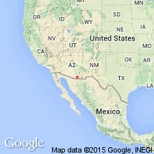
- Basin-and-Range province
Summary:
First published use. Recognized in the Empire Mountains, Pima Co, AZ, and in Adobe Canyon, Santa Rita Mountains, Santa Cruz Co, AZ, both localities in the Basin-and-Range province. Conformably overlies Willow Canyon formation (first published use). Underlies Shelleburg Canyon formation. Consists of dark-gray laminated limestone, grayish-olive and very dark-red siltstone and shale, and yellowish-brown sandstone. The shale is thin-bedded to laminated. Sandstone is medium to thick-bedded. Cement in clastic rocks is calcareous. Has some gypsum beds. Is 870 feet thick. Of Cretaceous age.
Source: GNU records (USGS DDS-6; Denver GNULEX).
- Usage in publication:
-
- Apache Canyon Formation*
- Modifications:
-
- Principal reference
- AAPG geologic province:
-
- Pedregosa basin
- Basin-and-Range province
Summary:
Used as a formation of the Bisbee Group. Extends into Empire Mountains. Is at least 1,600 feet thick in Empire Mountains, but only 550 to 740 feet thick at type section. Consists of thinly laminated to thick-bedded, silty, black limestone in an alternating sequence with gray, silty limestone; black shale; dark-gray, orange-red calcareous, thin-bedded to massive siltstone; and arkosic sandstone. The upper half has several beds of sandstone as much as 15 feet thick. Sandstone is gray, brown, fine- to very coarse-grained, partly cross-bedded and partly massive. Conformably overlies Willow Canyon Formation and conformably underlies Shellenberger Canyon Formation; both adopted by the USGS. Intertongues northward with Glance Conglomerate. Age is Early Cretaceous.
Type section: Apache Canyon, west flank of Whetstone Mountains, Cochise Co., AZ. Whetstone Mountains extends from SW/4 NW/4 sec. 31, T. 18 S., R. 19 E., to NW/4 NW/4 sec. 1, T. 19 S., R. 18 E.
Source: Modified from GNU records (USGS DDS-6; Denver GNULEX).

- Usage in publication:
-
- Apache Canyon Formation*
- Modifications:
-
- Overview
- AAPG geologic province:
-
- Basin-and-Range province
- Pedregosa basin
Summary:
Is formation of Bisbee Group in Santa Rita Mountains (Santa Cruz and Pima Cos, AZ) and Empire Mountains (Pima Co, AZ) in Basin-and-Range province, and in Whetstone Mountains (Pima and Cochise Cos, AZ) in Basin-and-Range province and Pedregosa basin. Overlies Willow Canyon Formation (Aptian) with gradational contact; underlies Shellenberger Formation (Albian) with gradational contact. Is 550-740 ft thick in Whetstone Mountains. Is locally at least 1,600 ft thick in Empire Mountains and laterally grades completely into Glance Conglomerate near north end of range. Is 1,500-2,000 ft thick in Santa Rita Mountains. Is considered correlative with Mural Limestone in Mule and Huachuca Mountains on basis of lithology. Age is shown to be Aptian and Albian (Early Cretaceous) on correlation chart (fig. 5).
Source: GNU records (USGS DDS-6; Denver GNULEX).
- Usage in publication:
-
- Apache Canyon Formation*
- Modifications:
-
- Areal extent
- AAPG geologic province:
-
- Basin-and-Range province
Summary:
Extended to Santa Rita Mountains, AZ in the Basin-and-Range province. Is of Early Cretaceous age.
Source: GNU records (USGS DDS-6; Denver GNULEX).
For more information, please contact Nancy Stamm, Geologic Names Committee Secretary.
Asterisk (*) indicates published by U.S. Geological Survey authors.
"No current usage" (†) implies that a name has been abandoned or has fallen into disuse. Former usage and, if known, replacement name given in parentheses ( ).
Slash (/) indicates name conflicts with nomenclatural guidelines (CSN, 1933; ACSN, 1961, 1970; NACSN, 1983, 2005, 2021). May be explained within brackets ([ ]).