The National Geologic Map Database is migrating to a new infrastructure. We apologize for any service disruptions during this process.
|
|---|


- Usage in publication:
-
- Anaverde formation*
- Modifications:
-
- [Principal reference]
- Dominant lithology:
-
- Conglomerate
- Arkose
- Shale
- AAPG geologic province:
-
- Capistrano basin
- Los Angeles basin
Summary:
Pg. 785, 790-792; Amer. Geophys. Union Trans., v. 27, no. 4, p. 552, 1946 [abs.]. Anaverde formation. Consists of pink to reddish conglomerate and arkose (at base), white to buff conglomerate and arkose, and about 1,000 feet gypsiferous shale at top. Thickness about 2,000 feet. Unconformably underlies Quaternary deposits; rests with depositional contact on granite. Age is early to middle Pliocene. Derivation of name given. Name credited to C.L. Gazin (unpub. ms.). [This may or may not be same unit as Anaverde Beds (O.P. Jenkins, 1938, Geol. map California, sheet 4).
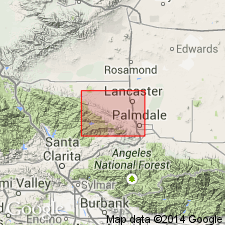
Occurs in trough of San Andreas Rift Zone btw. Palmdale and Elizabeth Lake, southern CA. Named from Anaverde Valley [Palmdale 7.5-min quadrangle, Los Angeles Co.], southern CA.
Source: US geologic names lexicon (USGS Bull. 1200, p. 92-93); GNU records (USGS DDS-6; Menlo GNULEX).
- Usage in publication:
-
- Anaverde formation*
- Modifications:
-
- Mapped
- Dominant lithology:
-
- Sandstone
- Shale
- AAPG geologic province:
-
- Capistrano basin
- Los Angeles basin
Summary:
Anaverde formation. Divided into 2 members (separately mapped). Upper member, well-bedded, yellowish-buff arkosic sandstone, locally conglomeratic, interbedded with hard brown sandstone and dark gypsiferous shale, 700+ feet thick; near base, yellowish, greenish, and whitish sandstone interfingers with pink arkosic sandstone of lower member. Lower member, obscurely bedded, pink or whitish-buff, coarse arkosic sandstone with much pink feldspar, weathering in places like massive granite, 700+ feet thick. Lies unconformably on granite; relations to Punchbowl Formation unknown. Total thickness about 1,400 feet. No fossils in quadrangle. In Palmdale quadrangle to west, a small flora in upper member; 19 species of plants idientified by D.I. Axelrod (Wallace, 1949, p. 791). Age is probably transitional from early to middle Pliocene; may be intermediate between Ricardo and Mount Eden floras. [This may or may not be same unit as Anaverde Beds (Jenkins, 1938).]
Present only north of San Andreas fault.
Source: Publication; US geologic names lexicon (USGS Bull. 1200, p. 92-93).
- Usage in publication:
-
- Anaverde Formation*
- Modifications:
-
- Principal reference
- AAPG geologic province:
-
- Capistrano basin
- Los Angeles basin
Summary:
Pg. 56, pl. 1 (west half). Anaverde Formation. Buff to pink pebbly arkosic sandstone, gypsiferous clay shale, and dioritic breccia. Formation severely deformed; exposed thickness about 1,500 feet. Top eroded. Overlies and in fault contact with pre-Tertiary rocks. Lithologically similar to and possibly correlative with Peace Valley Beds of Crowell, 1952 (California Div. Mines. Spec. Rpt., no. 24, Lebee quadrangle). Supposedly younger than, but possibly in part correlative with Punchbowl Formation (Noble, 1953) to southeast in Pearland quadrangle. Fossil plants identified by D.I. Axelrod (IN Wallace, 1949, p. 791) from basal part of clay shale unit have been assigned to the Hemphillian (citing Savage and others, 1954, California Div. Mines Bull., no. 170, p. 53). Age is considered middle Pliocene (Hemphillian). [This may or may not be same unit as Anaverde Beds (Jenkins, 1938).]
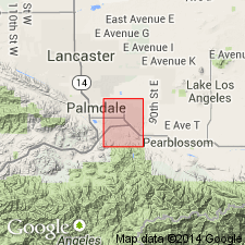
Type section: 2 to 3 mi west-southwest of Palmdale, in SW/4 sec. 28, sec. 29, and N/2 sec. 33, T. 6 N., R. 12 W., Ritter Ridge 7.5-min quadrangle, Los Angeles Co., southern CA.
Source: Publication.
For more information, please contact Nancy Stamm, Geologic Names Committee Secretary.
Asterisk (*) indicates published by U.S. Geological Survey authors.
"No current usage" (†) implies that a name has been abandoned or has fallen into disuse. Former usage and, if known, replacement name given in parentheses ( ).
Slash (/) indicates name conflicts with nomenclatural guidelines (CSN, 1933; ACSN, 1961, 1970; NACSN, 1983, 2005, 2021). May be explained within brackets ([ ]).