

- Usage in publication:
-
- American Falls lake beds*
- Modifications:
-
- Original reference
- Dominant lithology:
-
- Clay
- Sand
- Silt
- Basalt
- AAPG geologic province:
-
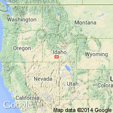
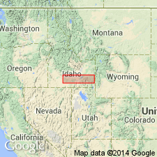
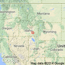
- Snake River basin
Summary:
Pg. 434-439; H.T. Stearns, 1932 (Corr. chart of Idaho compiled by M.G. Wilmarth, dated Sept. 1, 1932). American Falls lake beds. Buff, horizontal, evenly bedded, partly consolidated clay, sand, and silt, with an aphanitic, gray, pahoehoe basalt member, 10+/- feet thick, between American Falls and Gibson Butte, along north side of Snake River. Thickness of formation 150+/- feet. Older than Madson basalt and younger than Cedar Butte basalt. Age is Pleistocene.
Type locality: bluffs along Snake River from American Falls dam, Power Co., to narrows, a distance of 5 +/-mi, Power Co., southern ID.
Source: US geologic names lexicon (USGS Bull. 896, p. 44).
- Usage in publication:
-
- American Falls lake beds*
- Modifications:
-
- Areal extent
- AAPG geologic province:
-
- Snake River basin
Summary:
Pg. 30 (table), 69-72, pl. 6. American Falls lake beds. Report discusses ground-water resources of Snake River Plain. American Falls lake beds are younger than Cedar Butte basalt and older than Madson basalt. Consist of a sedimentary member and a basalt member. Thickness about 150 feet. Age is Pleistocene.
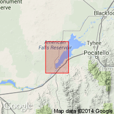
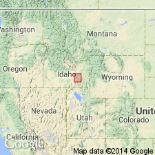
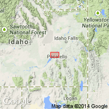
Recognized in American Falls Reservoir area, Bingham, Bannock and Power Counties, southern Idaho.
Source: Publication; US geologic names lexicon (USGS Bull. 1200, p. 3187).
- Usage in publication:
-
- American Falls Lake Beds*
- Modifications:
-
- Revised
- AAPG geologic province:
-
- Snake River basin
Summary:
The lower part of what Stearns and others (1938) included in the American Falls Lake Beds is now included in Raft Formation. American Falls Lake Beds are those units deposited after the Snake River and Cedar Butte Basalts were emplaced. As used in this report, the lake beds are exposed along the northwest side of the Snake River from a point 1 mi northeast of Eagle Rock to upper end of American Falls Reservoir. Is 40 to 80 ft thick. Consists of light-colored, bedded silt, sand, clay, and one persistent layer of block white diatomaceous clay. Considered to be late Pleistocene in age.
Source: GNU records (USGS DDS-6; Denver GNULEX).
- Usage in publication:
-
- American Falls lake beds*
- Modifications:
-
- Revised
- AAPG geologic province:
-
- Snake River basin
Summary:
Restricted stratigraphically to the upper part of what Stearns (1938) named American Falls lake beds because Stearns included in the American Falls, beds older than the basalt dam that caused the deposition of the American Falls. Unconformably overlies Raft formation. Overlain by Michaud gravel and younger deposits. Is mainly clay with silt, and locally abundant fine sand about 80 ft thick. Has a molluscan fauna, a mammoth, camel and bison fossils. Assigned to the late Pleistocene, probably Illinoian. Geologic map shows it along the reservoir and south of the dam in Power and Bingham Cos., ID in the Snake River basin. Measured section 51.3 ft thick described in SE1/4 SW1/4 sec 10, T8S, R30E. Geologic map.
Source: GNU records (USGS DDS-6; Denver GNULEX).
- Usage in publication:
-
- American Falls Lake Beds*
- Modifications:
-
- Geochronologic dating
- AAPG geologic province:
-
- Snake River basin
Summary:
Radiocarbon date of greater than 42,000 yr B.P. on peat in upper lacustrine part and Bison latifrons fossil in lower fine-grained alluvial part. Formed in Snake River basin after damming by Cedar Butte Basalt 72,000 +/-14,000 yrs. ago. Flooding 14,000 to 15,000 yrs. ago cut the Cedar Butte Basalt and drained the American Falls lake.
Source: GNU records (USGS DDS-6; Denver GNULEX).
- Usage in publication:
-
- American Falls Lake Beds*
- Modifications:
-
- Areal extent
- AAPG geologic province:
-
- Snake River basin
Summary:
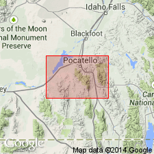
Limits of unit in subsurface shown to be about 6 km north of American Falls Reservoir under a young basalt unit, Bingham Co, ID and about 5 km east of American Falls Reservoir mostly under Snake River gravel deposits and a sand unit, extending northeast between Fort Hall Bottoms and Pocatello Range as far north as area between Ferry Butte and Buckskin Dome, Bingham and Bannock Cos, ID, Snake River basin. Geologic map; cross sections.
Source: GNU records (USGS DDS-6; Denver GNULEX).
- Usage in publication:
-
- American Falls Lake Beds*
- Modifications:
-
- Mapped
- AAPG geologic province:
-
- Snake River basin
Summary:
American Falls Lake Beds. Clay with some lacustrine silt, sand, and fluvial deposits; locally rich in vertebrate fossils. Thickness <80 feet (24 m). Overlies Raft Formation. Recognized in Power County, southern Idaho. Age is considered late Pleistocene. (Follows Trimble and Carr, 1976.)
Source: Publication.
For more information, please contact Nancy Stamm, Geologic Names Committee Secretary.
Asterisk (*) indicates published by U.S. Geological Survey authors.
"No current usage" (†) implies that a name has been abandoned or has fallen into disuse. Former usage and, if known, replacement name given in parentheses ( ).
Slash (/) indicates name conflicts with nomenclatural guidelines (CSN, 1933; ACSN, 1961, 1970; NACSN, 1983, 2005, 2021). May be explained within brackets ([ ]).